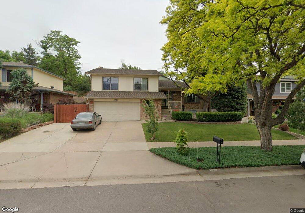
4621 W Union Ave Denver, CO 80236
Fort Logan NeighborhoodEstimated Value: $550,000 - $641,000
3
Beds
3
Baths
1,484
Sq Ft
$401/Sq Ft
Est. Value
About This Home
This home is located at 4621 W Union Ave, Denver, CO 80236 and is currently estimated at $594,586, approximately $400 per square foot. 4621 W Union Ave is a home located in Denver County with nearby schools including Kaiser Elementary School, Bear Valley International School, and John F Kennedy High School.
Ownership History
Date
Name
Owned For
Owner Type
Purchase Details
Closed on
Dec 26, 2002
Sold by
Le Khanh and Nguyen Ha Thi
Bought by
Ortiz Melvin L and Ortiz Anna M
Current Estimated Value
Home Financials for this Owner
Home Financials are based on the most recent Mortgage that was taken out on this home.
Original Mortgage
$188,000
Interest Rate
5.86%
Mortgage Type
Purchase Money Mortgage
Create a Home Valuation Report for This Property
The Home Valuation Report is an in-depth analysis detailing your home's value as well as a comparison with similar homes in the area
Home Values in the Area
Average Home Value in this Area
Purchase History
| Date | Buyer | Sale Price | Title Company |
|---|---|---|---|
| Ortiz Melvin L | $238,000 | -- |
Source: Public Records
Mortgage History
| Date | Status | Borrower | Loan Amount |
|---|---|---|---|
| Previous Owner | Ortiz Melvin L | $188,000 |
Source: Public Records
Tax History
| Year | Tax Paid | Tax Assessment Tax Assessment Total Assessment is a certain percentage of the fair market value that is determined by local assessors to be the total taxable value of land and additions on the property. | Land | Improvement |
|---|---|---|---|---|
| 2025 | $3,045 | $42,940 | $5,840 | $5,840 |
| 2024 | $3,045 | $38,450 | $1,870 | $36,580 |
| 2023 | $2,979 | $38,450 | $1,870 | $36,580 |
| 2022 | $2,628 | $33,050 | $5,760 | $27,290 |
| 2021 | $2,538 | $34,010 | $5,930 | $28,080 |
| 2020 | $2,320 | $31,270 | $5,390 | $25,880 |
| 2019 | $2,255 | $31,270 | $5,390 | $25,880 |
| 2018 | $2,028 | $26,210 | $4,890 | $21,320 |
| 2017 | $2,022 | $26,210 | $4,890 | $21,320 |
| 2016 | $1,947 | $23,880 | $5,405 | $18,475 |
| 2015 | $1,866 | $23,880 | $5,405 | $18,475 |
| 2014 | $1,553 | $18,700 | $3,980 | $14,720 |
Source: Public Records
Map
Nearby Homes
- 4724 W Tufts Cir
- 4900 Lakeshore Dr
- 5300 Yellowstone St Unit 9
- 4307 W Grand Ave
- 5350 Yellowstone St
- 4947 S Perry St
- 4264 W Radcliff Ave
- 4863 W Radcliff Ave
- 5134 S Perry St
- 4383 S Zenobia St
- 5155 W Quincy Ave Unit K103
- 4640 W Princeton Ave
- 4589 S Lowell Blvd Unit K2
- 4587 S Lowell Blvd
- 4639 S Lowell Blvd Unit F
- 4639 S Lowell Blvd Unit B
- 4641 S Lowell Blvd Unit A
- 4643 S Lowell Blvd Unit B
- 4681 S Lowell Blvd
- 4621 S Lowell Blvd Unit J6
- 4601 W Union Ave
- 4641 W Union Ave
- 4660 W Temple Place
- 4680 W Temple Place
- 4661 W Union Ave
- 4591 W Union Ave
- 4640 W Temple Place
- 4622 W Union Ave
- 4602 W Union Ave
- 4700 W Temple Place
- 4620 W Temple Place
- 4671 W Union Ave
- 4642 W Union Ave
- 4581 W Union Ave
- 4592 W Union Ave
- 4710 W Temple Place
- 4610 W Temple Place
- 4672 W Union Ave
- 4665 W Temple Place
- 4701 W Union Ave
Your Personal Tour Guide
Ask me questions while you tour the home.