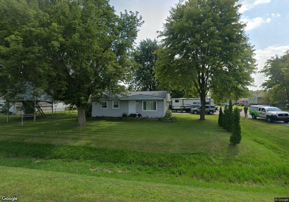
4625 9th St Kimball, MI 48074
Estimated Value: $205,000 - $251,000
4
Beds
2
Baths
1,318
Sq Ft
$174/Sq Ft
Est. Value
About This Home
This home is located at 4625 9th St, Kimball, MI 48074 and is currently estimated at $228,823, approximately $173 per square foot. 4625 9th St is a home located in St. Clair County with nearby schools including Marysville High School, St. Clair County Intervention Academy, and Blue Water SDA Elementary School.
Ownership History
Date
Name
Owned For
Owner Type
Purchase Details
Closed on
May 1, 2023
Sold by
Robert L Batton L and Robert Marie J
Bought by
Lawson Robyn
Current Estimated Value
Purchase Details
Closed on
Mar 17, 2023
Sold by
Robert L Batton L and Robert Marie J
Bought by
Lawson Robyn
Purchase Details
Closed on
Aug 9, 2018
Sold by
Batton Robert L
Bought by
Batton Robert L and Ba Marie
Purchase Details
Closed on
Nov 11, 2013
Sold by
Batton Robert L and Batton Marie J
Bought by
Batton Robert L and Batton Marie J
Purchase Details
Closed on
Mar 1, 2013
Sold by
Batton Robert L and Batton Marie
Bought by
Harris Robyn E
Purchase Details
Closed on
Oct 4, 2007
Sold by
Wood Denise E and Wood Christopher A
Bought by
Lasalle Bank National Association
Create a Home Valuation Report for This Property
The Home Valuation Report is an in-depth analysis detailing your home's value as well as a comparison with similar homes in the area
Home Values in the Area
Average Home Value in this Area
Purchase History
| Date | Buyer | Sale Price | Title Company |
|---|---|---|---|
| Lawson Robyn | $59,900 | None Listed On Document | |
| Lawson Robyn | $59,900 | None Listed On Document | |
| Batton Robert L | -- | None Listed On Document | |
| Batton Robert L | -- | None Available | |
| Harris Robyn E | -- | None Available | |
| Lasalle Bank National Association | $83,518 | None Available |
Source: Public Records
Tax History
| Year | Tax Paid | Tax Assessment Tax Assessment Total Assessment is a certain percentage of the fair market value that is determined by local assessors to be the total taxable value of land and additions on the property. | Land | Improvement |
|---|---|---|---|---|
| 2025 | $334 | $71,600 | $0 | $0 |
| 2024 | $324 | $72,700 | $0 | $0 |
| 2023 | $309 | $69,900 | $0 | $0 |
| 2022 | $769 | $63,100 | $0 | $0 |
| 2020 | $676 | $50,700 | $0 | $50,700 |
| 2019 | $663 | $57,000 | $0 | $0 |
| 2018 | $648 | $47,800 | $0 | $0 |
| 2017 | $634 | $37,300 | $0 | $0 |
| 2016 | $251 | $37,300 | $0 | $0 |
| 2015 | -- | $33,100 | $9,400 | $23,700 |
| 2014 | -- | $21,500 | $9,400 | $12,100 |
| 2013 | -- | $35,800 | $0 | $0 |
Source: Public Records
Map
Nearby Homes
- 354 Marion Ave
- 192 Pickford Rd
- 4601 Gratiot Rd
- 0 Georgia Ave Unit 20251028141
- 240 Oregon Ave
- 000 Montana Ave
- 0 Gratiot Blvd Unit 50105825
- 1330 Minnesota Ave
- 1419 Minnesota Ave
- 765 Lomasney Ln
- 1363 Wisconsin Ave
- 808 5th St
- 1674 Georgia Ave
- 183 Nevada Ave
- 277 Liberty Ave
- 260 Capitol Dr
- 532 Michigan Ave
- 1671 New Jersey Ave
- 0 Ravenswood Rd Unit 20251017048
- 0000 Ravenswood Rd
- 4615 9th St
- 320 Lincoln Ave
- 345 Lincoln Ave Unit Bldg-Unit
- 345 Lincoln Ave
- 325 Lincoln Ave
- 0 9th St Unit 4251524
- 0 9th St Unit 868456
- 0 9th St Unit 937507
- 0 Ninth St Unit 31337881
- 312 Lincoln Ave
- 4595 9th St
- 325 Garfield Rd
- 325 Garfield Rd
- 330 Garfield Rd
- 315 Lincoln Ave
- 309 Lincoln Ave
- 300 Lincoln Ave
- 300 Lincoln Ave
- 4585 9th St
- 315 Garfield Rd
Your Personal Tour Guide
Ask me questions while you tour the home.