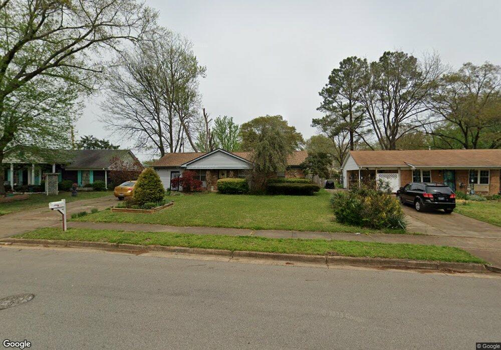
4626 Bill Knight Rd Millington, TN 38053
Estimated Value: $197,000 - $222,000
3
Beds
2
Baths
1,652
Sq Ft
$126/Sq Ft
Est. Value
About This Home
This home is located at 4626 Bill Knight Rd, Millington, TN 38053 and is currently estimated at $207,705, approximately $125 per square foot. 4626 Bill Knight Rd is a home located in Shelby County with nearby schools including Millington Elementary School, Millington High School, and Lighthouse Christian Academy.
Ownership History
Date
Name
Owned For
Owner Type
Purchase Details
Closed on
Mar 14, 1997
Sold by
Gabriel Alfred E and Gabriel Dorothy P
Bought by
Hupf Kristi
Current Estimated Value
Home Financials for this Owner
Home Financials are based on the most recent Mortgage that was taken out on this home.
Original Mortgage
$66,340
Outstanding Balance
$8,052
Interest Rate
7.75%
Mortgage Type
FHA
Estimated Equity
$199,653
Create a Home Valuation Report for This Property
The Home Valuation Report is an in-depth analysis detailing your home's value as well as a comparison with similar homes in the area
Home Values in the Area
Average Home Value in this Area
Purchase History
| Date | Buyer | Sale Price | Title Company |
|---|---|---|---|
| Hupf Kristi | $66,000 | Lawyers Title Insurance Corp |
Source: Public Records
Mortgage History
| Date | Status | Borrower | Loan Amount |
|---|---|---|---|
| Open | Hupf Kristi | $66,340 |
Source: Public Records
Tax History Compared to Growth
Tax History
| Year | Tax Paid | Tax Assessment Tax Assessment Total Assessment is a certain percentage of the fair market value that is determined by local assessors to be the total taxable value of land and additions on the property. | Land | Improvement |
|---|---|---|---|---|
| 2025 | $1,040 | $49,700 | $6,075 | $43,625 |
| 2024 | $2,517 | $37,125 | $4,650 | $32,475 |
| 2023 | $1,778 | $37,125 | $4,650 | $32,475 |
| 2022 | $1,778 | $37,125 | $4,650 | $32,475 |
| 2021 | $1,801 | $37,125 | $4,650 | $32,475 |
| 2020 | $1,353 | $24,250 | $4,650 | $19,600 |
| 2019 | $982 | $24,250 | $4,650 | $19,600 |
| 2018 | $1,353 | $24,250 | $4,650 | $19,600 |
| 2017 | $1,368 | $24,250 | $4,650 | $19,600 |
| 2016 | $1,375 | $23,300 | $0 | $0 |
| 2014 | $1,018 | $23,300 | $0 | $0 |
Source: Public Records
Map
Nearby Homes
- 4655 Doris Cir S
- 4690 Montgomery Rd
- 7727 Tecumseh St
- 8852 U S 51
- 4721 Janie Ave
- 7288 U S Highway 51
- 0000 U S Highway 51
- 4741 Janie Ave
- 5852 U S Highway 51
- 4752 Janie Cove
- 7988 Royster Creek Dr E
- 7994 Royster Creek Dr E
- 4812 Janie Ave
- 7963 Royster Creek Dr
- 7955 Royster Creek Dr
- 7943 Royster Creek Dr
- 7988 Royster Creek Dr
- 7932 Royster Creek Dr
- 7942 Royster Creek Dr
- 7980 Royster Creek Dr
- 4620 Bill Knight Rd
- 4638 Bill Knight Rd
- 7772 Tecumseh St
- 4641 Doris Cir S
- 4627 Bill Knight Rd
- 4633 Bill Knight Rd
- 4615 Bill Knight Rd
- 4649 Doris Cir S
- 4635 Doris Cir S
- 4641 Bill Knight Rd
- 4652 Bill Knight Rd
- 4629 Doris Cir S
- 7762 Tecumseh St
- 4598 Bill Knight Rd
- 4658 Bill Knight Rd
- 4601 Bill Knight Rd
- 7754 Kiowa St
- 4663 Doris Cir S
- 7737 Kiowa St
- 4623 Doris Cir S