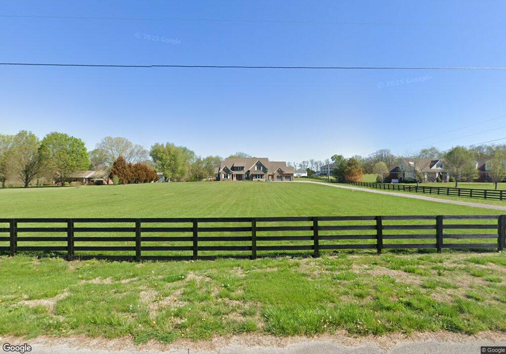
4628 Wilhoite Rd Franklin, TN 37064
Bethesda NeighborhoodEstimated Value: $1,891,000 - $2,340,429
4
Beds
6
Baths
5,462
Sq Ft
$378/Sq Ft
Est. Value
About This Home
This home is located at 4628 Wilhoite Rd, Franklin, TN 37064 and is currently estimated at $2,064,143, approximately $377 per square foot. 4628 Wilhoite Rd is a home located in Williamson County with nearby schools including Thompson's Station Middle School and Summit High School.
Ownership History
Date
Name
Owned For
Owner Type
Purchase Details
Closed on
May 15, 2015
Sold by
Gooddall Thomas D and Gooddall Karen
Bought by
Gilmour John C and Gilmour Teresa F
Current Estimated Value
Purchase Details
Closed on
Apr 19, 2010
Sold by
First Tennessee Bank National Associatio
Bought by
Goodall Thomas D and Goodall Karen
Purchase Details
Closed on
Sep 28, 2009
Sold by
Diversified Investments Inc
Bought by
First Tennessee Bank National Associatio
Create a Home Valuation Report for This Property
The Home Valuation Report is an in-depth analysis detailing your home's value as well as a comparison with similar homes in the area
Home Values in the Area
Average Home Value in this Area
Purchase History
| Date | Buyer | Sale Price | Title Company |
|---|---|---|---|
| Gilmour John C | $152,500 | Lehman Title & Escrow Llc | |
| Goodall Thomas D | $91,000 | Lehman | |
| First Tennessee Bank National Associatio | $170,000 | None Available |
Source: Public Records
Tax History Compared to Growth
Tax History
| Year | Tax Paid | Tax Assessment Tax Assessment Total Assessment is a certain percentage of the fair market value that is determined by local assessors to be the total taxable value of land and additions on the property. | Land | Improvement |
|---|---|---|---|---|
| 2024 | $5,366 | $285,425 | $62,050 | $223,375 |
| 2023 | $5,366 | $285,425 | $62,050 | $223,375 |
| 2022 | $5,366 | $285,425 | $62,050 | $223,375 |
| 2021 | $5,366 | $285,425 | $62,050 | $223,375 |
| 2020 | $5,370 | $241,875 | $34,075 | $207,800 |
| 2019 | $5,370 | $241,875 | $34,075 | $207,800 |
| 2018 | $5,200 | $241,875 | $34,075 | $207,800 |
| 2017 | $5,200 | $241,875 | $34,075 | $207,800 |
| 2016 | $733 | $34,075 | $34,075 | $0 |
| 2015 | -- | $22,450 | $22,450 | $0 |
| 2014 | -- | $22,450 | $22,450 | $0 |
Source: Public Records
Map
Nearby Homes
- 2311 Lucerne Ln
- 2117 Southern Preserve Ln
- 2035 Ober Brienz Ln
- 2113 Southern Preserve Ln
- 2028 Lewisburg Pike
- 5204 Fairhaven Ct
- 5093 Fairhaven Cir
- 5124 Bond Mill Rd
- Wyatt Plan at Fairhaven
- Wentworth Plan at Fairhaven
- Foxmoor Plan at Fairhaven
- Landon Plan at Fairhaven
- Lancaster Plan at Fairhaven
- 5109 Fairhaven Cir
- 5073 Fairhaven Cir
- 5104 Fairhaven Cir
- 5098 Fairhaven Cir
- 5092 Fairhaven Cir
- 5088 Fairhaven Cir
- 4815 Bethesda Rd
- 4630 Wilhoite Rd
- 4626 Wilhoite Rd
- 4620 Wilhoite Rd
- 4634 Wilhoite Rd
- 4635 Wilhoite Rd
- 4638 Wilhoite Rd
- 4631 Wilhoite Rd
- 4645 Wilhoite Rd
- 4621 Wilhoite Rd
- 4613 Wilhoite Rd
- 4617 Wilhoite Rd
- 4611 Wilhoite Rd
- 2139 Lewisburg Pike Unit 2141
- 2104 Lewisburg Pike
- 2130 Lewisburg Pike
- 2000 Ober Brienz Ln
- 2001 Ober Brienz Ln
- 2200 Brienz Valley Dr
- 2088 Lewisburg Pike
- 2707 Owl Hollow Rd