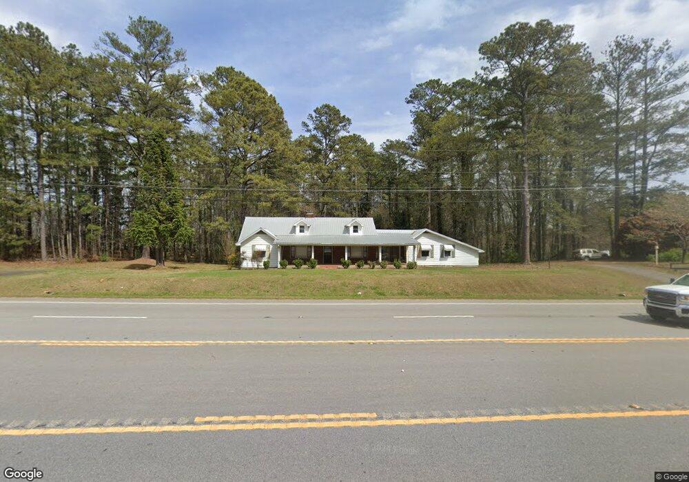
4629 Highway 27 Buchanan, GA 30113
Estimated Value: $119,000 - $436,000
2
Beds
1
Bath
2,081
Sq Ft
$149/Sq Ft
Est. Value
About This Home
This home is located at 4629 Highway 27, Buchanan, GA 30113 and is currently estimated at $309,888, approximately $148 per square foot. 4629 Highway 27 is a home located in Haralson County with nearby schools including Haralson County High School.
Ownership History
Date
Name
Owned For
Owner Type
Purchase Details
Closed on
Oct 26, 2009
Sold by
Dennis Lenn E
Bought by
L E Dennis Properties Llc
Current Estimated Value
Purchase Details
Closed on
Sep 21, 2005
Sold by
Dennis Barbara S
Bought by
Dennis Linda Gail
Purchase Details
Closed on
Jul 11, 1998
Sold by
Dennis Glenn R
Bought by
Dennis Lenn E and Dennis Doyal G
Purchase Details
Closed on
May 29, 1986
Sold by
Dennis Glenn R and Dennis Beu
Bought by
Dennis Glenn R and Dennis Beu
Create a Home Valuation Report for This Property
The Home Valuation Report is an in-depth analysis detailing your home's value as well as a comparison with similar homes in the area
Home Values in the Area
Average Home Value in this Area
Purchase History
| Date | Buyer | Sale Price | Title Company |
|---|---|---|---|
| L E Dennis Properties Llc | -- | -- | |
| Dennis Linda Gail | $37,000 | -- | |
| Dennis Barbara S | -- | -- | |
| Dennis Lenn E | $19,000 | -- | |
| Dennis Glenn R | -- | -- |
Source: Public Records
Tax History Compared to Growth
Tax History
| Year | Tax Paid | Tax Assessment Tax Assessment Total Assessment is a certain percentage of the fair market value that is determined by local assessors to be the total taxable value of land and additions on the property. | Land | Improvement |
|---|---|---|---|---|
| 2024 | $1,268 | $48,915 | $14,100 | $34,815 |
| 2023 | $1,278 | $49,284 | $11,721 | $37,563 |
| 2022 | $1,120 | $41,756 | $11,721 | $30,035 |
| 2021 | $1,100 | $39,367 | $10,687 | $28,680 |
| 2020 | $1,144 | $40,766 | $10,687 | $30,079 |
| 2019 | $1,045 | $35,856 | $10,687 | $25,169 |
| 2018 | $1,060 | $35,856 | $10,687 | $25,169 |
| 2017 | $1,045 | $32,141 | $10,687 | $21,454 |
| 2016 | $1,209 | $39,463 | $10,213 | $29,250 |
| 2015 | $1,208 | $39,390 | $10,213 | $29,178 |
| 2014 | $1,204 | $39,894 | $10,213 | $29,681 |
Source: Public Records
Map
Nearby Homes
- 4601 Highway 27
- 4669 Highway 27
- 139 Willie Head Rd
- 196 Willie Head Rd
- 4687 Highway 27
- 4687 Highway 27
- 234 Willie Head Rd
- 113 Willie Head Rd
- 4525 Highway 27
- 4525 Us Highway 27
- 97 Willie Head Rd
- 48 Ayers Spur
- 4735 U S 27
- 75 Ayers Spur
- 0 Willie Head Rd
- 57 Willie Head Rd
- 87 Ayers Spur
- 65 Ayers Spur
- 101 Ayers Spur
- 133 Ayers Spur