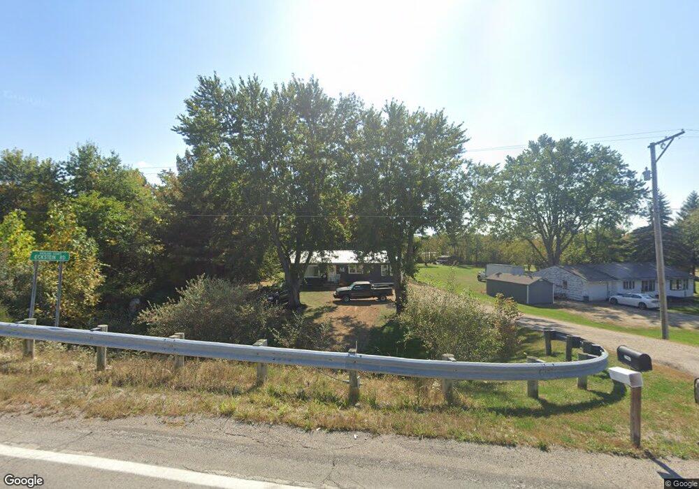
4629 State Route 181 Crestline, OH 44827
Estimated Value: $132,781 - $167,000
3
Beds
1
Bath
816
Sq Ft
$178/Sq Ft
Est. Value
About This Home
This home is located at 4629 State Route 181, Crestline, OH 44827 and is currently estimated at $145,195, approximately $177 per square foot. 4629 State Route 181 is a home located in Richland County with nearby schools including Stingel Elementary School, Ontario Middle School, and Ontario High School.
Ownership History
Date
Name
Owned For
Owner Type
Purchase Details
Closed on
May 7, 2021
Sold by
Miller Cathe
Bought by
James Bostic Miller Shane Cody
Current Estimated Value
Home Financials for this Owner
Home Financials are based on the most recent Mortgage that was taken out on this home.
Original Mortgage
$78,703
Outstanding Balance
$71,325
Interest Rate
3.1%
Mortgage Type
FHA
Estimated Equity
$73,870
Purchase Details
Closed on
Jun 20, 2005
Sold by
Nolen Judy and Nolen Judy L
Bought by
Miller Cathe
Home Financials for this Owner
Home Financials are based on the most recent Mortgage that was taken out on this home.
Original Mortgage
$51,000
Interest Rate
9.12%
Mortgage Type
Fannie Mae Freddie Mac
Purchase Details
Closed on
Oct 12, 1993
Sold by
Nolen Carl
Bought by
Nolen Judy L
Create a Home Valuation Report for This Property
The Home Valuation Report is an in-depth analysis detailing your home's value as well as a comparison with similar homes in the area
Home Values in the Area
Average Home Value in this Area
Purchase History
| Date | Buyer | Sale Price | Title Company |
|---|---|---|---|
| James Bostic Miller Shane Cody | $91,000 | Southern Title | |
| Miller Cathe | $60,000 | Foundation Title Agency | |
| Nolen Judy L | -- | -- |
Source: Public Records
Mortgage History
| Date | Status | Borrower | Loan Amount |
|---|---|---|---|
| Open | James Bostic Miller Shane Cody | $78,703 | |
| Previous Owner | Miller Cathe | $51,000 |
Source: Public Records
Tax History Compared to Growth
Tax History
| Year | Tax Paid | Tax Assessment Tax Assessment Total Assessment is a certain percentage of the fair market value that is determined by local assessors to be the total taxable value of land and additions on the property. | Land | Improvement |
|---|---|---|---|---|
| 2024 | $1,422 | $28,520 | $5,940 | $22,580 |
| 2023 | $1,422 | $28,520 | $5,940 | $22,580 |
| 2022 | $1,240 | $21,400 | $5,400 | $16,000 |
| 2021 | $735 | $21,400 | $5,400 | $16,000 |
| 2020 | $717 | $20,320 | $4,320 | $16,000 |
| 2019 | $587 | $17,310 | $3,660 | $13,650 |
| 2018 | $498 | $17,310 | $3,660 | $13,650 |
| 2017 | $496 | $17,310 | $3,660 | $13,650 |
| 2016 | $503 | $17,470 | $3,550 | $13,920 |
| 2015 | $503 | $17,470 | $3,550 | $13,920 |
| 2014 | $1,007 | $17,470 | $3,550 | $13,920 |
| 2012 | $943 | $18,010 | $3,660 | $14,350 |
Source: Public Records
Map
Nearby Homes
- 4825 Lincoln Hwy
- 832 State Route 314 N
- 3880 Horizon Dr
- 5263 Lincoln Hwy
- 0 Alexander Dr
- 0 Rudy Rd
- 5380 Lincoln Hwy
- 5446 Lincoln Hwy
- 5450 Lincoln Hwy
- 4451 Beam Rd
- 56 Lexington Ontario Rd
- 1260 Thrush Rd
- 3541 Oakstone Dr
- 3436 Ridgestone Ct
- 445 Rudy Rd
- 4663 Millsboro Rd W
- 1671 State Route 314 N
- 3516 Muirfield
- 3516 Muirfield Dr
- 3320 Oakstone Dr
- 4639 State Route 181
- 4655 Ohio 181
- 4655 State Route 181
- 4660 State Route 181
- 4653 State Route 181
- 4664 State Route 181
- 4666 State Route 181
- 4565 State Route 181
- 4685 State Route 181
- 4676 State Route 181
- 645 Eckstein Rd
- 4543 State Route 181
- 4531 State Route 181
- 4734 Ohio 181
- 4734 State Route 181
- 676 Eckstein Rd
- 4540 Park Ave W
- 701 Eckstein Rd
- 4493 State Route 181
- 4737 State Route 181