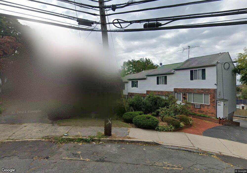
463 Cove Rd Unit 2 Stamford, CT 06902
The Cove NeighborhoodEstimated Value: $335,000 - $444,000
2
Beds
1
Bath
804
Sq Ft
$488/Sq Ft
Est. Value
About This Home
This home is located at 463 Cove Rd Unit 2, Stamford, CT 06902 and is currently estimated at $392,170, approximately $487 per square foot. 463 Cove Rd Unit 2 is a home located in Fairfield County with nearby schools including K. T. Murphy Elementary School, Rippowam Middle School, and Stamford High School.
Ownership History
Date
Name
Owned For
Owner Type
Purchase Details
Closed on
Dec 29, 2003
Sold by
Parker Locksley D and Parker Esther M
Bought by
Mitchell Mary
Current Estimated Value
Purchase Details
Closed on
Dec 5, 2001
Sold by
Degrace Rakiah
Bought by
Parker Esther M and Parker Locksley D
Create a Home Valuation Report for This Property
The Home Valuation Report is an in-depth analysis detailing your home's value as well as a comparison with similar homes in the area
Home Values in the Area
Average Home Value in this Area
Purchase History
| Date | Buyer | Sale Price | Title Company |
|---|---|---|---|
| Mitchell Mary | $254,750 | -- | |
| Parker Esther M | $195,000 | -- |
Source: Public Records
Mortgage History
| Date | Status | Borrower | Loan Amount |
|---|---|---|---|
| Open | Parker Esther M | $282,000 | |
| Closed | Parker Esther M | $270,750 | |
| Closed | Parker Esther M | $270,750 |
Source: Public Records
Tax History Compared to Growth
Tax History
| Year | Tax Paid | Tax Assessment Tax Assessment Total Assessment is a certain percentage of the fair market value that is determined by local assessors to be the total taxable value of land and additions on the property. | Land | Improvement |
|---|---|---|---|---|
| 2025 | $4,105 | $171,630 | $0 | $171,630 |
| 2024 | $4,009 | $171,630 | $0 | $171,630 |
| 2023 | $4,332 | $171,630 | $0 | $171,630 |
| 2022 | $4,220 | $155,310 | $0 | $155,310 |
| 2021 | $4,184 | $155,310 | $0 | $155,310 |
| 2020 | $4,092 | $155,310 | $0 | $155,310 |
| 2019 | $4,092 | $155,310 | $0 | $155,310 |
| 2018 | $3,965 | $155,310 | $0 | $155,310 |
| 2017 | $3,708 | $137,910 | $0 | $137,910 |
| 2016 | $3,602 | $137,910 | $0 | $137,910 |
| 2015 | $3,507 | $137,910 | $0 | $137,910 |
| 2014 | $3,419 | $137,910 | $0 | $137,910 |
Source: Public Records
Map
Nearby Homes
- 21 Saint Benedict Cir
- 31 Wascussee Ln Unit 65
- 697 Cove Rd Unit 1E
- 697 Cove Rd Unit 2A
- 737 Cove Rd Unit D2
- 78 Warren St
- 107 Lockwood Ave Unit 1B
- 14 Park St
- 421 Sylvan Knoll Rd
- 15 Robin St
- 114 Sylvan Knoll Rd
- 274 Sylvan Knoll Rd
- 55 Avery St
- 53 William St Unit C
- 209 Seaside Ave Unit 2
- 8 Wardwell St Unit 6
- 117 Maple Ave
- 3 Dean St Unit B2
- 214 Seaside Ave
- 214 Seaside Ave Unit 2
- 463 Cove Rd Unit 9
- 463 Cove Rd Unit 7
- 463 Cove Rd Unit 6
- 463 Cove Rd Unit 5
- 463 Cove Rd Unit 4
- 463 Cove Rd Unit 3
- 463 Cove Rd Unit 1
- 467 Cove Rd
- 459 Cove Rd
- 32 van Buskirk Ave
- 32 van Buskirk Ave Unit 2 flr
- 32 van Buskirk Ave Unit 2
- 477 Cove Rd
- 34 van Buskirk Ave
- 21 Robert Ct
- 28 van Buskirk Ave
- 24 van Buskirk Ave
- 489 Cove Rd
- 42 van Buskirk Ave
- 15 Robert Ct