Estimated Value: $715,526
--
Bed
--
Bath
7,800
Sq Ft
$92/Sq Ft
Est. Value
About This Home
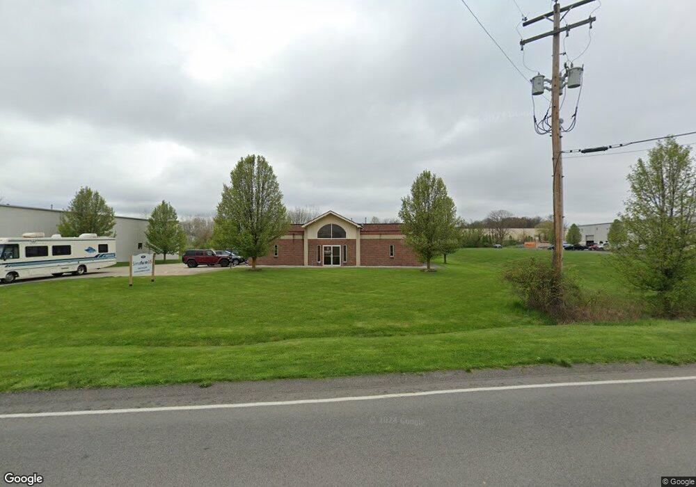
This home is located at 4631 Mogadore Rd, Kent, OH 44240 and is currently estimated at $715,526, approximately $91 per square foot. 4631 Mogadore Rd is a home located in Portage County with nearby schools including Brimfield Elementary School, Field Middle School, and Field High School.
Ownership History
Date
Name
Owned For
Owner Type
Purchase Details
Closed on
Sep 26, 2018
Sold by
Oneacre James L and Oneacre Susan B
Bought by
Simaform Us Inc
Current Estimated Value
Purchase Details
Closed on
Nov 26, 2014
Sold by
Palmer Property Management Ltd
Bought by
Oneacre James L and Oneacre Susan B
Purchase Details
Closed on
Oct 20, 2005
Sold by
Carmen Development Co
Bought by
Palmer Property Management Ltd
Home Financials for this Owner
Home Financials are based on the most recent Mortgage that was taken out on this home.
Original Mortgage
$61,500
Interest Rate
5.8%
Mortgage Type
Commercial
Create a Home Valuation Report for This Property
The Home Valuation Report is an in-depth analysis detailing your home's value as well as a comparison with similar homes in the area
Home Values in the Area
Average Home Value in this Area
Purchase History
| Date | Buyer | Sale Price | Title Company |
|---|---|---|---|
| Simaform Us Inc | $450,000 | None Available | |
| Oneacre James L | $402,000 | None Available | |
| Palmer Property Management Ltd | $120,000 | Village Title Agency Ltd |
Source: Public Records
Mortgage History
| Date | Status | Borrower | Loan Amount |
|---|---|---|---|
| Previous Owner | Palmer Property Management Ltd | $61,500 |
Source: Public Records
Tax History Compared to Growth
Tax History
| Year | Tax Paid | Tax Assessment Tax Assessment Total Assessment is a certain percentage of the fair market value that is determined by local assessors to be the total taxable value of land and additions on the property. | Land | Improvement |
|---|---|---|---|---|
| 2024 | $8,400 | $174,800 | $30,280 | $144,520 |
| 2023 | $8,014 | $140,320 | $22,790 | $117,530 |
| 2022 | $8,064 | $140,320 | $22,790 | $117,530 |
| 2021 | $8,185 | $140,320 | $22,790 | $117,530 |
| 2020 | $7,951 | $140,320 | $22,790 | $117,530 |
| 2019 | $8,140 | $140,320 | $22,790 | $117,530 |
| 2018 | $1,160 | $161,770 | $23,730 | $138,040 |
| 2017 | $1,160 | $161,770 | $23,730 | $138,040 |
| 2016 | $1,173 | $161,770 | $23,730 | $138,040 |
| 2015 | $1,175 | $161,770 | $23,730 | $138,040 |
| 2014 | $1,175 | $161,770 | $23,730 | $138,040 |
| 2013 | $1,229 | $161,770 | $23,730 | $138,040 |
Source: Public Records
Map
Nearby Homes
- 4642 Creekside Dr Unit 4642
- 4649 Creekside Dr Unit 4649
- 847 Lakeview Ct
- 43 Picadilly Ct
- 59 Tudor Ln
- 921 Sanctuary View Dr
- 4196 Lancaster Ln
- 98 Benjamin Way
- 779 Atwood Dr
- 124 Tallmadge Rd
- 112 Tallmadge Rd
- V/L Tallmadge Rd
- Aspire Plan at Tallmadge Reserve
- Fairview Plan at Tallmadge Reserve
- Crisfield Plan at Tallmadge Reserve
- Mitchell Plan at Tallmadge Reserve
- Passport Plan at Tallmadge Reserve
- Hampton Plan at Tallmadge Reserve
- Oakdale Plan at Tallmadge Reserve
- 1072 Carol Ln