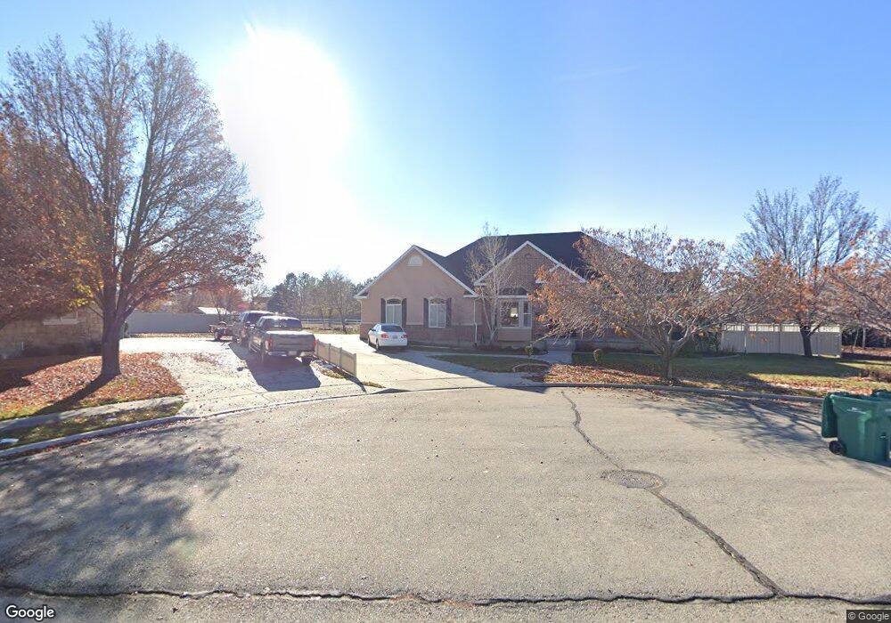
4633 W 10600 N Highland, UT 84003
Estimated Value: $918,000 - $1,226,161
4
Beds
3
Baths
4,789
Sq Ft
$221/Sq Ft
Est. Value
About This Home
This home is located at 4633 W 10600 N, Highland, UT 84003 and is currently estimated at $1,060,540, approximately $221 per square foot. 4633 W 10600 N is a home located in Utah County with nearby schools including Highland Elementary School, Mountain Ridge Junior High School, and Lone Peak High School.
Ownership History
Date
Name
Owned For
Owner Type
Purchase Details
Closed on
Sep 26, 2025
Sold by
Pack Brandon V and Pack Caroline
Bought by
Brandon And Caroline Pack Family Trust and Pack
Current Estimated Value
Purchase Details
Closed on
Sep 5, 2018
Sold by
Macdonald Tommy and Macdonald Ashlee
Bought by
Pack Brandon V and Pack Caroline
Home Financials for this Owner
Home Financials are based on the most recent Mortgage that was taken out on this home.
Original Mortgage
$552,000
Interest Rate
4.5%
Mortgage Type
New Conventional
Purchase Details
Closed on
Jul 17, 2018
Sold by
Macdonald Thomas W and Macdonald Ashlee
Bought by
Macdonald Tommy and Macdonald Ashlee
Home Financials for this Owner
Home Financials are based on the most recent Mortgage that was taken out on this home.
Original Mortgage
$552,000
Interest Rate
4.5%
Mortgage Type
New Conventional
Purchase Details
Closed on
Dec 10, 2010
Sold by
Macdonald Thomas W
Bought by
Macdonald Thomas W and Macdonald Ashlee
Home Financials for this Owner
Home Financials are based on the most recent Mortgage that was taken out on this home.
Original Mortgage
$320,000
Interest Rate
4.21%
Mortgage Type
New Conventional
Purchase Details
Closed on
May 19, 2010
Sold by
Macdonald Thomas W
Bought by
Macdonald Thomas W and Macdonald Ashlee
Home Financials for this Owner
Home Financials are based on the most recent Mortgage that was taken out on this home.
Original Mortgage
$310,400
Interest Rate
5.21%
Mortgage Type
New Conventional
Purchase Details
Closed on
Apr 22, 2010
Sold by
Aurora Loan Services Llc
Bought by
Macdonald Thomas W
Home Financials for this Owner
Home Financials are based on the most recent Mortgage that was taken out on this home.
Original Mortgage
$310,400
Interest Rate
5.21%
Mortgage Type
New Conventional
Purchase Details
Closed on
Oct 6, 2009
Sold by
Loeding Keith V and Loeding Carole A
Bought by
Aurora Loan Services Llc
Purchase Details
Closed on
Oct 24, 2005
Sold by
Loeding Keith V
Bought by
Loeding Keith and Loeding Carole A
Home Financials for this Owner
Home Financials are based on the most recent Mortgage that was taken out on this home.
Original Mortgage
$105,000
Interest Rate
5.74%
Mortgage Type
Stand Alone Second
Create a Home Valuation Report for This Property
The Home Valuation Report is an in-depth analysis detailing your home's value as well as a comparison with similar homes in the area
Home Values in the Area
Average Home Value in this Area
Purchase History
| Date | Buyer | Sale Price | Title Company |
|---|---|---|---|
| Brandon And Caroline Pack Family Trust | -- | Inwest Title | |
| Pack Brandon V | -- | Utah First Title Ins Ag | |
| Macdonald Tommy | -- | None Available | |
| Macdonald Thomas W | -- | Wasatch Title Insurance Age | |
| Macdonald Thomas W | -- | Backman Fptp | |
| Macdonald Thomas W | -- | Backman Fptp | |
| Aurora Loan Services Llc | $596,465 | Security Title Insurance Ag | |
| Loeding Keith | -- | Atlas Title | |
| Loeding Keith | -- | Atlas Title |
Source: Public Records
Mortgage History
| Date | Status | Borrower | Loan Amount |
|---|---|---|---|
| Previous Owner | Pack Brandon V | $552,000 | |
| Previous Owner | Macdonald Thomas W | $320,000 | |
| Previous Owner | Macdonald Thomas W | $310,400 | |
| Previous Owner | Loeding Keith | $105,000 | |
| Previous Owner | Loeding Keith | $420,000 |
Source: Public Records
Tax History Compared to Growth
Tax History
| Year | Tax Paid | Tax Assessment Tax Assessment Total Assessment is a certain percentage of the fair market value that is determined by local assessors to be the total taxable value of land and additions on the property. | Land | Improvement |
|---|---|---|---|---|
| 2025 | $4,331 | $588,610 | $435,000 | $635,200 |
| 2024 | $4,331 | $534,930 | $0 | $0 |
| 2023 | $4,011 | $534,435 | $0 | $0 |
| 2022 | $3,901 | $504,020 | $0 | $0 |
| 2021 | $3,325 | $639,800 | $232,200 | $407,600 |
| 2020 | $3,230 | $609,500 | $201,900 | $407,600 |
| 2019 | $3,087 | $609,500 | $201,900 | $407,600 |
| 2018 | $3,033 | $569,100 | $201,900 | $367,200 |
| 2017 | $3,087 | $309,155 | $0 | $0 |
| 2016 | $2,799 | $262,020 | $0 | $0 |
| 2015 | $2,889 | $256,300 | $0 | $0 |
| 2014 | $2,545 | $223,795 | $0 | $0 |
Source: Public Records
Map
Nearby Homes
- 10535 Janie Ln
- 4756 W 10370 N
- 4292 W Joshua Ln
- 4616 W Carriage Ln
- 10207 N Cottonwood Dr
- 10587 N Avalon St
- 4083 W Hayes Cir
- 10685 N Jerling Dr
- 4084 W Shinnecock
- 10052 N Marigold Ln
- 4812 W Pocosin Ct
- 4812 Pocosin Ct Unit 754
- 4816 W Pocosin Ct Unit 755
- 4822 W Pocosin Ct Unit 756
- 4822 W Pocosin Ct
- 4811 Pocosin Ct
- 10087 N Torreya Dr Unit 728
- 4821 W Pocosin Ct Unit 751
- 10088 N Loblobby Ln Unit 726
- 10088 N Loblobby Ln
- 4619 Caddie Ln
- 4619 W 10600 N
- 4619 W 10600 N Unit LOT 12
- 4649 W 10600 N
- 4605 W 10600 N
- 4663 W 10600 N
- 4663 W 10600 N Unit 9
- 4605 Caddie Ln
- 4642 W 10600 N
- 4642 W 10600 N Unit 15
- 4624 W 10600 N
- 4656 Caddie Ln
- 4656 W 10600 N
- 4656 W 10600 N Unit 16
- 10542 N Janie Ln
- 4608 W 10600 N
- 4646 W Brookridge Ln
- 4589 W 10600 N
- 4679 W 10600 N
- 4672 W 10600 N