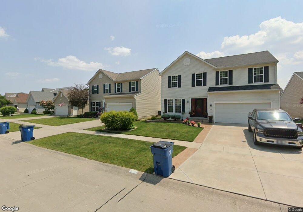
4635 Fields Way Lorain, OH 44053
Estimated Value: $305,865 - $392,000
4
Beds
3
Baths
2,460
Sq Ft
$145/Sq Ft
Est. Value
About This Home
This home is located at 4635 Fields Way, Lorain, OH 44053 and is currently estimated at $356,716, approximately $145 per square foot. 4635 Fields Way is a home located in Lorain County with nearby schools including Powers Elementary School, Walter G. Nord Middle School, and Amherst Junior High School.
Ownership History
Date
Name
Owned For
Owner Type
Purchase Details
Closed on
Feb 8, 2024
Sold by
Landman Paul E
Bought by
Rush Kathleen A
Current Estimated Value
Purchase Details
Closed on
Oct 20, 2011
Sold by
Landman Paul E
Bought by
Landman Paul E and Rush Kathleen A
Purchase Details
Closed on
Feb 23, 2010
Sold by
K Hovnanian Oster Homes Llc
Bought by
Landman Paul E
Home Financials for this Owner
Home Financials are based on the most recent Mortgage that was taken out on this home.
Original Mortgage
$168,614
Interest Rate
4.5%
Mortgage Type
FHA
Create a Home Valuation Report for This Property
The Home Valuation Report is an in-depth analysis detailing your home's value as well as a comparison with similar homes in the area
Home Values in the Area
Average Home Value in this Area
Purchase History
| Date | Buyer | Sale Price | Title Company |
|---|---|---|---|
| Rush Kathleen A | -- | None Listed On Document | |
| Landman Paul E | -- | Attorney | |
| Landman Paul E | $171,800 | Millennium Title-Kim |
Source: Public Records
Mortgage History
| Date | Status | Borrower | Loan Amount |
|---|---|---|---|
| Previous Owner | Landman Paul E | $168,614 |
Source: Public Records
Tax History
| Year | Tax Paid | Tax Assessment Tax Assessment Total Assessment is a certain percentage of the fair market value that is determined by local assessors to be the total taxable value of land and additions on the property. | Land | Improvement |
|---|---|---|---|---|
| 2024 | $1,856 | $44,664 | $21,000 | $23,664 |
| 2023 | $1,574 | $31,941 | $17,640 | $14,301 |
| 2022 | $1,511 | $31,941 | $17,640 | $14,301 |
| 2021 | $1,514 | $31,941 | $17,640 | $14,301 |
| 2020 | $800 | $14,960 | $14,960 | $0 |
| 2019 | $785 | $14,960 | $14,960 | $0 |
| 2018 | $789 | $14,960 | $14,960 | $0 |
| 2017 | $780 | $14,000 | $14,000 | $0 |
| 2016 | $774 | $14,000 | $14,000 | $0 |
| 2015 | $748 | $14,000 | $14,000 | $0 |
| 2014 | $750 | $14,000 | $14,000 | $0 |
| 2013 | $680 | $14,000 | $14,000 | $0 |
Source: Public Records
Map
Nearby Homes
- 4513 Vineyard Dr
- 4253 Santina Way
- 4518 Santina Way
- 3932 Courtyard Dr
- 3794 Freedom Place
- 3784 Freedom Place
- 4497 Bellow Dr
- 3774 Freedom Place Unit A
- 3772 Freedom Place Unit B
- 3770 Freedom Place Unit C
- 3769 Freedom Place
- 110 Habant Dr
- 3768 Martins Run Dr
- 1260 Meadowview Ln
- 3633 Reserve Trail
- 3502 Magnolia Dr
- 4201 Meadow Lark Dr
- 5227 Clovelly Dr
- 5145 Cardinal Ct
- 3439 Morningside Way
- 4639 Fields Way
- 4631 Fields Way
- 4627 Fields Way
- 4641 Fields Way
- 4636 Crossing Trail
- 4630 Crossing Trail
- 4625 Fields Way
- 4645 Fields Way
- 4636 Fields Way
- 4642 Crossing Trail
- 4634 Fields Way
- 4630 Fields Way
- 4626 Crossing Trail
- 4640 Fields Way
- 4628 Fields Way
- 4647 Fields Way
- 4648 Crossing Trail
- 4626 Fields Way
- 4623 Fields Way
- 4624 Crossing Trail
Your Personal Tour Guide
Ask me questions while you tour the home.