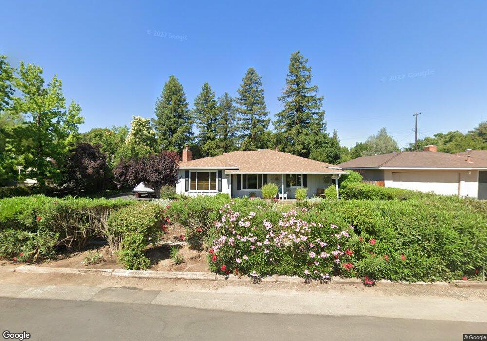
4635 N Safford Ave Fresno, CA 93704
Fig Garden NeighborhoodEstimated Value: $362,000 - $451,000
2
Beds
2
Baths
1,526
Sq Ft
$255/Sq Ft
Est. Value
About This Home
This home is located at 4635 N Safford Ave, Fresno, CA 93704 and is currently estimated at $388,912, approximately $254 per square foot. 4635 N Safford Ave is a home located in Fresno County with nearby schools including Powers-Ginsburg Elementary, Bullard High School, and Endeavor Charter.
Ownership History
Date
Name
Owned For
Owner Type
Purchase Details
Closed on
Feb 2, 2015
Sold by
Dunn Frank L and Dunn Doreen W
Bought by
2015 Dunn Family Trust and Dunn Doreen W
Current Estimated Value
Create a Home Valuation Report for This Property
The Home Valuation Report is an in-depth analysis detailing your home's value as well as a comparison with similar homes in the area
Home Values in the Area
Average Home Value in this Area
Purchase History
| Date | Buyer | Sale Price | Title Company |
|---|---|---|---|
| 2015 Dunn Family Trust | -- | None Available | |
| Dunn Frank L | -- | None Available |
Source: Public Records
Tax History Compared to Growth
Tax History
| Year | Tax Paid | Tax Assessment Tax Assessment Total Assessment is a certain percentage of the fair market value that is determined by local assessors to be the total taxable value of land and additions on the property. | Land | Improvement |
|---|---|---|---|---|
| 2025 | $2,232 | $189,379 | $55,173 | $134,206 |
| 2023 | $2,187 | $182,028 | $53,032 | $128,996 |
| 2022 | $2,156 | $178,460 | $51,993 | $126,467 |
| 2021 | $2,095 | $174,962 | $50,974 | $123,988 |
| 2020 | $2,086 | $173,169 | $50,452 | $122,717 |
| 2019 | $2,003 | $169,774 | $49,463 | $120,311 |
| 2018 | $1,958 | $166,446 | $48,494 | $117,952 |
| 2017 | $1,923 | $163,184 | $47,544 | $115,640 |
| 2016 | $1,857 | $159,985 | $46,612 | $113,373 |
| 2015 | $1,828 | $157,583 | $45,912 | $111,671 |
| 2014 | $1,790 | $154,497 | $45,013 | $109,484 |
Source: Public Records
Map
Nearby Homes
- 4666 N Harrison Ave
- 4734 N Harrison Ave
- 336 E Gettysburg Ave
- 4481 N Palm Ave
- 4822 N Safford Ave
- 4480 N Palm Ave
- 4843 N Palm Ave
- 116 E Alamos Ave
- 4689 N Van Ness Blvd
- 4895 N Thorne Ave
- 4702 N Fruit Ave
- 4915 N Wishon Ct
- 4834 N Wishon Ave
- 705 E Alamos Ave
- 638 W Rialto Ave
- 4939 N Fruit Ave
- 825 E Indianapolis Ave
- 709 W Alamos Ave
- 4175 N Van Ness Blvd
- 5048 N Wishon Ave Unit E
- 4643 N Safford Ave
- 4619 N Safford Ave
- 4632 N Harrison Ave
- 4642 N Harrison Ave
- 4622 N Harrison Ave
- 4655 N Safford Ave
- 4634 N Safford Ave
- 4610 N Harrison Ave
- 4622 N Safford Ave
- 4646 N Safford Ave
- 4667 N Safford Ave
- 207 E Gettysburg Ave
- 4658 N Safford Ave
- 4664 N Safford Ave
- 4677 N Safford Ave
- 4631 N Palm Ave
- 4635 N Harrison Ave
- 4621 N Palm Ave
- 4680 N Harrison Ave
- 4643 N Palm Ave