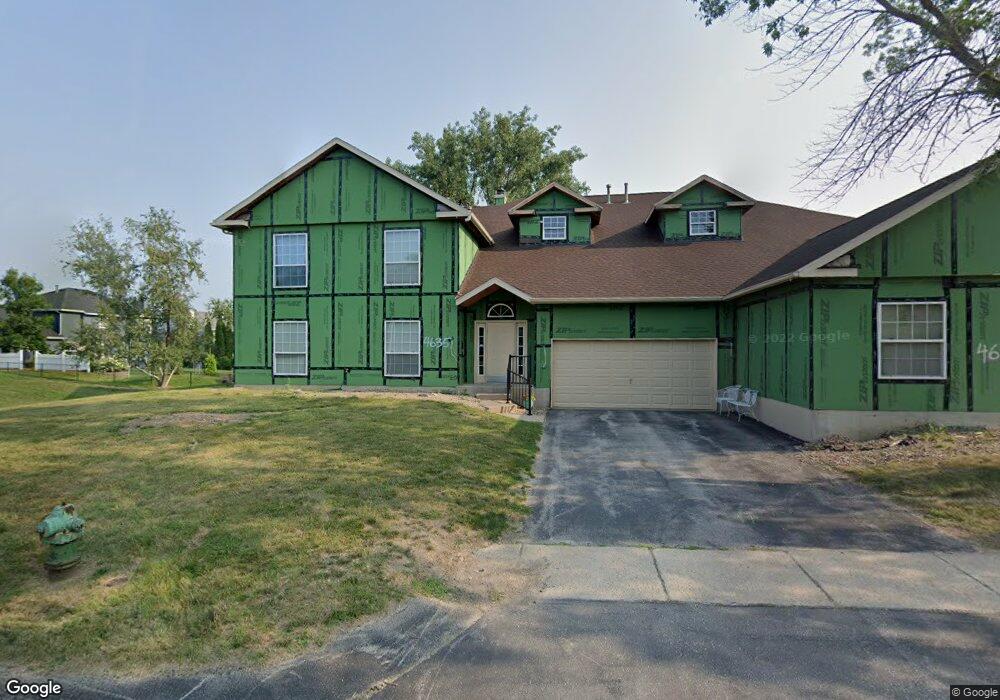
4635 Westchester Dr NE Cedar Rapids, IA 52402
Estimated Value: $152,000 - $174,000
2
Beds
2
Baths
1,340
Sq Ft
$121/Sq Ft
Est. Value
About This Home
This home is located at 4635 Westchester Dr NE, Cedar Rapids, IA 52402 and is currently estimated at $161,918, approximately $120 per square foot. 4635 Westchester Dr NE is a home located in Linn County with nearby schools including Ponderosa Elementary School, Pierce Elementary School, and Franklin Middle School.
Ownership History
Date
Name
Owned For
Owner Type
Purchase Details
Closed on
Sep 1, 2022
Sold by
Betty Graham
Bought by
Betty Ann Graham Revocable Living Trust
Current Estimated Value
Purchase Details
Closed on
Feb 23, 2019
Sold by
Chai Zhaokun and Zhang Huixue
Bought by
Graham Betty A and Graham Donald G
Home Financials for this Owner
Home Financials are based on the most recent Mortgage that was taken out on this home.
Original Mortgage
$98,000
Interest Rate
4.62%
Mortgage Type
Adjustable Rate Mortgage/ARM
Purchase Details
Closed on
Nov 13, 2012
Sold by
Robertson Merritt Wayne and Estate Of John Merritt Roberts
Bought by
Chai Zhaokun and Zhang Huixue
Create a Home Valuation Report for This Property
The Home Valuation Report is an in-depth analysis detailing your home's value as well as a comparison with similar homes in the area
Home Values in the Area
Average Home Value in this Area
Purchase History
| Date | Buyer | Sale Price | Title Company |
|---|---|---|---|
| Betty Ann Graham Revocable Living Trust | -- | -- | |
| Graham Betty A | $122,500 | None Available | |
| Chai Zhaokun | $103,000 | None Available |
Source: Public Records
Mortgage History
| Date | Status | Borrower | Loan Amount |
|---|---|---|---|
| Previous Owner | Graham Betty A | $98,000 |
Source: Public Records
Tax History Compared to Growth
Tax History
| Year | Tax Paid | Tax Assessment Tax Assessment Total Assessment is a certain percentage of the fair market value that is determined by local assessors to be the total taxable value of land and additions on the property. | Land | Improvement |
|---|---|---|---|---|
| 2025 | $2,208 | $149,200 | $23,000 | $126,200 |
| 2024 | $2,396 | $145,900 | $23,000 | $122,900 |
| 2023 | $2,396 | $135,200 | $23,000 | $112,200 |
| 2022 | $2,334 | $122,500 | $21,000 | $101,500 |
| 2021 | $2,470 | $121,600 | $19,000 | $102,600 |
| 2020 | $2,470 | $120,500 | $19,000 | $101,500 |
| 2019 | $2,504 | $116,200 | $19,000 | $97,200 |
| 2018 | $2,422 | $116,200 | $19,000 | $97,200 |
| 2017 | $2,478 | $113,800 | $11,000 | $102,800 |
| 2016 | $2,330 | $109,600 | $11,000 | $98,600 |
| 2015 | $2,438 | $114,601 | $11,000 | $103,601 |
| 2014 | $2,438 | $114,601 | $11,000 | $103,601 |
| 2013 | $1,193 | $114,601 | $11,000 | $103,601 |
Source: Public Records
Map
Nearby Homes
- 4645 Westchester Dr NE Unit A
- 4545 Westchester Dr NE Unit D
- 4745 Westchester Dr NE Unit A
- 4761 Westchester Dr NE Unit C
- 4460 Westchester Dr NE Unit C
- 4433 Coventry Ln NE
- 4609 White Pine Dr NE
- 4417 Twin Pine Dr NE
- 2520 Falbrook Dr NE
- 4113 Lark Ct NE Unit 4113
- 4216 Marilyn Dr NE
- 3719 Blue Mound Dr NE
- 4131 Blue Jay Dr NE Unit A
- 4131 Blue Jay Dr NE Unit C
- 3524 Swallow Ct NE
- 2611 Brookland Dr NE
- 2400 Brookland Dr NE
- 3608 Foxborough Terrace NE Unit B
- 3607 Foxborough Terrace NE Unit A
- 306 10th Ave
- 4635 Westchester Dr NE
- 4635 Westchester Dr NE
- 4635 Westchester Dr NE Unit D
- 4635 Westchester Dr NE Unit A
- 4635 Westchester Dr NE Unit B
- 4620 Lancaster Dr NE
- 4625 Westchester Dr NE Unit C
- 4625 Westchester Dr NE
- 4625 Westchester Dr NE Unit D
- 4625 Westchester Dr NE Unit A
- 4625 Westchester Dr NE Unit B
- 4610 Lancaster Dr NE
- 4645 Westchester Dr NE
- 4645 Westchester Dr NE
- 4645 Westchester Dr NE
- 4645 Westchester Dr NE Unit B
- 4630 Lancaster Dr NE
- 4615 Westchester Dr NE Unit C
- 4615 Westchester Dr NE
- 4615 Westchester Dr NE