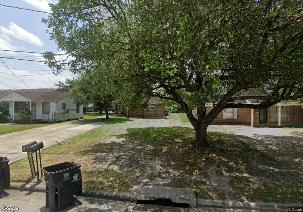
4636 Mayflower St Unit A Houston, TX 77033
Sunnyside NeighborhoodEstimated Value: $241,187 - $353,000
2
Beds
1
Bath
750
Sq Ft
$397/Sq Ft
Est. Value
About This Home
This home is located at 4636 Mayflower St Unit A, Houston, TX 77033 and is currently estimated at $298,047, approximately $397 per square foot. 4636 Mayflower St Unit A is a home located in Harris County with nearby schools including Bastian Elementary School, Attucks Middle School, and Worthing High School.
Ownership History
Date
Name
Owned For
Owner Type
Purchase Details
Closed on
Aug 16, 2006
Sold by
Ford Stephen R
Bought by
Romar John and Romar Willie Mae
Current Estimated Value
Purchase Details
Closed on
Jul 13, 1999
Sold by
Goffney Hamlin and Goffney Dorethea B
Bought by
Ford Stephen R
Purchase Details
Closed on
May 31, 1961
Sold by
Noble George H and Noble Lora Dell
Bought by
Goffney Hamlin and Goffney Doretha B
Create a Home Valuation Report for This Property
The Home Valuation Report is an in-depth analysis detailing your home's value as well as a comparison with similar homes in the area
Home Values in the Area
Average Home Value in this Area
Purchase History
| Date | Buyer | Sale Price | Title Company |
|---|---|---|---|
| Romar John | -- | Stewart Title Company | |
| Romar John | -- | Stewart Title Company | |
| Ford Stephen R | -- | Stewart Title | |
| Ford Stephen R | -- | Stewart Title | |
| Goffney Hamlin | -- | Stewart Title | |
| Goffney Hamlin | -- | Stewart Title |
Source: Public Records
Tax History Compared to Growth
Tax History
| Year | Tax Paid | Tax Assessment Tax Assessment Total Assessment is a certain percentage of the fair market value that is determined by local assessors to be the total taxable value of land and additions on the property. | Land | Improvement |
|---|---|---|---|---|
| 2025 | $5,520 | $261,472 | $85,125 | $176,347 |
| 2024 | $5,520 | $263,800 | $79,450 | $184,350 |
| 2023 | $5,332 | $264,653 | $73,775 | $190,878 |
| 2022 | $5,041 | $228,938 | $56,750 | $172,188 |
| 2021 | $4,214 | $180,794 | $39,725 | $141,069 |
| 2020 | $4,005 | $165,379 | $32,632 | $132,747 |
| 2019 | $4,008 | $158,410 | $24,119 | $134,291 |
| 2018 | $3,436 | $135,800 | $17,025 | $118,775 |
| 2017 | $2,529 | $133,700 | $12,769 | $120,931 |
| 2016 | $3,661 | $144,782 | $12,769 | $132,013 |
| 2015 | $1,954 | $132,133 | $12,769 | $119,364 |
| 2014 | $1,954 | $76,000 | $12,769 | $63,231 |
Source: Public Records
Map
Nearby Homes
- 4624 Mayflower St Unit A/B
- 4718 Teton St
- 4602 Teton St
- 4903 Mayflower St
- 4741 Bricker St
- 4526 Edfield St
- 7905 Rock Rose St
- 4555 Newberry St
- 4601 Newberry St Unit A/B
- 4830 Van Fleet St
- 4614 Redbud St
- 4519 Teton St
- 4510 Mayflower St Unit A/B
- 4607 Bricker St
- 4843 Bricker St
- 8103 Calhoun Rd
- 4545 Bricker St
- 8107 Calhoun Rd
- 4930 Teton St
- 4910 Southwind St
- 4636 Mayflower St
- 4636 Mayflower St Unit B
- 4636 Mayflower St Unit A
- 4640 Mayflower St
- 4632 Mayflower St
- 4629 Edfield St
- 4637 Edfield St
- 4650 Mayflower St
- 4641 Edfield St
- 4645 Edfield St
- 4624 Mayfower
- 4620 Mayflower St
- 4646 Edfield St
- 0 Mayflower St Unit 82870826
- 0 Mayflower St Unit 4161326
- 0 Mayflower St Unit 21265569
- 0 Mayflower St Unit 41045438
- 4813 Mayflower St
- 4811 Mayflower St
- 4622 Edfield St
