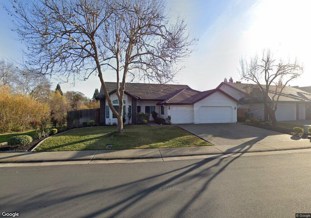
4637 Mountaingate Dr Unit 1 Rocklin, CA 95765
Stanford Ranch NeighborhoodEstimated Value: $392,000 - $644,159
3
Beds
2
Baths
1,747
Sq Ft
$325/Sq Ft
Est. Value
About This Home
This home is located at 4637 Mountaingate Dr Unit 1, Rocklin, CA 95765 and is currently estimated at $567,790, approximately $325 per square foot. 4637 Mountaingate Dr Unit 1 is a home located in Placer County with nearby schools including Breen Elementary, Granite Oaks Middle, and Rocklin High.
Ownership History
Date
Name
Owned For
Owner Type
Purchase Details
Closed on
Jan 29, 2010
Sold by
Morgalis Bernard P and Morgalis Lione
Bought by
Morgalis Bernard P
Current Estimated Value
Purchase Details
Closed on
Mar 30, 1998
Sold by
Morgalis Bernard P
Bought by
Morgalis Bernard P
Home Financials for this Owner
Home Financials are based on the most recent Mortgage that was taken out on this home.
Original Mortgage
$111,795
Outstanding Balance
$21,037
Interest Rate
7%
Estimated Equity
$546,753
Purchase Details
Closed on
Oct 14, 1996
Sold by
Mckim Ron Construction Inc
Bought by
Morgalis Bernard P
Home Financials for this Owner
Home Financials are based on the most recent Mortgage that was taken out on this home.
Original Mortgage
$110,000
Interest Rate
8.3%
Create a Home Valuation Report for This Property
The Home Valuation Report is an in-depth analysis detailing your home's value as well as a comparison with similar homes in the area
Home Values in the Area
Average Home Value in this Area
Purchase History
| Date | Buyer | Sale Price | Title Company |
|---|---|---|---|
| Morgalis Bernard P | -- | None Available | |
| Morgalis Bernard P | -- | Sierra Valley Title Company | |
| Morgalis Bernard P | $175,500 | Placer Title Company |
Source: Public Records
Mortgage History
| Date | Status | Borrower | Loan Amount |
|---|---|---|---|
| Open | Morgalis Bernard P | $111,795 | |
| Closed | Morgalis Bernard P | $110,000 |
Source: Public Records
Tax History Compared to Growth
Tax History
| Year | Tax Paid | Tax Assessment Tax Assessment Total Assessment is a certain percentage of the fair market value that is determined by local assessors to be the total taxable value of land and additions on the property. | Land | Improvement |
|---|---|---|---|---|
| 2025 | $3,391 | $303,366 | $97,705 | $205,661 |
| 2023 | $3,391 | $291,588 | $93,912 | $197,676 |
| 2022 | $3,284 | $285,871 | $92,071 | $193,800 |
| 2021 | $3,248 | $280,266 | $90,266 | $190,000 |
| 2020 | $3,243 | $277,393 | $89,341 | $188,052 |
| 2019 | $3,199 | $271,955 | $87,590 | $184,365 |
| 2018 | $4,090 | $266,623 | $85,873 | $180,750 |
| 2017 | $4,064 | $261,396 | $84,190 | $177,206 |
| 2016 | $3,950 | $256,272 | $82,540 | $173,732 |
| 2015 | $3,887 | $252,424 | $81,301 | $171,123 |
| 2014 | $4,402 | $247,480 | $79,709 | $167,771 |
Source: Public Records
Map
Nearby Homes
- 2601 Wyckford Ct
- 5112 Stratton Ct
- 2100 Wyckford Blvd
- 5013 Bradford Dr
- 5038 Concord Rd
- 4811 Hartwick Rd
- 3456 Hidden Ranch Loop
- 2600 Catalina Ct
- 5229 Del Vista Way
- 2145 Hanover Place
- 5217 Del Vista Way
- 716 Chesterfield Way
- 4834 Blaydon Rd
- 2596 Clubhouse Dr W
- 1360 Bear Creek Dr
- 3204 Camelot Dr
- 3305 Jamboree Dr
- 1352 Bear Creek Dr
- 1349 Bear Creek Dr
- 981 Dusty Stone Loop
- 4639 Mountaingate Dr
- 4641 Mountaingate Dr
- 4633 Mountaingate Dr
- 4458 Pebble Beach Rd
- 4638 Mountaingate Dr
- 4643 Mountaingate Dr
- 4640 Mountaingate Dr
- 4631 Mountaingate Dr
- 4456 Pebble Beach Rd
- 4642 Mountaingate Dr
- 4645 Mountaingate Dr
- 4644 Mountaingate Dr
- 4454 Pebble Beach Rd
- 4629 Mountaingate Dr
- 2603 Wyckford Ct
- 4903 Bradford Place
- 4646 Mountaingate Dr
- 4901 Bradford Place
- 4452 Pebble Beach Rd
- 4905 Bradford Place