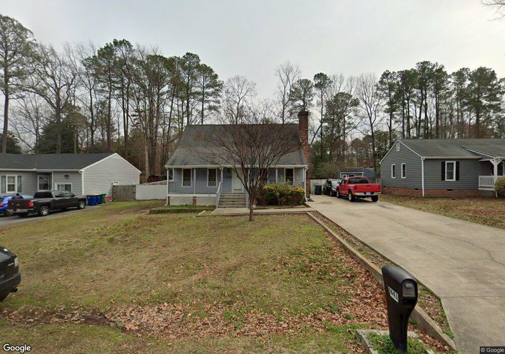
4641 Brookridge Rd Chesterfield, VA 23832
Estimated Value: $322,000 - $341,000
4
Beds
2
Baths
1,482
Sq Ft
$226/Sq Ft
Est. Value
About This Home
This home is located at 4641 Brookridge Rd, Chesterfield, VA 23832 and is currently estimated at $334,479, approximately $225 per square foot. 4641 Brookridge Rd is a home located in Chesterfield County with nearby schools including Thelma Crenshaw Elementary School, Bailey Bridge Middle School, and Manchester High.
Ownership History
Date
Name
Owned For
Owner Type
Purchase Details
Closed on
Jun 19, 2002
Sold by
First Union Natl Bk
Bought by
Balcaceres Juvencio A and Balcaceres Ana C
Current Estimated Value
Home Financials for this Owner
Home Financials are based on the most recent Mortgage that was taken out on this home.
Original Mortgage
$95,917
Outstanding Balance
$40,556
Interest Rate
6.81%
Mortgage Type
New Conventional
Estimated Equity
$293,923
Purchase Details
Closed on
Dec 6, 2001
Sold by
Smith Dennie L
Bought by
First Union National Bank
Create a Home Valuation Report for This Property
The Home Valuation Report is an in-depth analysis detailing your home's value as well as a comparison with similar homes in the area
Home Values in the Area
Average Home Value in this Area
Purchase History
| Date | Buyer | Sale Price | Title Company |
|---|---|---|---|
| Balcaceres Juvencio A | $104,500 | -- | |
| First Union National Bank | $18,430 | -- |
Source: Public Records
Mortgage History
| Date | Status | Borrower | Loan Amount |
|---|---|---|---|
| Open | First Union National Bank | $95,917 |
Source: Public Records
Tax History
| Year | Tax Paid | Tax Assessment Tax Assessment Total Assessment is a certain percentage of the fair market value that is determined by local assessors to be the total taxable value of land and additions on the property. | Land | Improvement |
|---|---|---|---|---|
| 2025 | $2,708 | $301,500 | $60,000 | $241,500 |
| 2024 | $2,708 | $285,700 | $52,000 | $233,700 |
| 2023 | $2,471 | $271,500 | $49,000 | $222,500 |
| 2022 | $2,280 | $247,800 | $47,000 | $200,800 |
| 2021 | $2,152 | $219,600 | $45,000 | $174,600 |
| 2020 | $1,917 | $201,800 | $45,000 | $156,800 |
| 2019 | $1,846 | $194,300 | $42,000 | $152,300 |
| 2018 | $1,730 | $182,100 | $42,000 | $140,100 |
| 2017 | $1,623 | $169,100 | $42,000 | $127,100 |
| 2016 | $1,530 | $159,400 | $42,000 | $117,400 |
| 2015 | $1,453 | $148,700 | $42,000 | $106,700 |
| 2014 | $1,426 | $145,900 | $42,000 | $103,900 |
Source: Public Records
Map
Nearby Homes
- 4519 Bexwood Dr
- 5108 Oakforest Dr
- 5124 Rollingway Rd
- 10383 Qualla Trace Dr
- 10376 Qualla Trace Dr
- 10508 Rollingway Ct
- 10370 Qualla Trace Dr
- 5101 Blossomwood Cir
- 5212 Rollingway Rd
- Stanley Plan at Lawson Mill
- Drexel Plan at Lawson Mill
- Caldwell Plan at Lawson Mill
- Ellerbe Plan at Lawson Mill
- Avery Plan at Lawson Mill
- Raleigh Plan at Lawson Mill
- Oxford Plan at Lawson Mill
- Davidson Plan at Lawson Mill
- Cypress Plan at Lawson Mill
- 10344 Qualla Trace Dr
- 4468 Braden Woods Dr
- 4647 Brookridge Rd
- 4633 Brookridge Rd
- 10520 Oakforest Ct
- 4623 Brookridge Rd
- 4653 Brookridge Rd
- 10522 Oakforest Ct
- 10518 Oakforest Ct
- 4642 Brookridge Rd
- 4636 Brookridge Rd
- 4648 Brookridge Rd
- 4613 Brookridge Rd
- 4659 Brookridge Rd
- 4630 Brookridge Rd
- 4654 Brookridge Rd
- 10512 Oakforest Ct
- 4607 Brookridge Rd
- 10521 Oakforest Ct
- 10802 Brookridge Way
- 4624 Brookridge Rd
- 4660 Brookridge Rd