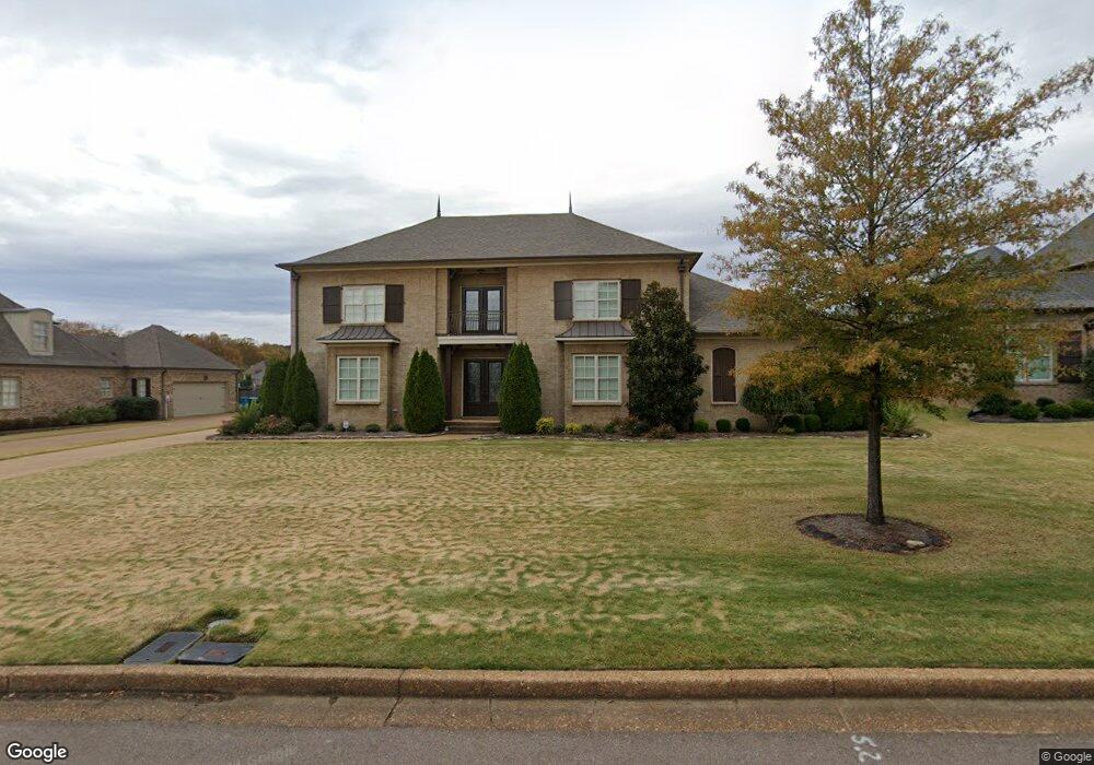
4641 Robinson Loop E Olive Branch, MS 38654
Pleasant Hill NeighborhoodEstimated Value: $578,000 - $755,000
3
Beds
--
Bath
4,816
Sq Ft
$143/Sq Ft
Est. Value
About This Home
This home is located at 4641 Robinson Loop E, Olive Branch, MS 38654 and is currently estimated at $688,519, approximately $142 per square foot. 4641 Robinson Loop E is a home with nearby schools including Pleasant Hill Elementary School, DeSoto Central Middle School, and DeSoto Central High School.
Ownership History
Date
Name
Owned For
Owner Type
Purchase Details
Closed on
Nov 12, 2020
Sold by
Green James H
Bought by
Green James H and Green Alisha D
Current Estimated Value
Home Financials for this Owner
Home Financials are based on the most recent Mortgage that was taken out on this home.
Original Mortgage
$360,000
Interest Rate
2.8%
Mortgage Type
New Conventional
Create a Home Valuation Report for This Property
The Home Valuation Report is an in-depth analysis detailing your home's value as well as a comparison with similar homes in the area
Home Values in the Area
Average Home Value in this Area
Purchase History
| Date | Buyer | Sale Price | Title Company |
|---|---|---|---|
| Green James H | -- | Servicelink |
Source: Public Records
Mortgage History
| Date | Status | Borrower | Loan Amount |
|---|---|---|---|
| Closed | Green James H | $360,000 |
Source: Public Records
Tax History
| Year | Tax Paid | Tax Assessment Tax Assessment Total Assessment is a certain percentage of the fair market value that is determined by local assessors to be the total taxable value of land and additions on the property. | Land | Improvement |
|---|---|---|---|---|
| 2025 | $6,504 | $58,763 | $4,600 | $54,163 |
| 2024 | $5,351 | $41,402 | $4,600 | $36,802 |
| 2023 | $5,351 | $41,402 | $0 | $0 |
| 2022 | $5,351 | $41,402 | $4,600 | $36,802 |
| 2021 | $5,351 | $41,402 | $4,600 | $36,802 |
| 2020 | $3,552 | $38,527 | $4,600 | $33,927 |
| 2019 | $3,552 | $38,527 | $4,600 | $33,927 |
| 2017 | $3,476 | $70,404 | $37,502 | $32,902 |
| 2016 | $3,476 | $37,502 | $4,600 | $32,902 |
| 2015 | $3,776 | $70,404 | $37,502 | $32,902 |
| 2014 | $695 | $6,900 | $0 | $0 |
| 2013 | $763 | $5,175 | $0 | $0 |
Source: Public Records
Map
Nearby Homes
- 4223 S Bolivar Trail
- 4285 S Bolivar Trail
- 4209 S Bolivar Trail
- 4291 S Bolivar Trail
- 4183 Robinson Crossing
- 4435 Parish Row
- 179 Hayes Cove
- 4426 Macon Cove
- 4342 Robinson Loop E
- 4245 Lundy Bend W
- 3929 Summer Pointe Dr
- 5137 Meadow Pointe Dr
- 4912 Jessica Dr
- 4087 Jessica Dr
- 5035 Wethersfield Blvd
- 4092 Pinehurst Blvd
- 4703 W Dublin
- 5518 Bunyan Hill Dr
- 3218 Wellbrook Ln
- 3167 Roseleigh Dr
- 4627 Robinson Loop E
- 4653 Robinson Loop E
- 4679 Robinson Loop E
- 4611 Robinson Crossing
- 4696 Robinson Loop W
- 4676 Robinson Loop W
- 4718 Robinson Loop W
- 4611 Robinson Loop E
- 4189 Robinson Loop N
- 4636 Robinson Loop E
- 4648 Robinson Loop E
- 4602 Robinson Crossing
- 4602 Robinson Loop E
- 4622 Robinson Loop E
- 4602 Robinson Loop E
- 4120 Robinson Crossing
- 4130 Robinson Crossing
- 4104 Robinson Crossing
- 4680 Robinson Loop E
- 4660 Robinson Loop W
Your Personal Tour Guide
Ask me questions while you tour the home.