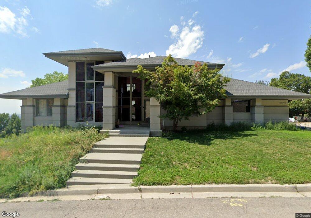
4643 Mile High Dr Provo, UT 84604
Rock Canyon NeighborhoodEstimated Value: $886,000 - $1,212,000
5
Beds
5
Baths
4,981
Sq Ft
$208/Sq Ft
Est. Value
About This Home
This home is located at 4643 Mile High Dr, Provo, UT 84604 and is currently estimated at $1,036,258, approximately $208 per square foot. 4643 Mile High Dr is a home located in Utah County with nearby schools including Canyon Crest Elementary School, Centennial Middle School, and Timpview High School.
Ownership History
Date
Name
Owned For
Owner Type
Purchase Details
Closed on
Oct 29, 2024
Sold by
Hecs Properties Llc
Bought by
Keystone Surveys Inc
Current Estimated Value
Purchase Details
Closed on
Feb 18, 2019
Sold by
Olsen Paul and Olsen Serena
Bought by
Terry Adam R and Terry Melissa N
Home Financials for this Owner
Home Financials are based on the most recent Mortgage that was taken out on this home.
Original Mortgage
$434,800
Interest Rate
4.4%
Mortgage Type
New Conventional
Purchase Details
Closed on
May 6, 2016
Sold by
Zhang Chengwei
Bought by
Olsen Paul and Olsen Serena
Purchase Details
Closed on
Dec 14, 2006
Sold by
Ollivier Joseph and Ollivier Aaron
Bought by
Ollivier Joseph and Ollivier Aaron
Home Financials for this Owner
Home Financials are based on the most recent Mortgage that was taken out on this home.
Original Mortgage
$2,000,000
Interest Rate
6.32%
Mortgage Type
New Conventional
Purchase Details
Closed on
Oct 28, 2004
Sold by
Ollivier Revocable Trust
Bought by
Ollivier Joseph and Ollivier Aaron
Purchase Details
Closed on
Jul 23, 2004
Sold by
Sunrise Ranch Lc
Bought by
Ollivier Allyson
Purchase Details
Closed on
Dec 30, 1998
Sold by
Ollivier Joseph and Ollivier Allyson
Bought by
Ollivier Joseph and Ollivier Allyson
Purchase Details
Closed on
May 15, 1996
Sold by
Ollivier Joseph F and Ollivier Allyson
Bought by
Ollivier Revocable Trust
Create a Home Valuation Report for This Property
The Home Valuation Report is an in-depth analysis detailing your home's value as well as a comparison with similar homes in the area
Home Values in the Area
Average Home Value in this Area
Purchase History
| Date | Buyer | Sale Price | Title Company |
|---|---|---|---|
| Keystone Surveys Inc | -- | None Listed On Document | |
| Terry Adam R | -- | Cottonwood Ttl Ins Agcy Inc | |
| Olsen Paul | -- | Vanguard Title Ins Agency | |
| Ollivier Joseph | -- | Century Title Company | |
| Ollivier Joseph | -- | -- | |
| Ollivier Allyson | -- | -- | |
| Ollivier Joseph | -- | -- | |
| Ollivier Joseph | -- | -- | |
| Ollivier Revocable Trust | -- | -- |
Source: Public Records
Mortgage History
| Date | Status | Borrower | Loan Amount |
|---|---|---|---|
| Previous Owner | Terry Adam R | $434,800 | |
| Previous Owner | Ollivier Joseph | $2,000,000 |
Source: Public Records
Tax History Compared to Growth
Tax History
| Year | Tax Paid | Tax Assessment Tax Assessment Total Assessment is a certain percentage of the fair market value that is determined by local assessors to be the total taxable value of land and additions on the property. | Land | Improvement |
|---|---|---|---|---|
| 2025 | $3,582 | $423,280 | $60,800 | $708,800 |
| 2024 | $3,582 | $352,550 | $0 | $0 |
| 2023 | $3,462 | $335,995 | $0 | $0 |
| 2022 | $2,990 | $292,545 | $0 | $0 |
| 2021 | $2,560 | $436,800 | $51,400 | $385,400 |
| 2020 | $2,641 | $422,500 | $44,700 | $377,800 |
| 2019 | $2,539 | $422,500 | $44,700 | $377,800 |
| 2018 | $2,487 | $419,700 | $44,700 | $375,000 |
| 2017 | $2,490 | $230,835 | $0 | $0 |
| 2016 | $2,549 | $220,330 | $0 | $0 |
| 2015 | $2,224 | $194,260 | $0 | $0 |
| 2014 | $1,866 | $169,950 | $0 | $0 |
Source: Public Records
Map
Nearby Homes
- 4612 N Bristol Cir
- 4365 Bedford Dr
- 4299 Ivy Ln
- 4606 Brookshire Cir
- 924 Redford Dr
- 981 Waterford Dr Unit 5&6
- 4601 Foothill Dr
- 4077 N Devonshire Cir
- 4093 Imperial Way
- 3943 Foothill Dr
- 3936 Foothill Dr
- 3985 N 850 St E
- 4839 N 350 E
- 645 Foothill Dr
- 3811 N Devonshire Dr E
- 3702 N 920 E
- 221 E 4735 N
- 209 E 4735 N
- 4161 N Canyon Rd Unit 2
- 299 E 4000 N
- 4619 Mile High Dr
- 4665 Mile High Dr
- 4619 N Mile High Dr E
- 4642 Windsor Dr
- 4618 Windsor Dr
- 4620 Mile High Dr
- 4600 Windsor Dr
- 4719 Mile High Dr
- 4596 Mile High Dr
- 4574 Windsor Dr
- 4653 Windsor Dr
- 4629 Windsor Dr
- 4607 Windsor Dr
- 4734 Mile High Dr
- 4681 Windsor Dr
- 4726 Mile High Dr
- 4552 Windsor Dr
- 4585 Windsor Dr
- 4728 Mile High Dr
- 4717 Mile High Dr