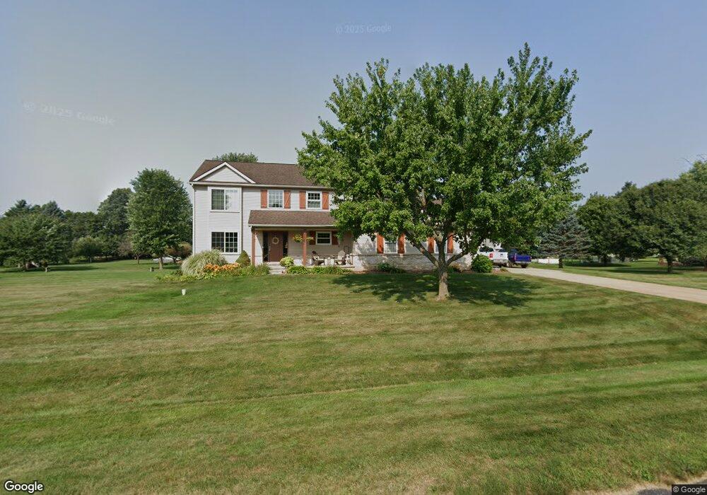
4645 Melanie Ln Unit 14 White Lake, MI 48383
Estimated Value: $446,000 - $474,116
3
Beds
3
Baths
2,170
Sq Ft
$212/Sq Ft
Est. Value
About This Home
This home is located at 4645 Melanie Ln Unit 14, White Lake, MI 48383 and is currently estimated at $461,029, approximately $212 per square foot. 4645 Melanie Ln Unit 14 is a home located in Oakland County with nearby schools including Holly High School.
Ownership History
Date
Name
Owned For
Owner Type
Purchase Details
Closed on
Mar 30, 2004
Sold by
Cdc Homes Inc
Bought by
Thorell Tobin and Thorell Maryann
Current Estimated Value
Home Financials for this Owner
Home Financials are based on the most recent Mortgage that was taken out on this home.
Original Mortgage
$242,250
Outstanding Balance
$114,000
Interest Rate
5.66%
Mortgage Type
Purchase Money Mortgage
Estimated Equity
$347,029
Purchase Details
Closed on
Jun 14, 2002
Sold by
Maier Ernest L
Bought by
Sandy Investments Ltd
Create a Home Valuation Report for This Property
The Home Valuation Report is an in-depth analysis detailing your home's value as well as a comparison with similar homes in the area
Home Values in the Area
Average Home Value in this Area
Purchase History
| Date | Buyer | Sale Price | Title Company |
|---|---|---|---|
| Thorell Tobin | $50,000 | Metropolitan Title Company | |
| Cdc Homes Inc | -- | Metropolitan Title Company | |
| Sandy Investments Ltd | $46,000 | -- |
Source: Public Records
Mortgage History
| Date | Status | Borrower | Loan Amount |
|---|---|---|---|
| Open | Thorell Tobin | $242,250 |
Source: Public Records
Tax History Compared to Growth
Tax History
| Year | Tax Paid | Tax Assessment Tax Assessment Total Assessment is a certain percentage of the fair market value that is determined by local assessors to be the total taxable value of land and additions on the property. | Land | Improvement |
|---|---|---|---|---|
| 2024 | $2,536 | $187,770 | $0 | $0 |
| 2023 | $2,418 | $174,700 | $0 | $0 |
| 2022 | $3,705 | $169,970 | $0 | $0 |
| 2021 | $3,467 | $158,410 | $0 | $0 |
| 2020 | $2,213 | $138,810 | $0 | $0 |
| 2019 | $3,335 | $131,140 | $0 | $0 |
| 2018 | $3,260 | $122,440 | $0 | $0 |
| 2017 | $3,144 | $122,440 | $0 | $0 |
| 2016 | $3,135 | $121,540 | $0 | $0 |
| 2015 | -- | $103,320 | $0 | $0 |
| 2014 | -- | $94,570 | $0 | $0 |
| 2011 | -- | $80,410 | $0 | $0 |
Source: Public Records
Map
Nearby Homes
- 4640 Melanie Ln
- 4200 Stockemer
- 5550 McKeachie Rd
- 5744 Hidden Lane Ct
- 7391 Denali Dr Unit 7
- 4491 Ormond Rd
- 4694 Lakeborn Dr
- 5115 Allingham Dr
- 6090 Raphael Ct Unit 47
- 2880 Steeple Hill Rd
- 5246 Wayne Rd
- 3453 Ormond Rd
- 2500 Nottingham Ct
- 5355 Lake Grove Dr
- 2431 Porter Rd
- 3155 Ridge Rd
- 3734 Navarra Ave
- 4710 Ormond Rd
- 12100 Woodland Trail
- 2300 Canyon Ridge Dr Unit 18
- 4740 McKeachie Rd
- 4665 Melanie Ln Unit 13
- 4660 Melanie Ln
- 4780 McKeachie Rd
- 4680 Melanie Ln Unit Bldg-Unit
- 4680 Melanie Ln Unit 5
- 4625 Melanie Ln
- 4820 McKeachie Rd
- 4620 Melanie Ln
- 6015 Brendel Rd
- 4675 Melanie Ln
- 4700 Melanie Ln
- 6225 Brendel Rd
- 0 Brendle Unit 4919085
- 4685 Melanie Ln Unit 11
- 4860 McKeachie Rd
- 4710 Melanie Ln
- 4695 Melanie Ln
- 6000 Brendel Rd Unit Bldg-Unit
- 6000 Brendel Rd