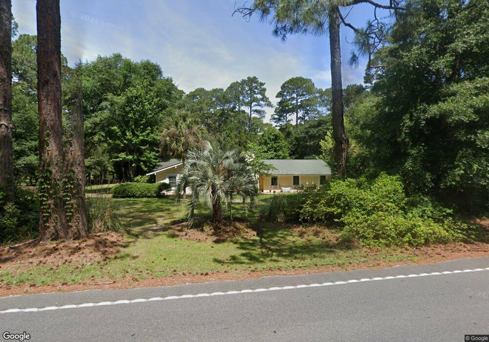
465 Sams Point Rd Beaufort, SC 29907
Estimated Value: $450,000 - $500,000
3
Beds
2
Baths
2,284
Sq Ft
$207/Sq Ft
Est. Value
About This Home
This home is located at 465 Sams Point Rd, Beaufort, SC 29907 and is currently estimated at $472,950, approximately $207 per square foot. 465 Sams Point Rd is a home located in Beaufort County with nearby schools including Coosa Elementary School, Lady's Island Middle School, and Beaufort High School.
Ownership History
Date
Name
Owned For
Owner Type
Purchase Details
Closed on
Jul 24, 2019
Sold by
Goers Randolph
Bought by
Ewell Stephanie M
Current Estimated Value
Home Financials for this Owner
Home Financials are based on the most recent Mortgage that was taken out on this home.
Original Mortgage
$265,000
Outstanding Balance
$232,164
Interest Rate
3.82%
Mortgage Type
VA
Estimated Equity
$240,786
Purchase Details
Closed on
Oct 27, 2008
Sold by
Federal Home Loan Mortgage Corporation
Bought by
Goers Randolph
Home Financials for this Owner
Home Financials are based on the most recent Mortgage that was taken out on this home.
Original Mortgage
$190,000
Interest Rate
6.11%
Mortgage Type
Purchase Money Mortgage
Purchase Details
Closed on
Jun 11, 2008
Sold by
Crumbley Robert D and Crumley Barbara D
Bought by
Federal Home Loan Mortgage Corporation
Purchase Details
Closed on
Jun 10, 2003
Sold by
Thomas Hubert D and Thomas Barbara C
Bought by
Crumley Robert D and Crumley Barbara D
Create a Home Valuation Report for This Property
The Home Valuation Report is an in-depth analysis detailing your home's value as well as a comparison with similar homes in the area
Home Values in the Area
Average Home Value in this Area
Purchase History
| Date | Buyer | Sale Price | Title Company |
|---|---|---|---|
| Ewell Stephanie M | $265,000 | None Available | |
| Goers Randolph | $200,000 | -- | |
| Federal Home Loan Mortgage Corporation | $125,000 | -- | |
| Crumley Robert D | -- | -- |
Source: Public Records
Mortgage History
| Date | Status | Borrower | Loan Amount |
|---|---|---|---|
| Open | Ewell Stephanie M | $265,000 | |
| Previous Owner | Goers Randolph | $190,000 |
Source: Public Records
Tax History Compared to Growth
Tax History
| Year | Tax Paid | Tax Assessment Tax Assessment Total Assessment is a certain percentage of the fair market value that is determined by local assessors to be the total taxable value of land and additions on the property. | Land | Improvement |
|---|---|---|---|---|
| 2024 | $100 | $13,156 | $3,164 | $9,992 |
| 2023 | $100 | $13,156 | $3,164 | $9,992 |
| 2022 | $1,677 | $10,600 | $2,364 | $8,236 |
| 2021 | $1,629 | $10,600 | $2,364 | $8,236 |
| 2020 | $4,180 | $10,600 | $2,364 | $8,236 |
| 2019 | $1,373 | $9,148 | $2,364 | $6,784 |
| 2018 | $1,329 | $13,720 | $0 | $0 |
| 2017 | $1,356 | $9,300 | $0 | $0 |
| 2016 | $3,497 | $13,940 | $0 | $0 |
| 2014 | $3,169 | $13,940 | $0 | $0 |
Source: Public Records
Map
Nearby Homes
- 14 Wade Hampton Dr
- 22 Wade Hampton Dr
- 34 Thomas Sumter St
- 106 Gator Ln
- 4 Shiney Leaf Ct
- 525 Sams Point Rd
- 125 Middle Rd
- 64 Southern Magnolia Dr
- 47 Wade Hampton Dr
- 101 Furrow Ln
- 9 Woods Ln
- 7 Woods Ln
- 42 Le Moyne Dr
- 15 Woods Ln
- 13 Woods Ln
- 571 Sams Point Rd
- 250 Thistle Ln
- 112 Furrow Ln
- 114 Furrow Ln
- 32 Le Moyne Dr
- 2 Wade Hampton Dr
- 477 Sams Point Rd
- 6 Wade Hampton Dr
- 479 Sams Point Rd
- 1 Wade Hampton Dr
- 48 Cedar Crest Cir
- 50 Cedar Crest Cir
- 2 Thomas Sumter St
- 46 Cedar Crest Cir
- 8a Wade Hampton Dr
- 6 Thomas Sumter St
- 44 Cedar Crest Cir
- 8 Wade Hampton Dr
- 8 Wade Hampton Dr
- 52 Cedar Crest Cir
- 8 Thomas Sumter St
- 3 Wade Hampton Dr
- 42 Cedar Crest Cir
- 5 Wade Hampton Dr
- 49 Cedar Crest Cir