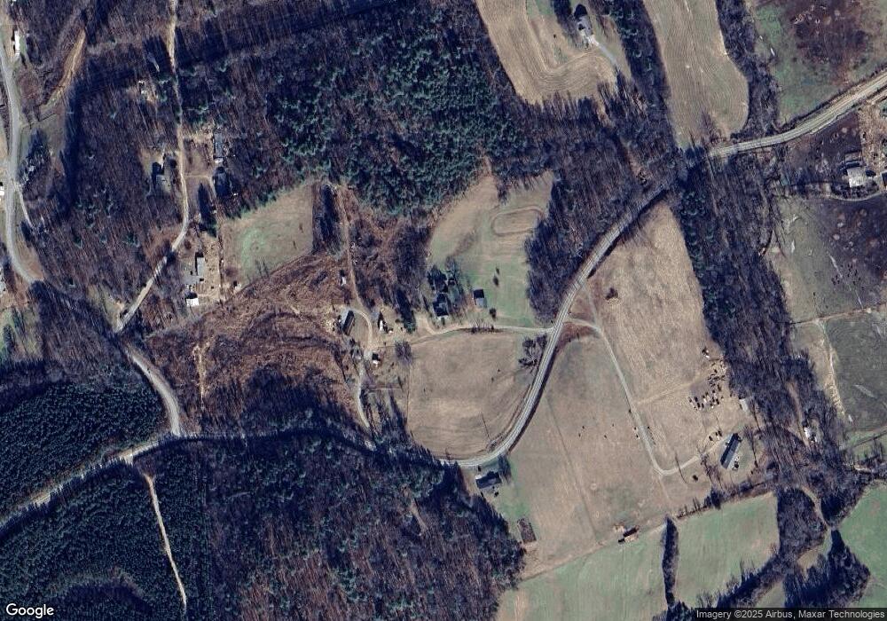
4650 Morrison Rd Morganton, NC 28655
Estimated Value: $335,000 - $401,000
4
Beds
1
Bath
2,602
Sq Ft
$138/Sq Ft
Est. Value
About This Home
This home is located at 4650 Morrison Rd, Morganton, NC 28655 and is currently estimated at $358,216, approximately $137 per square foot. 4650 Morrison Rd is a home located in Burke County with nearby schools including W.A. Young Elementary School, Table Rock Middle School, and Freedom High School.
Ownership History
Date
Name
Owned For
Owner Type
Purchase Details
Closed on
Oct 26, 2005
Sold by
Morrison James L and Morrison Beverly M
Bought by
Hilton Bryan and Hilton Shirley
Current Estimated Value
Home Financials for this Owner
Home Financials are based on the most recent Mortgage that was taken out on this home.
Original Mortgage
$82,320
Outstanding Balance
$43,792
Interest Rate
5.76%
Mortgage Type
New Conventional
Estimated Equity
$314,424
Create a Home Valuation Report for This Property
The Home Valuation Report is an in-depth analysis detailing your home's value as well as a comparison with similar homes in the area
Home Values in the Area
Average Home Value in this Area
Purchase History
| Date | Buyer | Sale Price | Title Company |
|---|---|---|---|
| Hilton Bryan | $103,000 | None Available |
Source: Public Records
Mortgage History
| Date | Status | Borrower | Loan Amount |
|---|---|---|---|
| Open | Hilton Bryan | $82,320 |
Source: Public Records
Tax History
| Year | Tax Paid | Tax Assessment Tax Assessment Total Assessment is a certain percentage of the fair market value that is determined by local assessors to be the total taxable value of land and additions on the property. | Land | Improvement |
|---|---|---|---|---|
| 2025 | $1,639 | $234,342 | $25,474 | $208,868 |
| 2024 | $1,646 | $234,342 | $25,474 | $208,868 |
| 2023 | $1,643 | $233,842 | $25,474 | $208,368 |
| 2022 | $902 | $102,481 | $19,474 | $83,007 |
| 2021 | $896 | $102,481 | $19,474 | $83,007 |
| 2020 | $892 | $102,481 | $19,474 | $83,007 |
| 2019 | $866 | $102,481 | $19,474 | $83,007 |
| 2018 | $793 | $93,043 | $19,474 | $73,569 |
| 2017 | $791 | $93,043 | $19,474 | $73,569 |
| 2016 | $772 | $93,043 | $19,474 | $73,569 |
| 2015 | $769 | $93,043 | $19,474 | $73,569 |
| 2014 | $770 | $93,360 | $19,791 | $73,569 |
| 2013 | $770 | $93,360 | $19,791 | $73,569 |
Source: Public Records
Map
Nearby Homes
- 2130 South Dr Unit Lot 34
- 4970 Morrison Rd
- 4796 Nursery Rd
- 0 Elk Ct Unit 26
- 0 Elk Ct Unit 27 CAR4005593
- 6555 Myers Hill
- 4454 Windy Hill Rd
- Lot 6 Rainhill Church Rd
- Lot 1 & 2 Rainhill Church Rd
- 5235 Mount Olive Church Rd
- 5251 Mount Olive Church Rd
- 4204 Bennett Rd Unit 4206
- 0 Pinnacle Church Rd Unit CAR4328221
- 5264 Matthews Pond Rd
- 6467 U S 64 Unit 23
- 6800 Gold Mine Rd
- 20 Forest Ridge Dr Unit 3-C
- 4815 Mount Olive Church Rd
- 6091 Nowlings Chapel Rd
- 175 Shilah Lane Dr
- 4731 Morrison Rd
- 4711 Morrison Rd
- 5850 Neil Rd
- 5881 Neil Rd
- 4578 Morrison Rd
- 5917 Neil Rd
- 5786 Abee Farm St
- 6156 Mount Olive Church Rd
- 6156-A Mount Olive Church Rd
- 6156-B Mount Olive Church Rd
- 5640 South Dr
- 5655 Abee Farm St
- 5750 Mount Olive Church Rd
- 4465 Dewroe Dr
- 4546 Theron Dr
- 5626 Abee Farm St
- 4780 Nursery Rd
- 4829 Nursery Rd
- 4543 Theron Dr
- 4506 Theron Dr
