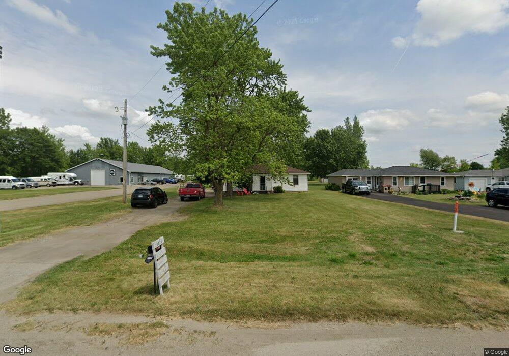
4651 12th St Wayland, MI 49348
Estimated Value: $239,634 - $894,000
3
Beds
1
Bath
1
Sq Ft
$412,409/Sq Ft
Est. Value
About This Home
This home is located at 4651 12th St, Wayland, MI 49348 and is currently estimated at $412,409, approximately $412,409 per square foot. 4651 12th St is a home located in Allegan County with nearby schools including Wayland High School, Byron Center Charter School, and Moline Christian School.
Ownership History
Date
Name
Owned For
Owner Type
Purchase Details
Closed on
Sep 10, 2008
Sold by
Foster Stanley R and Foster Betty Paulette
Bought by
Great Lakes Offshore Lc
Current Estimated Value
Home Financials for this Owner
Home Financials are based on the most recent Mortgage that was taken out on this home.
Original Mortgage
$240,000
Outstanding Balance
$159,862
Interest Rate
6.55%
Mortgage Type
Commercial
Estimated Equity
$252,547
Purchase Details
Closed on
Jun 27, 1997
Sold by
Billington Raymond N
Bought by
Foster Stanley R
Purchase Details
Closed on
Feb 24, 1995
Sold by
Reed Donnie Alma
Bought by
Billington Raymond N
Create a Home Valuation Report for This Property
The Home Valuation Report is an in-depth analysis detailing your home's value as well as a comparison with similar homes in the area
Home Values in the Area
Average Home Value in this Area
Purchase History
| Date | Buyer | Sale Price | Title Company |
|---|---|---|---|
| Great Lakes Offshore Lc | $300,000 | Www.Safetitle.Net | |
| Foster Stanley R | $59,000 | -- | |
| Billington Raymond N | $55,500 | -- |
Source: Public Records
Mortgage History
| Date | Status | Borrower | Loan Amount |
|---|---|---|---|
| Open | Great Lakes Offshore Lc | $240,000 |
Source: Public Records
Tax History Compared to Growth
Tax History
| Year | Tax Paid | Tax Assessment Tax Assessment Total Assessment is a certain percentage of the fair market value that is determined by local assessors to be the total taxable value of land and additions on the property. | Land | Improvement |
|---|---|---|---|---|
| 2025 | $2,719 | $85,400 | $16,700 | $68,700 |
| 2024 | $1,524 | $83,500 | $15,600 | $67,900 |
| 2023 | $1,524 | $73,800 | $15,600 | $58,200 |
| 2022 | $1,524 | $65,700 | $15,600 | $50,100 |
| 2021 | $1,443 | $62,200 | $15,800 | $46,400 |
| 2020 | $1,999 | $58,500 | $15,800 | $42,700 |
| 2019 | $2,130 | $52,700 | $15,100 | $37,600 |
| 2018 | $1,967 | $52,700 | $15,100 | $37,600 |
| 2017 | $0 | $47,500 | $15,100 | $32,400 |
| 2016 | $0 | $36,600 | $15,100 | $21,500 |
| 2015 | -- | $36,600 | $15,100 | $21,500 |
| 2014 | -- | $34,300 | $14,900 | $19,400 |
| 2013 | $1,621 | $32,800 | $14,900 | $17,900 |
Source: Public Records
Map
Nearby Homes
- 4653 Leighton Lakes Dr Unit 9
- 4351 Hickory View Ct
- 1069 108th St SW
- 4335 Tavistock Dr
- 4316 Sussex Place
- 82 100th St SW
- 82 100th St SW
- 92 100th St SW
- 112 100th St SW
- Lot 11 Walnut Dale Dr
- 4273 Highpoint Dr Unit 112
- Unit 111 Highpoint Dr
- 4274 Butternut Dr
- 9669 Division Ave S
- Lot 142 Butternut Dr
- Lot 141 Butternut Dr
- 4249 Butternut Dr
- 4245 Butternut Dr
- 4240 Butternut Dr
- Vienna Plan at Harvest Meadows
- 4651 Division St
- 4649 Division St
- 4647 Division St
- 4655 12th St
- 4655 Division St
- 4625 Division St
- 4625 Division St
- 1222 Ingle Rd
- 4617 Division St
- 4617 Division Ave S
- 4609 Division St
- 4609 Division St
- 4614 12th St
- 1195 146th Ave
- 1185 146th Ave
- 1201 146th Ave
- 0 146th Ave Unit M18054275
- 0 146th Ave Unit M19049847
- 0 146th Ave Unit M20039351
- 7 146th Ave
