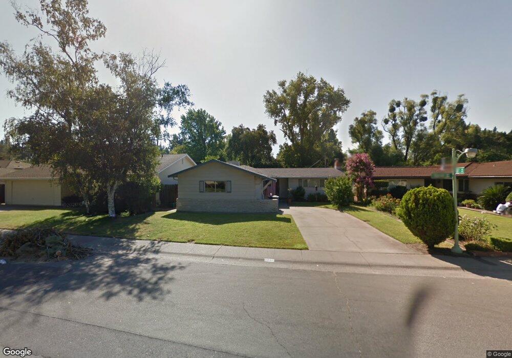
4651 Euclid Ave Sacramento, CA 95822
South Land Park NeighborhoodEstimated Value: $413,000 - $612,000
3
Beds
2
Baths
1,381
Sq Ft
$387/Sq Ft
Est. Value
About This Home
This home is located at 4651 Euclid Ave, Sacramento, CA 95822 and is currently estimated at $534,363, approximately $386 per square foot. 4651 Euclid Ave is a home located in Sacramento County with nearby schools including John Cabrillo Elementary School, Sam Brannan Middle School, and John F. Kennedy High School.
Ownership History
Date
Name
Owned For
Owner Type
Purchase Details
Closed on
Dec 2, 1993
Sold by
Oyoung Robert and Oyoung Flora L
Bought by
Oyoung Suzanne L
Current Estimated Value
Home Financials for this Owner
Home Financials are based on the most recent Mortgage that was taken out on this home.
Original Mortgage
$142,200
Interest Rate
6.89%
Create a Home Valuation Report for This Property
The Home Valuation Report is an in-depth analysis detailing your home's value as well as a comparison with similar homes in the area
Home Values in the Area
Average Home Value in this Area
Purchase History
| Date | Buyer | Sale Price | Title Company |
|---|---|---|---|
| Oyoung Suzanne L | $158,000 | Chicago Title Company |
Source: Public Records
Mortgage History
| Date | Status | Borrower | Loan Amount |
|---|---|---|---|
| Closed | Oyoung Suzanne L | $142,200 |
Source: Public Records
Tax History Compared to Growth
Tax History
| Year | Tax Paid | Tax Assessment Tax Assessment Total Assessment is a certain percentage of the fair market value that is determined by local assessors to be the total taxable value of land and additions on the property. | Land | Improvement |
|---|---|---|---|---|
| 2025 | $3,303 | $268,518 | $84,626 | $183,892 |
| 2024 | $3,303 | $263,254 | $82,967 | $180,287 |
| 2023 | $3,217 | $258,093 | $81,341 | $176,752 |
| 2022 | $3,176 | $253,034 | $79,747 | $173,287 |
| 2021 | $3,022 | $248,074 | $78,184 | $169,890 |
| 2020 | $3,039 | $245,531 | $77,383 | $168,148 |
| 2019 | $2,974 | $240,717 | $75,866 | $164,851 |
| 2018 | $2,896 | $235,998 | $74,379 | $161,619 |
| 2017 | $2,851 | $231,371 | $72,921 | $158,450 |
| 2016 | $2,781 | $226,836 | $71,492 | $155,344 |
| 2015 | $2,735 | $223,430 | $70,419 | $153,011 |
| 2014 | $2,670 | $219,054 | $69,040 | $150,014 |
Source: Public Records
Map
Nearby Homes
- 4801 da Rosa Dr
- 5200 Pleasant Dr
- 5440 Pleasant Dr
- 5081 Karbet Way
- 1224 Nevis Ct
- 4960 Flora Vista Ln
- 1050 Appollo Way
- 4500 Crestwood Way
- 995 Piedmont Dr
- 4271 Warren Ave
- 5453 Parish Ct
- 1432 Oregon Dr
- 5779 Gloria Dr
- 5716 Lonsdale Dr
- 936 Roeder Way
- 1433 32nd Ave
- 5720 Riverside Blvd
- 5880 Gloria Dr
- 80 Petrilli Cir
- 5875 Gloria Dr Unit 4
- 4701 Euclid Ave
- 4601 Euclid Ave
- 4741 Euclid Ave
- 4533 Euclid Ave
- 4600 Euclid Ave
- 4700 Euclid Ave
- 4781 Euclid Ave
- 4529 Euclid Ave
- 5008 S Land Park Dr
- 5004 S Land Park Dr
- 1180 26th Ave
- 1179 26th Ave
- 1196 25th Ave
- 5012 S Land Park Dr
- 4780 Euclid Ave
- 4801 Euclid Ave
- 4525 Euclid Ave
- 1205 Ridgeway Dr
- 4800 Euclid Ave
- 1209 Ridgeway Dr