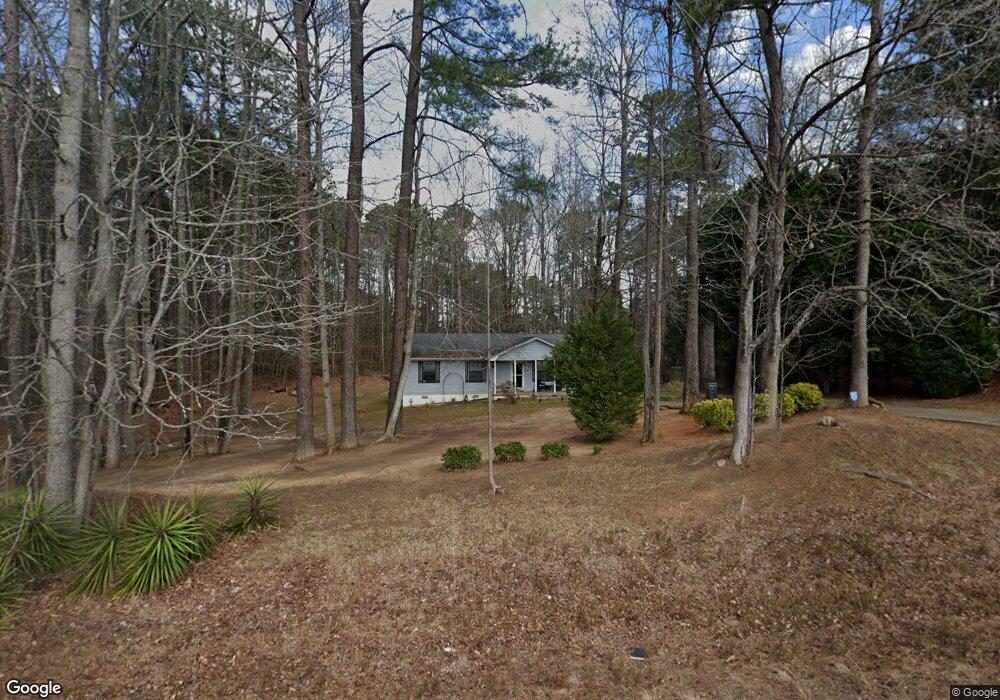
4651 Highway 42 S Locust Grove, GA 30248
Estimated Value: $191,000 - $241,000
3
Beds
2
Baths
1,058
Sq Ft
$206/Sq Ft
Est. Value
About This Home
This home is located at 4651 Highway 42 S, Locust Grove, GA 30248 and is currently estimated at $218,290, approximately $206 per square foot. 4651 Highway 42 S is a home located in Henry County with nearby schools including Locust Grove Elementary School, Locust Grove Middle School, and Locust Grove High School.
Ownership History
Date
Name
Owned For
Owner Type
Purchase Details
Closed on
May 24, 2019
Sold by
Walburn Donald L
Bought by
Grier James
Current Estimated Value
Home Financials for this Owner
Home Financials are based on the most recent Mortgage that was taken out on this home.
Original Mortgage
$127,878
Outstanding Balance
$112,431
Interest Rate
4.2%
Mortgage Type
New Conventional
Estimated Equity
$105,859
Purchase Details
Closed on
Nov 18, 1999
Sold by
Hutcheson Loy
Bought by
Walburn Donald L and Walburn Deborah E
Home Financials for this Owner
Home Financials are based on the most recent Mortgage that was taken out on this home.
Original Mortgage
$69,086
Interest Rate
7.81%
Mortgage Type
New Conventional
Create a Home Valuation Report for This Property
The Home Valuation Report is an in-depth analysis detailing your home's value as well as a comparison with similar homes in the area
Home Values in the Area
Average Home Value in this Area
Purchase History
| Date | Buyer | Sale Price | Title Company |
|---|---|---|---|
| Grier James | $126,900 | -- | |
| Walburn Donald L | $75,000 | -- |
Source: Public Records
Mortgage History
| Date | Status | Borrower | Loan Amount |
|---|---|---|---|
| Open | Grier James | $127,878 | |
| Previous Owner | Walburn Donald L | $69,086 |
Source: Public Records
Tax History Compared to Growth
Tax History
| Year | Tax Paid | Tax Assessment Tax Assessment Total Assessment is a certain percentage of the fair market value that is determined by local assessors to be the total taxable value of land and additions on the property. | Land | Improvement |
|---|---|---|---|---|
| 2025 | $2,550 | $83,160 | $15,680 | $67,480 |
| 2024 | $2,550 | $86,080 | $14,240 | $71,840 |
| 2023 | $1,702 | $77,240 | $13,680 | $63,560 |
| 2022 | $1,886 | $63,320 | $12,640 | $50,680 |
| 2021 | $1,633 | $52,520 | $10,840 | $41,680 |
| 2020 | $1,743 | $47,080 | $10,200 | $36,880 |
| 2019 | $1,281 | $43,760 | $9,680 | $34,080 |
| 2018 | $1,106 | $36,560 | $8,960 | $27,600 |
| 2016 | $901 | $29,520 | $7,000 | $22,520 |
| 2015 | $668 | $23,160 | $7,080 | $16,080 |
| 2014 | $550 | $20,120 | $7,080 | $13,040 |
Source: Public Records
Map
Nearby Homes
- 1537 Jackson St
- 0 Locust Rd Unit 10495072
- 0 Locust Rd Unit 19967321
- 0 Jackson St Unit 10554689
- 501 Grove Park Dr
- 65 Grove Creek Dr
- 565 Carleton Place
- 155 Skyland Dr E
- 1064 Lear Dr
- 176 Rockwood Ln
- 143 Massey Ln
- 540 Easton Dr
- 26 Skyland Dr W
- 114 Skyland Dr E
- 215 Highland Dr
- 208 Umber Rd
- 4 Skyland Dr W
- 212 Umber Rd
- 36 Highpoint Ln
- 231 Ferguson Ave
- 4651 Georgia 42
- 4657 Highway 42
- 4657 Georgia 42
- 0 Tanger Blvd Unit 3277466
- 0 Tanger Blvd Unit 7129434
- 0 Tanger Blvd Unit 3131099
- 0 Tanger Blvd Unit 3166641
- 0 Tanger Blvd Unit 154 8213581
- 0 Tanger Blvd
- 0 Tanger Blvd Unit 8.98 AC 10023034
- 0 Tanger Blvd Unit 7356621
- 0 Tanger Blvd Unit 7108157
- 0 Tanger Blvd and Indian Creek Rd Unit 7073559
- 0 Tanger Blvd and Indian Creek Rd Unit 7064021
- 0 Tanger Blvd Unit 3260899
- 0 Tanger Blvd Unit 12.02 Ac 8914972
- 0 Tanger Blvd Unit 8829327
- 4645 Georgia 42
- 4645 Highway 42
- 1520 Jackson St