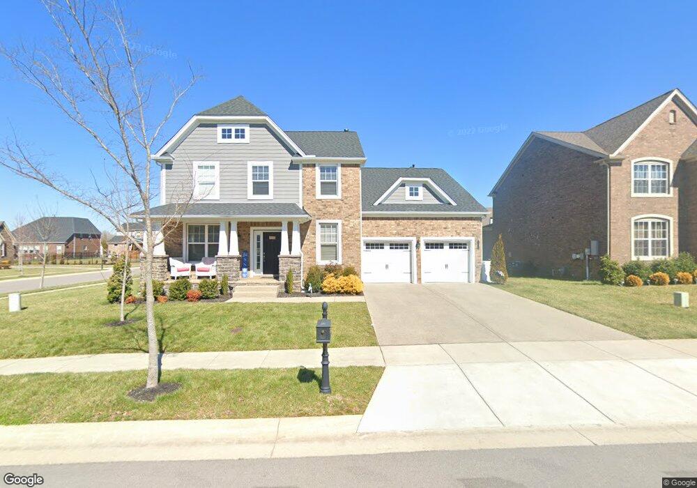
4659 Robin Ln Nolensville, TN 37135
Estimated Value: $943,630 - $1,001,000
--
Bed
1
Bath
3,370
Sq Ft
$289/Sq Ft
Est. Value
About This Home
This home is located at 4659 Robin Ln, Nolensville, TN 37135 and is currently estimated at $972,315, approximately $288 per square foot. 4659 Robin Ln is a home with nearby schools including Mill Creek Elementary School, Mill Creek Middle School, and Nolensville High School.
Ownership History
Date
Name
Owned For
Owner Type
Purchase Details
Closed on
Apr 18, 2018
Sold by
The Jones Company Of Tenessee
Bought by
Mccarthy Ashley L
Current Estimated Value
Home Financials for this Owner
Home Financials are based on the most recent Mortgage that was taken out on this home.
Original Mortgage
$404,379
Outstanding Balance
$347,174
Interest Rate
4.46%
Mortgage Type
New Conventional
Estimated Equity
$625,141
Create a Home Valuation Report for This Property
The Home Valuation Report is an in-depth analysis detailing your home's value as well as a comparison with similar homes in the area
Home Values in the Area
Average Home Value in this Area
Purchase History
| Date | Buyer | Sale Price | Title Company |
|---|---|---|---|
| Mccarthy Ashley L | $505,474 | Southland Title & Escrow Co |
Source: Public Records
Mortgage History
| Date | Status | Borrower | Loan Amount |
|---|---|---|---|
| Open | Mccarthy Ashley L | $404,379 |
Source: Public Records
Tax History Compared to Growth
Tax History
| Year | Tax Paid | Tax Assessment Tax Assessment Total Assessment is a certain percentage of the fair market value that is determined by local assessors to be the total taxable value of land and additions on the property. | Land | Improvement |
|---|---|---|---|---|
| 2025 | $3,107 | $219,900 | $62,500 | $157,400 |
| 2024 | $3,107 | $143,200 | $37,500 | $105,700 |
| 2023 | $3,107 | $143,200 | $37,500 | $105,700 |
| 2022 | $3,107 | $143,200 | $37,500 | $105,700 |
| 2021 | $3,107 | $143,200 | $37,500 | $105,700 |
| 2020 | $2,887 | $115,000 | $22,500 | $92,500 |
| 2019 | $2,625 | $110,775 | $22,500 | $88,275 |
| 2018 | $1,911 | $83,075 | $22,500 | $60,575 |
| 2017 | $513 | $22,500 | $22,500 | $0 |
Source: Public Records
Map
Nearby Homes
- 3236 Bradfield Dr
- 4604 Robin Ln
- 3136 Bradfield Dr
- 1525 Halsey Dr
- 1117 Millshed Dr
- 2105 Sugar Mill Dr
- 1114 Crossfield Dr
- 842 Nolenmeade Place
- 0 Rocky Fork Rd
- 2370 Rocky Fork Rd Unit Lot 03
- 2622 Sanford Rd
- 244 Siegert Place
- 2036 Bocage Cir
- 304 Thesing Ct
- 112 Telfair Ln
- 3025 Ash Dale Ln
- 3051 Ash Dale Ln
- 3021 Ash Dale Ln
- 3019 Ash Dale Ln
- 3027 Ash Dale Ln
- 231 Bradfield Dr Lot 231
- 222 Bradfield Dr
- 4655 Robin Ln
- 202 Robin Lane-Lot 202
- 224 Bradfield Unit 224
- 200 Robin-Lot 200
- 4651 Robin Ln
- 223 Bradfield Dr Unit 223
- 1924 Vine St
- 1920 Vine St
- 4660 Robin Ln
- 4654 Robin Ln
- 1916 Vine St
- 3214 Bradfield Dr
- 4647 Robin Ln Unit 144
- 218 Bradfield-Lot 218
- 4650 Robin Ln
- 3210 Bradfield Dr Unit 219
- 3210 Bradfield Dr
- 1912 Vine St