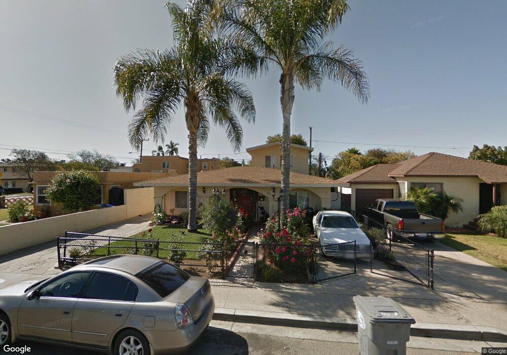
466 E Date St Oxnard, CA 93033
Cal-Gisler NeighborhoodEstimated Value: $631,000 - $734,669
4
Beds
3
Baths
1,656
Sq Ft
$423/Sq Ft
Est. Value
About This Home
This home is located at 466 E Date St, Oxnard, CA 93033 and is currently estimated at $699,917, approximately $422 per square foot. 466 E Date St is a home located in Ventura County with nearby schools including Elm Street Elementary School, R.J. Frank Academy of Marine Science & Engineering, and Santa Clara High School.
Ownership History
Date
Name
Owned For
Owner Type
Purchase Details
Closed on
Jan 15, 2021
Sold by
Lopez Edgard and Lopez Francisca
Bought by
Lopez Edgard and Lopez Francisca
Current Estimated Value
Home Financials for this Owner
Home Financials are based on the most recent Mortgage that was taken out on this home.
Original Mortgage
$246,000
Outstanding Balance
$179,867
Interest Rate
2.71%
Mortgage Type
New Conventional
Estimated Equity
$520,050
Purchase Details
Closed on
Oct 20, 2011
Sold by
Tritay Property Investments Llc
Bought by
Lopez Edgard and Lopez Francisca
Home Financials for this Owner
Home Financials are based on the most recent Mortgage that was taken out on this home.
Original Mortgage
$282,648
Interest Rate
4.87%
Mortgage Type
FHA
Purchase Details
Closed on
Oct 6, 2011
Sold by
Montes Jose C and Montes Maria G
Bought by
Tritay Property Investments Llc
Home Financials for this Owner
Home Financials are based on the most recent Mortgage that was taken out on this home.
Original Mortgage
$282,648
Interest Rate
4.87%
Mortgage Type
FHA
Purchase Details
Closed on
May 3, 1999
Sold by
Montes Jose C and Montes Maria G
Bought by
Montes Jose C and Montes Maria G
Home Financials for this Owner
Home Financials are based on the most recent Mortgage that was taken out on this home.
Original Mortgage
$135,000
Interest Rate
6.92%
Purchase Details
Closed on
Jan 2, 1998
Sold by
Nunez Jesus C and Nunez Ofelia
Bought by
Montes Jose C and Montes Maria G
Purchase Details
Closed on
Jun 15, 1997
Sold by
Montes Jose C and Montes Maria G
Bought by
Montes Jose C and Montes Maria G
Home Financials for this Owner
Home Financials are based on the most recent Mortgage that was taken out on this home.
Original Mortgage
$139,366
Interest Rate
7.91%
Mortgage Type
FHA
Create a Home Valuation Report for This Property
The Home Valuation Report is an in-depth analysis detailing your home's value as well as a comparison with similar homes in the area
Home Values in the Area
Average Home Value in this Area
Purchase History
| Date | Buyer | Sale Price | Title Company |
|---|---|---|---|
| Lopez Edgard | -- | Stewart Title Of Ca Inc | |
| Lopez Edgard | $290,000 | Lawyers Title | |
| Tritay Property Investments Llc | $205,619 | None Available | |
| Montes Jose C | $45,000 | First American Title Ins Co | |
| Montes Jose C | -- | -- | |
| Montes Jose C | $1,500 | Lawyers Title Company |
Source: Public Records
Mortgage History
| Date | Status | Borrower | Loan Amount |
|---|---|---|---|
| Open | Lopez Edgard | $246,000 | |
| Previous Owner | Lopez Edgard | $282,648 | |
| Previous Owner | Montes Jose C | $135,000 | |
| Previous Owner | Montes Jose C | $139,366 |
Source: Public Records
Tax History
| Year | Tax Paid | Tax Assessment Tax Assessment Total Assessment is a certain percentage of the fair market value that is determined by local assessors to be the total taxable value of land and additions on the property. | Land | Improvement |
|---|---|---|---|---|
| 2025 | $5,477 | $450,287 | $294,035 | $156,252 |
| 2024 | $5,477 | $441,458 | $288,269 | $153,189 |
| 2023 | $5,277 | $432,802 | $282,616 | $150,186 |
| 2022 | $5,119 | $424,316 | $277,074 | $147,242 |
| 2021 | $4,117 | $336,504 | $220,470 | $116,034 |
| 2020 | $4,193 | $333,056 | $218,210 | $114,846 |
| 2019 | $4,076 | $326,527 | $213,932 | $112,595 |
| 2018 | $4,019 | $320,126 | $209,738 | $110,388 |
| 2017 | $3,815 | $313,850 | $205,626 | $108,224 |
| 2016 | $3,682 | $307,697 | $201,595 | $106,102 |
| 2015 | $3,721 | $303,077 | $198,568 | $104,509 |
| 2014 | $3,680 | $297,142 | $194,679 | $102,463 |
Source: Public Records
Map
Nearby Homes
- 225 W Iris St
- 1239 S C St
- 1127 S C St
- 2024 S J St
- 2151 E Wooley Rd
- 865 S B St Unit Q1
- 3130 Paula St
- 3151 Fournier St
- 819 S B St Unit 34
- 633 Meta St
- 1030 Ilena St
- 1928 San Benito St
- 3631 La Costa Place
- 860 Morro Way
- 550 S G St
- 603 S G St
- 3638 S B St
- 360 Ibsen Place Unit 129
- 403 E 2nd St
- 807 Kingfisher Way
- 458 E Date St
- 1605 California St
- 1609 California St
- 450 E Date St
- 467 E Elm St
- 461 E Elm St
- 475 E Elm St
- 442 E Date St
- 451 E Elm St
- 445 E Elm St
- 434 E Date St
- 1541 California St Unit 15
- 509 E Date St
- 435 E Elm St
- 1560 California St
- 426 E Date St
- 1552 California St
- 427 E Elm St
- 435 E Date St
- 1644 California St Unit 9
Your Personal Tour Guide
Ask me questions while you tour the home.