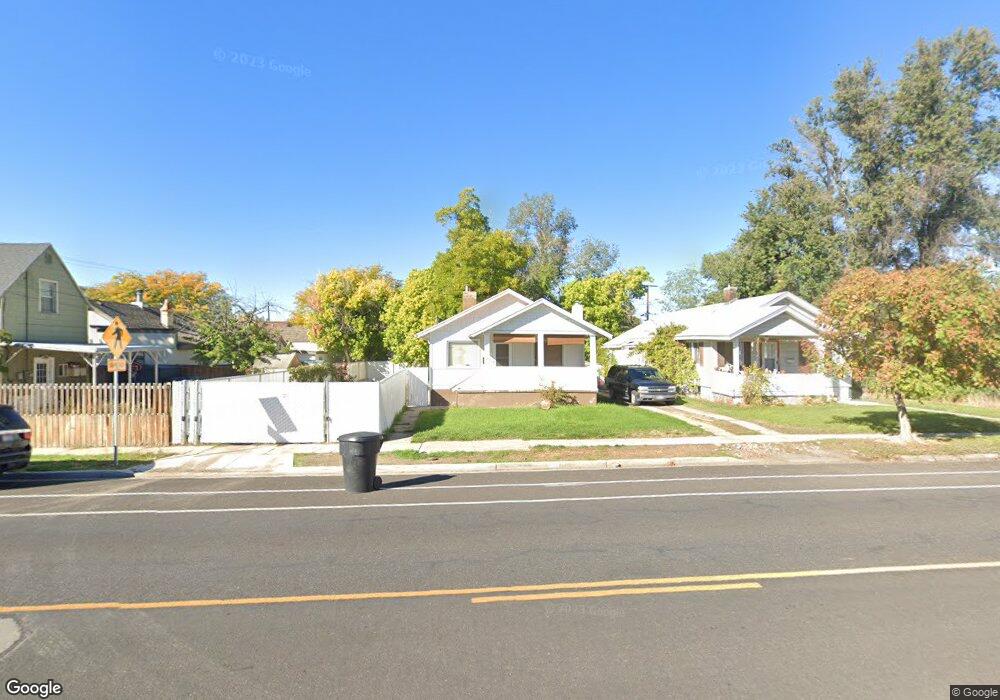
466 S Freedom Blvd Provo, UT 84601
Franklin NeighborhoodEstimated Value: $351,000 - $416,000
4
Beds
1
Bath
1,058
Sq Ft
$361/Sq Ft
Est. Value
About This Home
This home is located at 466 S Freedom Blvd, Provo, UT 84601 and is currently estimated at $382,282, approximately $361 per square foot. 466 S Freedom Blvd is a home located in Utah County with nearby schools including Franklin Elementary School, Dixon Middle School, and Provo High School.
Ownership History
Date
Name
Owned For
Owner Type
Purchase Details
Closed on
Jun 5, 2020
Sold by
Witte Mary Louise and Witte William Robert
Bought by
Witte William Robert and Williamson Witte Mary
Current Estimated Value
Purchase Details
Closed on
Mar 26, 2003
Sold by
Witte William Robert and Witte Mary Louise
Bought by
Witte William Robert and Witte Mary Louise
Home Financials for this Owner
Home Financials are based on the most recent Mortgage that was taken out on this home.
Original Mortgage
$74,200
Interest Rate
5.79%
Create a Home Valuation Report for This Property
The Home Valuation Report is an in-depth analysis detailing your home's value as well as a comparison with similar homes in the area
Home Values in the Area
Average Home Value in this Area
Purchase History
| Date | Buyer | Sale Price | Title Company |
|---|---|---|---|
| Witte William Robert | -- | None Available | |
| Witte William Robert | -- | Sundance Title Insurance Ag |
Source: Public Records
Mortgage History
| Date | Status | Borrower | Loan Amount |
|---|---|---|---|
| Closed | Witte William Robert | $74,200 |
Source: Public Records
Tax History Compared to Growth
Tax History
| Year | Tax Paid | Tax Assessment Tax Assessment Total Assessment is a certain percentage of the fair market value that is determined by local assessors to be the total taxable value of land and additions on the property. | Land | Improvement |
|---|---|---|---|---|
| 2025 | $1,535 | $173,910 | $144,300 | $171,900 |
| 2024 | $1,535 | $151,140 | $0 | $0 |
| 2023 | $1,512 | $146,685 | $0 | $0 |
| 2022 | $1,654 | $161,865 | $0 | $0 |
| 2021 | $1,221 | $208,300 | $86,100 | $122,200 |
| 2020 | $1,178 | $188,400 | $78,300 | $110,100 |
| 2019 | $1,096 | $182,400 | $72,300 | $110,100 |
| 2018 | $978 | $165,000 | $69,300 | $95,700 |
| 2017 | $869 | $80,575 | $0 | $0 |
| 2016 | $827 | $71,445 | $0 | $0 |
| 2015 | $747 | $65,230 | $0 | $0 |
| 2014 | $709 | $64,570 | $0 | $0 |
Source: Public Records
Map
Nearby Homes
- 491 S Freedom Blvd Unit 104204
- 516 S Freedom Blvd
- 244 W 400 S
- 475 S 400 W Unit D1
- 330 W 600 S
- 325 S 300 W
- 461 S 400 W
- 389 W 500 S
- 393 W 300 S
- 3404 W 1500 N
- 751 S 400 W
- 215 S 400 W
- 608 S 500 W Unit 3
- 131 E 500 S Unit 11
- 648 S 500 W Unit 4
- 70 E 200 S
- 213 S 100 E
- 40 S Freedom Blvd
- 590 S 600 W
- 144 E 200 S
- 456 S Freedom Blvd
- 490 S Freedom Blvd
- 490 S 200 W
- 220 W 500 S
- 234 W 500 S
- 444 S Freedom Blvd
- 242 W 500 S
- 430 S Freedom Blvd
- 260 W 500 S
- 420 S 200 W
- 447 S Freedom Blvd
- 231 W 400 S
- 491 S Freedom Blvd Unit 102
- 491 S Freedom Blvd Unit 103
- 491 S Freedom Blvd Unit 109
- 491 S Freedom Blvd Unit 111
- 491 S Freedom Blvd Unit 110
- 491 S Freedom Blvd Unit 108
- 491 S Freedom Blvd Unit 104
- 491 S Freedom Blvd Unit 105