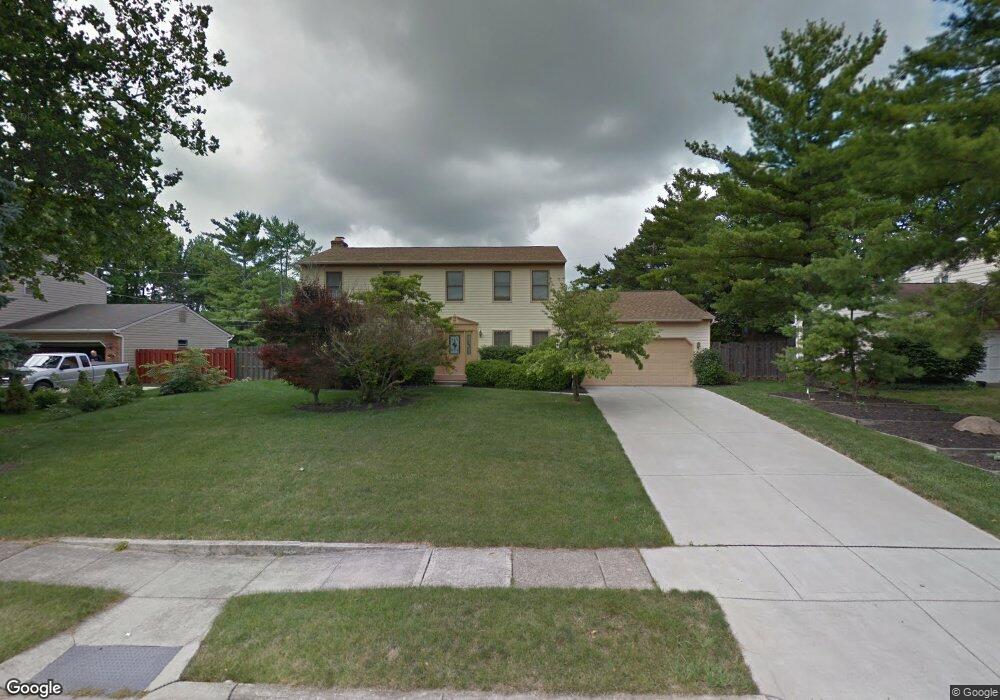
4663 Nugent Dr Columbus, OH 43220
Estimated Value: $634,000 - $762,000
4
Beds
3
Baths
2,840
Sq Ft
$247/Sq Ft
Est. Value
About This Home
This home is located at 4663 Nugent Dr, Columbus, OH 43220 and is currently estimated at $701,815, approximately $247 per square foot. 4663 Nugent Dr is a home located in Franklin County with nearby schools including Greensview Elementary School, Hastings Middle School, and Upper Arlington High School.
Ownership History
Date
Name
Owned For
Owner Type
Purchase Details
Closed on
Oct 12, 2016
Sold by
Patel Mahesh C and Patel Tarla M
Bought by
Desai Shrina S and Patel Amisha K
Current Estimated Value
Purchase Details
Closed on
Dec 19, 2000
Sold by
Funakoshi George
Bought by
Patel Mahesh C and Patel Tarla M
Home Financials for this Owner
Home Financials are based on the most recent Mortgage that was taken out on this home.
Original Mortgage
$172,000
Outstanding Balance
$60,647
Interest Rate
7.83%
Estimated Equity
$641,168
Purchase Details
Closed on
Jul 28, 1992
Bought by
Funakoshi George
Create a Home Valuation Report for This Property
The Home Valuation Report is an in-depth analysis detailing your home's value as well as a comparison with similar homes in the area
Home Values in the Area
Average Home Value in this Area
Purchase History
| Date | Buyer | Sale Price | Title Company |
|---|---|---|---|
| Desai Shrina S | -- | None Available | |
| Patel Mahesh C | $215,000 | -- | |
| Funakoshi George | -- | -- |
Source: Public Records
Mortgage History
| Date | Status | Borrower | Loan Amount |
|---|---|---|---|
| Open | Patel Mahesh C | $172,000 |
Source: Public Records
Tax History
| Year | Tax Paid | Tax Assessment Tax Assessment Total Assessment is a certain percentage of the fair market value that is determined by local assessors to be the total taxable value of land and additions on the property. | Land | Improvement |
|---|---|---|---|---|
| 2025 | $10,162 | $185,330 | $74,100 | $111,230 |
| 2024 | $10,162 | $185,330 | $74,100 | $111,230 |
| 2023 | $10,072 | $185,325 | $74,095 | $111,230 |
| 2022 | $9,598 | $146,100 | $50,090 | $96,010 |
| 2021 | $8,496 | $146,100 | $50,090 | $96,010 |
| 2020 | $8,957 | $146,100 | $50,090 | $96,010 |
| 2019 | $8,374 | $120,760 | $50,090 | $70,670 |
| 2018 | $7,740 | $120,760 | $50,090 | $70,670 |
| 2017 | $7,790 | $120,760 | $50,090 | $70,670 |
| 2016 | $7,146 | $108,080 | $32,060 | $76,020 |
| 2015 | $7,096 | $107,420 | $32,060 | $75,360 |
| 2014 | $7,104 | $107,420 | $32,060 | $75,360 |
| 2013 | $3,393 | $97,650 | $29,155 | $68,495 |
Source: Public Records
Map
Nearby Homes
- 2158 Sandston Rd
- 2242 Atlee Ct Unit 5
- 1916 Willoway Cir S
- 1883 Willoway Cir N Unit 1883
- 1594 Lafayette Dr Unit 1594
- 4803 Wynwood Ct
- 2626 Chartwell Rd
- 5268 Captains Ct
- 5258 Captains Ct Unit E
- 5108 Ranstead Ct
- 5107 Delancey St
- 2176 Hedgerow Rd Unit 2176D
- 5000 Slate Run Woods Ct
- 2200 Nayland Rd
- 5233 Brandy Oaks Ln Unit 5233
- 5273 Brandy Oaks Ln
- 5294 Brandy Oaks Ln
- 4818 Winterset Dr Unit 820
- 1466 Weybridge Rd
- 5273 Berrywood Dr Unit 5273
- 4675 Nugent Dr
- 2065 Sandover Ct
- 2060 Sandover Ct Unit 62
- 4639 Nugent Dr
- 4689 Nugent Dr
- 2027 Braemar Dr
- 2073 Sandover Ct
- 4676 Nugent Dr
- 2074 Sandover Ct
- 2024 Keswick Dr
- 4701 Nugent Dr Unit 705
- 4627 Nugent Dr
- 2015 Braemar Dr
- 2081 Sandover Ct
- 2014 Braemar Dr
- 4690 Nugent Dr Unit 692
- 4692 Nugent Dr
- 2065 Mackenzie Dr Unit 2065
- 2061 Mackenzie Dr
- 2082 Sandover Ct
Your Personal Tour Guide
Ask me questions while you tour the home.