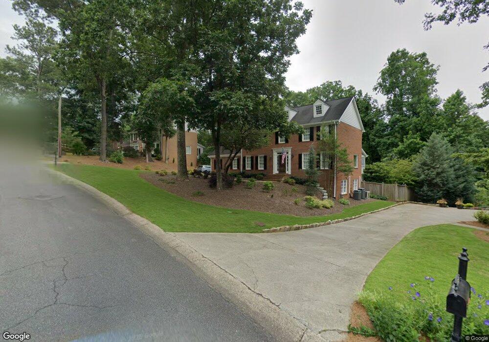
4664 Bancroft Ct Unit 1 Marietta, GA 30062
East Cobb NeighborhoodEstimated Value: $674,000 - $868,000
5
Beds
4
Baths
2,599
Sq Ft
$300/Sq Ft
Est. Value
About This Home
This home is located at 4664 Bancroft Ct Unit 1, Marietta, GA 30062 and is currently estimated at $778,920, approximately $299 per square foot. 4664 Bancroft Ct Unit 1 is a home located in Cobb County with nearby schools including Timber Ridge Elementary School, Dodgen Middle School, and Pope High School.
Ownership History
Date
Name
Owned For
Owner Type
Purchase Details
Closed on
Jan 12, 2011
Sold by
Sutherland Amy T
Bought by
Sutherland Thomas B
Current Estimated Value
Home Financials for this Owner
Home Financials are based on the most recent Mortgage that was taken out on this home.
Original Mortgage
$224,050
Outstanding Balance
$152,259
Interest Rate
4.79%
Mortgage Type
New Conventional
Estimated Equity
$626,661
Purchase Details
Closed on
Feb 28, 1995
Sold by
Southerland Howard H Beverly
Bought by
Sutherland Thomas B Amy T
Create a Home Valuation Report for This Property
The Home Valuation Report is an in-depth analysis detailing your home's value as well as a comparison with similar homes in the area
Home Values in the Area
Average Home Value in this Area
Purchase History
| Date | Buyer | Sale Price | Title Company |
|---|---|---|---|
| Sutherland Thomas B | -- | -- | |
| Sutherland Thomas B Amy T | $193,800 | -- |
Source: Public Records
Mortgage History
| Date | Status | Borrower | Loan Amount |
|---|---|---|---|
| Open | Sutherland Thomas B | $224,050 | |
| Closed | Sutherland Thomas B Amy T | $0 |
Source: Public Records
Tax History Compared to Growth
Tax History
| Year | Tax Paid | Tax Assessment Tax Assessment Total Assessment is a certain percentage of the fair market value that is determined by local assessors to be the total taxable value of land and additions on the property. | Land | Improvement |
|---|---|---|---|---|
| 2025 | $6,671 | $282,324 | $76,000 | $206,324 |
| 2024 | $6,677 | $282,324 | $76,000 | $206,324 |
| 2023 | $4,865 | $223,824 | $52,000 | $171,824 |
| 2022 | $5,451 | $223,824 | $52,000 | $171,824 |
| 2021 | $5,275 | $215,812 | $52,000 | $163,812 |
| 2020 | $5,275 | $215,812 | $52,000 | $163,812 |
| 2019 | $4,741 | $191,388 | $46,000 | $145,388 |
| 2018 | $4,741 | $191,388 | $46,000 | $145,388 |
| 2017 | $4,611 | $191,388 | $46,000 | $145,388 |
| 2016 | $4,144 | $169,768 | $42,000 | $127,768 |
| 2015 | $4,227 | $169,768 | $42,000 | $127,768 |
| 2014 | $4,252 | $169,768 | $0 | $0 |
Source: Public Records
Map
Nearby Homes
- 4780 Waterhaven Bend
- 2100 Stone Hollow Ct
- 4789 Waterhaven Bend
- 2082 Kinsmon Dr
- 4599 Lasalle Ct Unit 8A
- 2281 Fox Hound Pkwy
- 4586 Hunting Hound Ln
- 2269 Chimney Springs Dr
- 1961 Fields Pond Dr
- 4804 Dalhousie Place NE
- 2249 Smoke Stone Cir
- 2743 Chimney Springs Dr
- 1929 Fields Pond Glen
- 4255 Green Ridge Dr
- 4580 Roswell Rd
- 2212 Heritage Trace View
- 1804 Shelburne Ridge
- 4658 Bancroft Ct
- 4670 Bancroft Ct
- 0 Bancroft Ct Unit 7532082
- 0 Bancroft Ct
- 4671 Bancroft Ct Unit 1
- 4652 Bancroft Ct
- 4678 Bancroft Ct
- 4652 Newell Dr
- 4663 Bancroft Ct
- 2081 Haverhill Dr Unit 1
- 4650 Newell Dr Unit 4650
- 4650 Newell Dr Unit 2
- 4656 Newell Dr
- 4674 Bancroft Ct
- 2083 Haverhill Dr Unit 1
- 4650 Bancroft Ct Unit 1
- 4657 Bancroft Ct Unit 1
- 4651 Bancroft Ct Unit I
- 4658 Newell Dr
- 1912 Denton Walk Ct Unit B