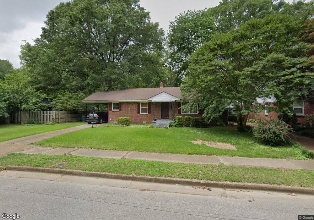
4664 Kaye Rd Memphis, TN 38117
Colonial Acres NeighborhoodEstimated Value: $213,000 - $273,000
3
Beds
1
Bath
1,250
Sq Ft
$195/Sq Ft
Est. Value
About This Home
This home is located at 4664 Kaye Rd, Memphis, TN 38117 and is currently estimated at $243,536, approximately $194 per square foot. 4664 Kaye Rd is a home located in Shelby County with nearby schools including Sea Isle Elementary School, Colonial Middle, and Overton High.
Ownership History
Date
Name
Owned For
Owner Type
Purchase Details
Closed on
Mar 24, 1999
Sold by
Aiello Blainas Mary T
Bought by
Scatamacchia Dino L and Scatamacchia Ashley A
Current Estimated Value
Home Financials for this Owner
Home Financials are based on the most recent Mortgage that was taken out on this home.
Original Mortgage
$95,245
Outstanding Balance
$23,189
Interest Rate
6.82%
Mortgage Type
FHA
Estimated Equity
$220,347
Purchase Details
Closed on
Feb 29, 1996
Bought by
Rogers Carolyn J and Rogers Eliza
Create a Home Valuation Report for This Property
The Home Valuation Report is an in-depth analysis detailing your home's value as well as a comparison with similar homes in the area
Home Values in the Area
Average Home Value in this Area
Purchase History
| Date | Buyer | Sale Price | Title Company |
|---|---|---|---|
| Scatamacchia Dino L | $95,500 | -- | |
| Rogers Carolyn J | $89,500 | -- |
Source: Public Records
Mortgage History
| Date | Status | Borrower | Loan Amount |
|---|---|---|---|
| Open | Scatamacchia Dino L | $95,245 |
Source: Public Records
Tax History Compared to Growth
Tax History
| Year | Tax Paid | Tax Assessment Tax Assessment Total Assessment is a certain percentage of the fair market value that is determined by local assessors to be the total taxable value of land and additions on the property. | Land | Improvement |
|---|---|---|---|---|
| 2025 | $1,635 | $51,800 | $11,250 | $40,550 |
| 2024 | $1,635 | $48,225 | $9,050 | $39,175 |
| 2023 | $2,938 | $48,225 | $9,050 | $39,175 |
| 2022 | $2,938 | $48,225 | $9,050 | $39,175 |
| 2021 | $2,972 | $48,225 | $9,050 | $39,175 |
| 2020 | $2,353 | $32,475 | $9,050 | $23,425 |
| 2019 | $2,353 | $32,475 | $9,050 | $23,425 |
| 2018 | $2,353 | $32,475 | $9,050 | $23,425 |
| 2017 | $1,335 | $32,475 | $9,050 | $23,425 |
| 2016 | $1,386 | $31,725 | $0 | $0 |
| 2014 | $1,386 | $31,725 | $0 | $0 |
Source: Public Records
Map
Nearby Homes
- 1014 S Perkins Rd
- 4680 Crossover Ln
- 4614 Perkins Cove
- 1086 Perkins Terrace
- 4539 Kings Park Rd
- 881 S Perkins Rd
- 883 Drake Manor Cove
- 1160 W Perkins Rd
- 4522 Park Ave
- 820 Creekside Dr Unit 1
- 931 Toscana Park Ct
- 4514 Park Ave
- 812 Creekside Dr Unit 2
- 4844 Welchshire Ave
- 814 Thistledown Dr Unit 1206
- 830 Colonial Rd
- 4764 Eagle Crest Dr Unit 4002
- 1063 Woodview Dr
- 4784 Marlin Ave
- 809 Merrywood Dr Unit 4
- 1004 Perkins Terrace
- 1004 S Perkins Rd
- 4674 Kaye Rd
- 4637 Crossover Ln
- 4651 Crossover Ln
- 4665 Kaye Rd
- 4671 Kaye Rd
- 4657 Crossover Ln
- 4682 Kaye Rd
- 1005 W Perkins Rd
- 4681 Kaye Rd
- 1005 S Perkins Rd
- 1024 Perkins Terrace
- 4663 Crossover Ln
- 4623 Crossover Ln
- 1015 S Perkins Rd
- 4689 Kaye Rd
- 4673 Crossover Ln
- 4690 Kaye Rd
- 4682 Chip Rd