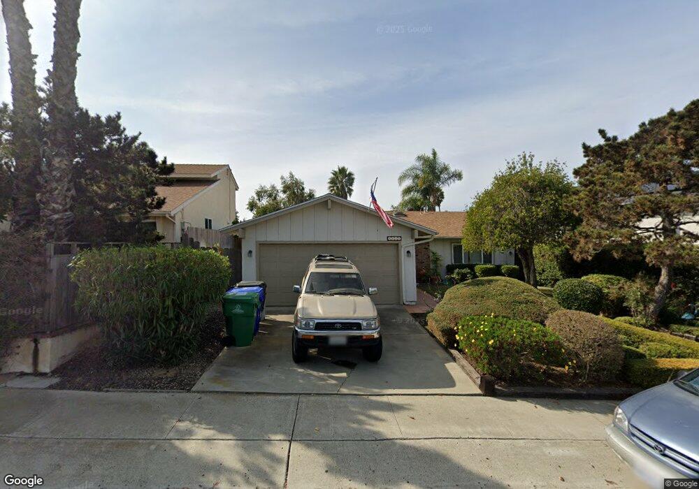
4665 Pauling Ave San Diego, CA 92122
University City NeighborhoodEstimated Value: $1,312,440 - $1,521,000
3
Beds
2
Baths
1,254
Sq Ft
$1,128/Sq Ft
Est. Value
About This Home
This home is located at 4665 Pauling Ave, San Diego, CA 92122 and is currently estimated at $1,414,360, approximately $1,127 per square foot. 4665 Pauling Ave is a home located in San Diego County with nearby schools including Marie Curie Elementary School, Standley Middle School, and University City High School.
Ownership History
Date
Name
Owned For
Owner Type
Purchase Details
Closed on
Jan 31, 2018
Sold by
Cohn Stefan M and Walter A Cohn Family Trust
Bought by
Cohn Eric R
Current Estimated Value
Purchase Details
Closed on
Jun 9, 2016
Sold by
Cohn Walter A
Bought by
Cohn Walter A and Walter A Cohn Family Trust
Purchase Details
Closed on
Dec 8, 2015
Sold by
Rutherford Beth Daniell
Bought by
Cohn Walter A and Cohn Dietlinde
Create a Home Valuation Report for This Property
The Home Valuation Report is an in-depth analysis detailing your home's value as well as a comparison with similar homes in the area
Home Values in the Area
Average Home Value in this Area
Purchase History
| Date | Buyer | Sale Price | Title Company |
|---|---|---|---|
| Cohn Eric R | -- | None Available | |
| Cohn Walter A | -- | None Available | |
| Cohn Walter A | $628,500 | Corinthian Title Company |
Source: Public Records
Tax History Compared to Growth
Tax History
| Year | Tax Paid | Tax Assessment Tax Assessment Total Assessment is a certain percentage of the fair market value that is determined by local assessors to be the total taxable value of land and additions on the property. | Land | Improvement |
|---|---|---|---|---|
| 2025 | $8,983 | $743,204 | $555,778 | $187,426 |
| 2024 | $8,983 | $728,632 | $544,881 | $183,751 |
| 2023 | $8,785 | $714,347 | $534,198 | $180,149 |
| 2022 | $8,552 | $700,341 | $523,724 | $176,617 |
| 2021 | $8,493 | $686,609 | $513,455 | $173,154 |
| 2020 | $8,390 | $679,570 | $508,191 | $171,379 |
| 2019 | $8,250 | $666,968 | $498,767 | $168,201 |
| 2018 | $7,631 | $653,891 | $488,988 | $164,903 |
| 2017 | $81 | $641,070 | $479,400 | $161,670 |
| 2016 | $1,574 | $131,500 | $55,015 | $76,485 |
| 2015 | $1,551 | $129,526 | $54,189 | $75,337 |
| 2014 | $1,528 | $126,990 | $53,128 | $73,862 |
Source: Public Records
Map
Nearby Homes
- 4635 Pauling Ave
- 7056 Haworth St
- 4627 Huggins St
- 7212 Florey St
- 4282 Robbins St
- 7190 Shoreline Dr Unit 6313
- 4612 Benhurst Ave
- 7160 Shoreline Dr Unit 4213
- 4224 Governor Dr
- 6214 Agee St Unit 34
- 7224 Shoreline Dr Unit 172
- 6180 Agee St Unit 159
- 6188 Agee St Unit 230
- 7182 Calabria Ct Unit A
- 6190 Agee St Unit 260
- 6330 Genesee Ave Unit 319
- 6330 Genesee Ave Unit 220
- 6330 Genesee Ave Unit 119
- 6330 Genesee Ave Unit 112
- 6330 Genesee Ave Unit 213
- 4695 Pauling Ave
- 7087 Weller St
- 7081 Weller St
- 7146 Haworth St
- 7132 Haworth St
- 7095 Weller St
- 4678 Pauling Ave
- 4666 Pauling Ave
- 4690 Pauling Ave
- 7118 Haworth St
- 4654 Pauling Ave
- 4706 Pauling Ave
- 4642 Pauling Ave
- 7075 Weller St
- 4630 Pauling Ave
- 7104 Haworth St
- 4716 Pauling Ave
- 4618 Pauling Ave
- 4715 Cather Ave
- 4707 Cather Ave