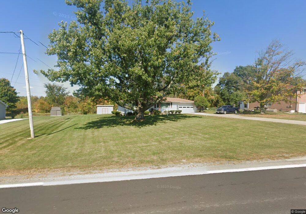
4666 State Route 181 Crestline, OH 44827
Estimated Value: $142,000 - $214,000
3
Beds
1
Bath
1,300
Sq Ft
$144/Sq Ft
Est. Value
About This Home
This home is located at 4666 State Route 181, Crestline, OH 44827 and is currently estimated at $186,706, approximately $143 per square foot. 4666 State Route 181 is a home located in Richland County with nearby schools including Stingel Elementary School, Ontario Middle School, and Ontario High School.
Ownership History
Date
Name
Owned For
Owner Type
Purchase Details
Closed on
May 10, 2021
Sold by
Scott Timothy A and Scott Shawanna K
Bought by
Scott Timothy A and Scott Shawauna K
Current Estimated Value
Home Financials for this Owner
Home Financials are based on the most recent Mortgage that was taken out on this home.
Original Mortgage
$108,000
Outstanding Balance
$81,765
Interest Rate
3.1%
Mortgage Type
New Conventional
Estimated Equity
$104,941
Purchase Details
Closed on
Apr 27, 2021
Sold by
Scott Timothy A and Scott Shawauna K
Bought by
Scott Timothy A and Scott Shawauna K
Home Financials for this Owner
Home Financials are based on the most recent Mortgage that was taken out on this home.
Original Mortgage
$108,000
Outstanding Balance
$81,765
Interest Rate
3.1%
Mortgage Type
New Conventional
Estimated Equity
$104,941
Purchase Details
Closed on
Feb 25, 1997
Sold by
Eichelberger Max J
Bought by
Scott Timothy A
Home Financials for this Owner
Home Financials are based on the most recent Mortgage that was taken out on this home.
Original Mortgage
$101,850
Interest Rate
7.92%
Mortgage Type
VA
Create a Home Valuation Report for This Property
The Home Valuation Report is an in-depth analysis detailing your home's value as well as a comparison with similar homes in the area
Home Values in the Area
Average Home Value in this Area
Purchase History
| Date | Buyer | Sale Price | Title Company |
|---|---|---|---|
| Scott Timothy A | -- | First American Title Ins Co | |
| Scott Timothy A | -- | First American Title | |
| Scott Timothy A | $99,900 | -- |
Source: Public Records
Mortgage History
| Date | Status | Borrower | Loan Amount |
|---|---|---|---|
| Open | Scott Timothy A | $108,000 | |
| Closed | Scott Timothy A | $108,000 | |
| Previous Owner | Scott Timothy A | $101,850 |
Source: Public Records
Tax History
| Year | Tax Paid | Tax Assessment Tax Assessment Total Assessment is a certain percentage of the fair market value that is determined by local assessors to be the total taxable value of land and additions on the property. | Land | Improvement |
|---|---|---|---|---|
| 2024 | $2,058 | $42,250 | $6,270 | $35,980 |
| 2023 | $2,105 | $42,250 | $6,270 | $35,980 |
| 2022 | $1,872 | $32,320 | $5,700 | $26,620 |
| 2021 | $1,875 | $32,320 | $5,700 | $26,620 |
| 2020 | $2,001 | $32,320 | $5,700 | $26,620 |
| 2019 | $1,874 | $27,390 | $4,830 | $22,560 |
| 2018 | $1,591 | $27,390 | $4,830 | $22,560 |
| 2017 | $1,566 | $27,390 | $4,830 | $22,560 |
| 2016 | $1,577 | $27,420 | $4,690 | $22,730 |
| 2015 | $1,576 | $27,420 | $4,690 | $22,730 |
| 2014 | $1,578 | $27,420 | $4,690 | $22,730 |
| 2012 | $739 | $28,260 | $4,830 | $23,430 |
Source: Public Records
Map
Nearby Homes
- 4310 Snodgrass Rd
- 5263 Lincoln Hwy
- 3880 Horizon Dr
- 0 Snodgrass Rd
- 3872 Snodgrass Rd
- 3670 Pearl St
- 0 Rudy Rd
- 1260 Thrush Rd
- 3560 Park Ave W
- 847 S Horning Rd
- 820 South St
- 1689 Ohio 314
- 1689 State Route 314
- 714 South St
- 3516 Muirfield
- 3516 Muirfield Dr
- 3320 Oakstone Dr
- 763 County Line Rd Unit 104
- 763 County Line Rd Unit Lot 109
- 763 County Line Rd Unit Lot 103
- 4664 State Route 181
- 4676 State Route 181
- 4685 State Route 181
- 4653 State Route 181
- 4660 State Route 181
- 4655 State Route 181
- 4734 Ohio 181
- 4734 State Route 181
- 4655 Ohio 181
- 4639 State Route 181
- 4737 State Route 181
- 4629 State Route 181
- 645 Eckstein Rd
- 4743 State Route 181
- 701 Eckstein Rd
- 676 Eckstein Rd
- 4809 State Route 181
- 4565 State Route 181
- 749 Eckstein Rd
- 4543 State Route 181
Your Personal Tour Guide
Ask me questions while you tour the home.