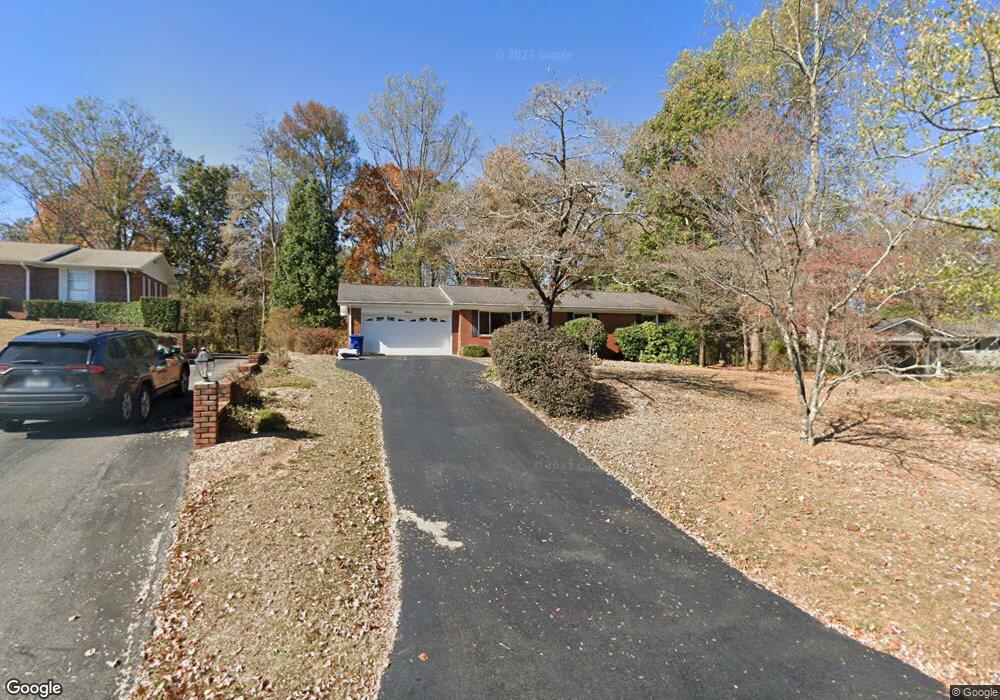
4667 Pierson Dr Ooltewah, TN 37363
Estimated Value: $268,770 - $344,000
--
Bed
1
Bath
1,380
Sq Ft
$223/Sq Ft
Est. Value
About This Home
This home is located at 4667 Pierson Dr, Ooltewah, TN 37363 and is currently estimated at $307,193, approximately $222 per square foot. 4667 Pierson Dr is a home located in Hamilton County with nearby schools including Apison Elementary School, Ooltewah Middle School, and Ooltewah High School.
Ownership History
Date
Name
Owned For
Owner Type
Purchase Details
Closed on
Jun 21, 2011
Sold by
Shultz Kari L
Bought by
Shultz Kari L and Kari L Shultz Revocable Living
Current Estimated Value
Purchase Details
Closed on
Jul 30, 2003
Sold by
Southern Adventist University
Bought by
Shultz Kari L
Home Financials for this Owner
Home Financials are based on the most recent Mortgage that was taken out on this home.
Original Mortgage
$106,632
Outstanding Balance
$45,415
Interest Rate
5.17%
Mortgage Type
Purchase Money Mortgage
Estimated Equity
$261,778
Purchase Details
Closed on
Sep 20, 2002
Sold by
Reid Nelda M
Bought by
Southern Adventist University
Create a Home Valuation Report for This Property
The Home Valuation Report is an in-depth analysis detailing your home's value as well as a comparison with similar homes in the area
Home Values in the Area
Average Home Value in this Area
Purchase History
| Date | Buyer | Sale Price | Title Company |
|---|---|---|---|
| Shultz Kari L | -- | None Available | |
| Shultz Kari L | $116,500 | -- | |
| Southern Adventist University | $116,500 | Chattanooga Title |
Source: Public Records
Mortgage History
| Date | Status | Borrower | Loan Amount |
|---|---|---|---|
| Open | Shultz Kari L | $106,632 |
Source: Public Records
Tax History Compared to Growth
Tax History
| Year | Tax Paid | Tax Assessment Tax Assessment Total Assessment is a certain percentage of the fair market value that is determined by local assessors to be the total taxable value of land and additions on the property. | Land | Improvement |
|---|---|---|---|---|
| 2024 | $982 | $43,900 | $0 | $0 |
| 2023 | $1,672 | $43,900 | $0 | $0 |
| 2022 | $1,601 | $43,900 | $0 | $0 |
| 2021 | $1,601 | $43,900 | $0 | $0 |
| 2020 | $1,611 | $36,275 | $0 | $0 |
| 2019 | $1,611 | $36,275 | $0 | $0 |
| 2018 | $1,469 | $36,275 | $0 | $0 |
| 2017 | $1,469 | $36,275 | $0 | $0 |
| 2016 | $1,313 | $0 | $0 | $0 |
| 2015 | $1,313 | $31,525 | $0 | $0 |
| 2014 | $1,313 | $0 | $0 | $0 |
Source: Public Records
Map
Nearby Homes
- 10050 Forest Dr
- 9986 Forest Dr
- 10035 Shagbark Trail
- 3911 Darbo Ln
- 9795 Trestle Cir
- 9888 Trestle Cir
- 9892 Trestle Cir
- 9876 Trestle Cir
- 4988 Saginaw Ln
- 9570 Legacy Oaks Dr
- 0 Bowen Trail Unit RTC2996720
- 0 Bowen Trail Unit 1520739
- 0 Bowen Trail Unit 19102809
- 9677 Bowen Trail
- 9877 Trestle Cir
- 9885 Trestle Cir
- 9891 Trestle Cir
- 4053 Barnsley Loop
- 9702 Dutton Ln
- 10092 Sunny Ln
- 4671 Pierson Dr
- 4663 Pierson Dr
- 4659 Pierson Dr
- 138 Pierson Dr
- 169 Pierson Dr
- 210 Pierson Dr
- 4672 Pierson Dr
- 4673 Pierson Dr
- 4668 Pierson Dr Unit 3
- 4655 Pierson Dr
- 4676 Pierson Dr
- 4466 Suhrie Rd
- 4677 Pierson Dr
- 4471 Suhrie Rd
- 4649 Pierson Dr
- 4464 Suhrie Rd
- 4680 Pierson Dr Unit 1
- 4672 University Dr
- 4467 Suhrie Rd
- 4644 Pierson Dr