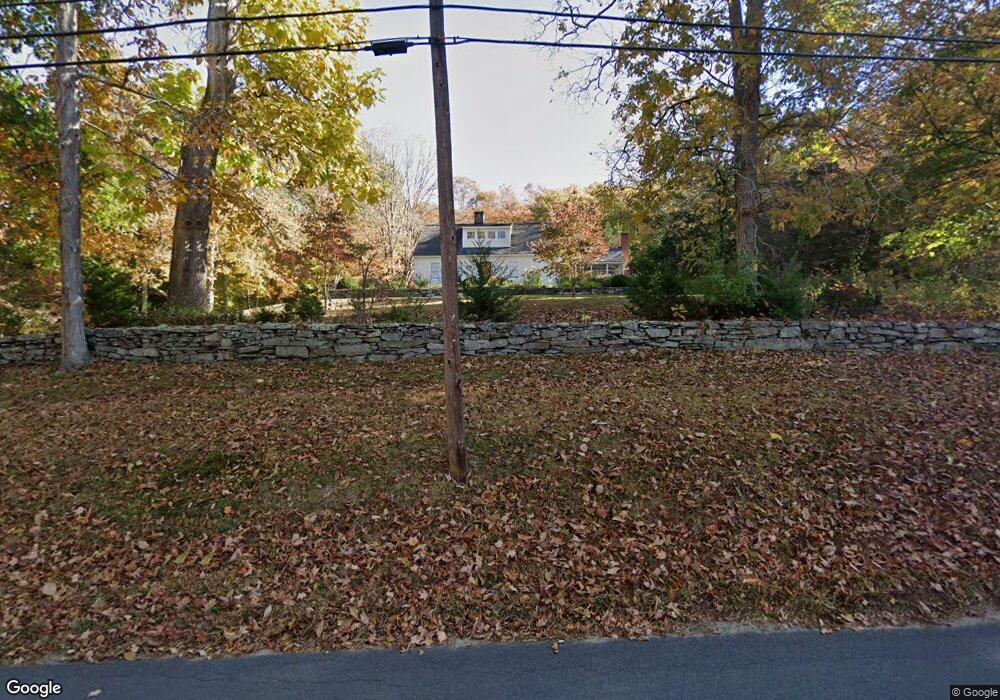
467 Joshuatown Rd Old Lyme, CT 06371
Estimated Value: $1,008,000 - $1,139,000
3
Beds
3
Baths
2,410
Sq Ft
$441/Sq Ft
Est. Value
About This Home
This home is located at 467 Joshuatown Rd, Old Lyme, CT 06371 and is currently estimated at $1,062,764, approximately $440 per square foot. 467 Joshuatown Rd is a home located in New London County with nearby schools including Lyme Consolidated School, Lyme-Old Lyme Middle School, and Lyme-Old Lyme High School.
Ownership History
Date
Name
Owned For
Owner Type
Purchase Details
Closed on
Feb 5, 1999
Sold by
Oconnor Arthur R and Oconnor Laurel U
Bought by
Catlett John M and Catlett Athana K
Current Estimated Value
Home Financials for this Owner
Home Financials are based on the most recent Mortgage that was taken out on this home.
Original Mortgage
$217,000
Outstanding Balance
$51,362
Interest Rate
6.74%
Estimated Equity
$1,011,402
Create a Home Valuation Report for This Property
The Home Valuation Report is an in-depth analysis detailing your home's value as well as a comparison with similar homes in the area
Home Values in the Area
Average Home Value in this Area
Purchase History
| Date | Buyer | Sale Price | Title Company |
|---|---|---|---|
| Catlett John M | $317,000 | -- |
Source: Public Records
Mortgage History
| Date | Status | Borrower | Loan Amount |
|---|---|---|---|
| Open | Catlett John M | $217,000 | |
| Previous Owner | Catlett John M | $15,000 | |
| Previous Owner | Catlett John M | $120,000 | |
| Previous Owner | Catlett John M | $20,000 |
Source: Public Records
Tax History Compared to Growth
Tax History
| Year | Tax Paid | Tax Assessment Tax Assessment Total Assessment is a certain percentage of the fair market value that is determined by local assessors to be the total taxable value of land and additions on the property. | Land | Improvement |
|---|---|---|---|---|
| 2025 | $8,620 | $594,500 | $214,100 | $380,400 |
| 2024 | $8,620 | $594,500 | $214,100 | $380,400 |
| 2023 | $7,898 | $405,000 | $136,200 | $268,800 |
| 2022 | $8,080 | $405,000 | $136,200 | $268,800 |
| 2021 | $8,080 | $405,000 | $136,200 | $268,800 |
| 2020 | $8,080 | $405,000 | $136,200 | $268,800 |
| 2019 | $8,080 | $405,000 | $136,200 | $268,800 |
| 2018 | $8,517 | $457,900 | $175,900 | $282,000 |
| 2017 | $8,357 | $457,900 | $175,900 | $282,000 |
| 2016 | $8,357 | $457,900 | $175,900 | $282,000 |
| 2015 | $8,128 | $457,900 | $175,900 | $282,000 |
| 2014 | $7,784 | $457,900 | $175,900 | $282,000 |
Source: Public Records
Map
Nearby Homes
- 496 Joshuatown Rd
- 53 Selden Rd
- 14 Ferry Rd Unit E2
- 11 Phelps Rd
- 7 Shelter Rock Rd
- 153 Ferry Rd
- 153 Mitchell Hill Rd
- 89 Brush Hill Rd
- 47 Ferry Rd
- 45 Clark Rd
- 131 Middlesex Ave
- 36 Kings Hwy
- 274 Joshuatown Rd
- 79 Middlesex Ave
- 0 Florida Rd
- 5 Mitchell Ln
- 21 River Ln
- 11 Kings Hwy
- 132 Tantumorantum Rd
- 11 Winter Ave
- 22-2 Selden Rd
- 53-3 Selden Rd
- 473 Joshuatown Rd
- 1 Selden Rd
- 463 Joshuatown Rd
- 2 Selden Rd
- 44 Ferry Rd
- 481 Joshuatown Rd
- 486 Joshuatown Rd
- 15 Selden Rd
- 445 Joshuatown Rd
- 40 Ferry Rd
- 452 Joshuatown Rd
- 433 Joshuatown Rd
- 491 Joshuatown Rd
- 485 Joshuatown Rd
- 488 Joshuatown Rd
- 492 Joshuatown Rd
- 48 Ferry Rd