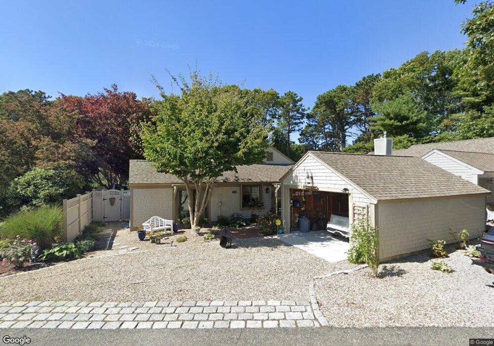
467 Mashie Cir Mashpee, MA 02649
New Seabury-Popponesset Island NeighborhoodEstimated Value: $822,000 - $953,000
2
Beds
2
Baths
1,270
Sq Ft
$675/Sq Ft
Est. Value
About This Home
This home is located at 467 Mashie Cir, Mashpee, MA 02649 and is currently estimated at $856,731, approximately $674 per square foot. 467 Mashie Cir is a home located in Barnstable County with nearby schools including Kenneth C. Coombs School, Quashnet School, and Mashpee Middle School.
Ownership History
Date
Name
Owned For
Owner Type
Purchase Details
Closed on
Jan 6, 2020
Sold by
Blanchard Jill
Bought by
Jill Blanchard Ret
Current Estimated Value
Purchase Details
Closed on
Oct 27, 2008
Sold by
Tuite Charles B and Tuite Jill Blanchard
Bought by
Blanchard Jill
Purchase Details
Closed on
Mar 30, 2005
Sold by
Tuite Jill Blanchard and Blanchard Jill Britt
Bought by
Tuite Charles B
Home Financials for this Owner
Home Financials are based on the most recent Mortgage that was taken out on this home.
Original Mortgage
$236,300
Interest Rate
5.61%
Purchase Details
Closed on
Jan 8, 2004
Sold by
Blanchard Joseph R and Blanchard Marilyn M
Bought by
Blanchard Jill Britt
Home Financials for this Owner
Home Financials are based on the most recent Mortgage that was taken out on this home.
Original Mortgage
$302,300
Interest Rate
5.88%
Mortgage Type
Purchase Money Mortgage
Create a Home Valuation Report for This Property
The Home Valuation Report is an in-depth analysis detailing your home's value as well as a comparison with similar homes in the area
Home Values in the Area
Average Home Value in this Area
Purchase History
| Date | Buyer | Sale Price | Title Company |
|---|---|---|---|
| Jill Blanchard Ret | -- | None Available | |
| Blanchard Jill | -- | -- | |
| Tuite Charles B | -- | -- | |
| Blanchard Jill Britt | $324,300 | -- |
Source: Public Records
Mortgage History
| Date | Status | Borrower | Loan Amount |
|---|---|---|---|
| Previous Owner | Tuite Charles B | $236,300 | |
| Previous Owner | Blanchard Jill Britt | $302,300 |
Source: Public Records
Tax History Compared to Growth
Tax History
| Year | Tax Paid | Tax Assessment Tax Assessment Total Assessment is a certain percentage of the fair market value that is determined by local assessors to be the total taxable value of land and additions on the property. | Land | Improvement |
|---|---|---|---|---|
| 2025 | $4,893 | $739,100 | $408,300 | $330,800 |
| 2024 | $4,415 | $686,700 | $371,300 | $315,400 |
| 2023 | $4,065 | $579,900 | $318,200 | $261,700 |
| 2022 | $3,830 | $468,800 | $252,900 | $215,900 |
| 2021 | $3,847 | $424,200 | $243,400 | $180,800 |
| 2020 | $3,715 | $408,700 | $234,100 | $174,600 |
| 2019 | $3,845 | $424,900 | $263,900 | $161,000 |
| 2018 | $3,737 | $418,900 | $278,900 | $140,000 |
| 2017 | $3,732 | $406,100 | $278,900 | $127,200 |
| 2016 | $3,689 | $399,200 | $278,900 | $120,300 |
| 2015 | $3,585 | $393,500 | $278,900 | $114,600 |
| 2014 | $3,628 | $386,400 | $273,200 | $113,200 |
Source: Public Records
Map
Nearby Homes
- 3 Niblick Ln
- 59 Mashie Cir
- 28 Quinns Way
- 51 Fairway Ln
- 7 Brassie Way
- 5 Tide Run
- 100 Mid-Iron Way Unit 7005
- 100 Mid Iron Way Unit 7005
- 51 Walton Heath Way
- 72 Walton Heath Way
- 4 Lanyard Way Unit 7242C
- 16 Slice Way
- 27 Prestwick Ln
- 23 Topping Lift
- 1 Manitoba Rd
- 236 Glenneagle Dr
- 12 Mizzenmast
- 3 Mizzenmast
- 51 Manitoba Rd
- 111 Waterline Dr S
- 47 Mashie Cir
- 51 Mashie Cir
- 468 Mashie Cir
- 466 Mashie Cir
- 45 Mashie Cir
- 43 Mashie Cir
- 462 Mashie Cir
- 469 Mashie Cir
- 465 Mashie Cir
- 461 Mashie Cir
- 53 Mashie Cir
- 460 Mashie Cir
- 460 Mashie Cir Unit 460
- 55 Mashie Cir
- 470 Mashie Cir
- 495 Mashie Cir
- 46 Mashie Cir
- 459 Mashie Cir
- 496 Mashie Cir
- 494 Mashie Cir