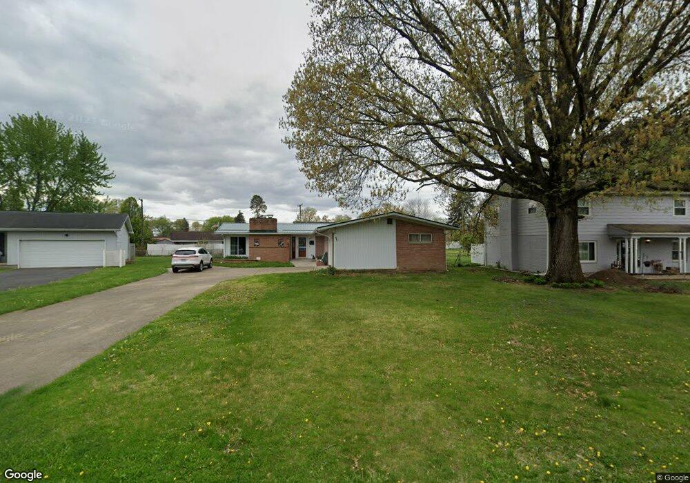
467 Meadowbrook Dr Newark, OH 43055
Estimated Value: $275,000 - $293,000
3
Beds
2
Baths
1,678
Sq Ft
$170/Sq Ft
Est. Value
About This Home
This home is located at 467 Meadowbrook Dr, Newark, OH 43055 and is currently estimated at $285,351, approximately $170 per square foot. 467 Meadowbrook Dr is a home located in Licking County with nearby schools including John Clem Elementary School, Liberty Middle School, and Newark High School.
Ownership History
Date
Name
Owned For
Owner Type
Purchase Details
Closed on
Apr 7, 2006
Sold by
Barclay Craig D
Bought by
Jeffers Ii George E
Current Estimated Value
Home Financials for this Owner
Home Financials are based on the most recent Mortgage that was taken out on this home.
Original Mortgage
$135,375
Outstanding Balance
$77,661
Interest Rate
6.33%
Mortgage Type
Fannie Mae Freddie Mac
Estimated Equity
$207,690
Create a Home Valuation Report for This Property
The Home Valuation Report is an in-depth analysis detailing your home's value as well as a comparison with similar homes in the area
Home Values in the Area
Average Home Value in this Area
Purchase History
| Date | Buyer | Sale Price | Title Company |
|---|---|---|---|
| Jeffers Ii George E | $142,500 | Central |
Source: Public Records
Mortgage History
| Date | Status | Borrower | Loan Amount |
|---|---|---|---|
| Open | Jeffers Ii George E | $135,375 |
Source: Public Records
Tax History
| Year | Tax Paid | Tax Assessment Tax Assessment Total Assessment is a certain percentage of the fair market value that is determined by local assessors to be the total taxable value of land and additions on the property. | Land | Improvement |
|---|---|---|---|---|
| 2024 | $2,710 | $75,810 | $23,730 | $52,080 |
| 2023 | $2,705 | $75,810 | $23,730 | $52,080 |
| 2022 | $2,400 | $57,930 | $13,510 | $44,420 |
| 2021 | $2,436 | $57,930 | $13,510 | $44,420 |
| 2020 | $2,494 | $57,930 | $13,510 | $44,420 |
| 2019 | $2,051 | $45,930 | $10,400 | $35,530 |
| 2018 | $2,053 | $0 | $0 | $0 |
| 2017 | $2,041 | $0 | $0 | $0 |
| 2016 | $2,071 | $0 | $0 | $0 |
| 2015 | $2,116 | $0 | $0 | $0 |
| 2014 | $2,711 | $0 | $0 | $0 |
| 2013 | $2,205 | $0 | $0 | $0 |
Source: Public Records
Map
Nearby Homes
- 469 King Ct
- 584 Moull St Unit A
- 188 Meadow Dr
- 184 Meadow Dr
- 476 W Shields St
- 632 Moull St
- 792 Stone Ridge Way Unit 792
- 946 Lateglow Ct
- 565 Granville St
- 189 N Quentin Rd
- 574 Blakeley Place Unit 574
- 385 Woods Ave
- 222 Bachmann Ave
- 655 Evans St
- 361 Granville St
- 34 Charles St
- 355 Eddy St
- 15 W Postal Ave
- 158 English Ave
- 122 W Shields St
- 459 Meadowbrook Dr
- 481 Meadowbrook Dr
- 468 Jefferson Rd
- 451 Meadowbrook Dr
- 460 Jefferson Rd
- 484 Jefferson Rd
- 489 Meadowbrook Dr
- 456 Meadowbrook Dr
- 443 Meadowbrook Dr
- 472 Meadowbrook Dr
- 462 Meadowbrook Dr
- 912 Welsh View Dr
- 480 Meadowbrook Dr
- 446 Reverie Place
- 444 Jefferson Rd
- 497 Meadowbrook Dr
- 488 Meadowbrook Dr
- 500 Jefferson Rd
- 440 Reverie Place
- 494 Meadowbrook Dr
Your Personal Tour Guide
Ask me questions while you tour the home.