Estimated Value: $249,000 - $277,000
3
Beds
3
Baths
1,629
Sq Ft
$164/Sq Ft
Est. Value
About This Home
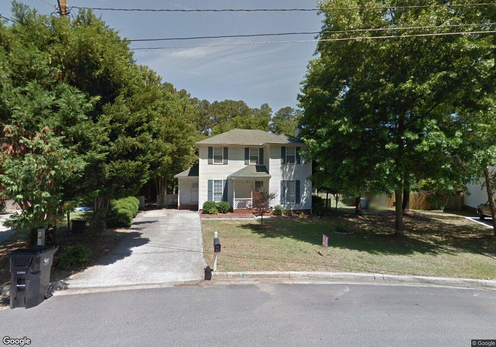
This home is located at 467 Pheasant Run Dr, Evans, GA 30809 and is currently estimated at $267,227, approximately $164 per square foot. 467 Pheasant Run Dr is a home located in Columbia County with nearby schools including Evans Elementary School, Evans Middle School, and Evans High School.
Ownership History
Date
Name
Owned For
Owner Type
Purchase Details
Closed on
Jun 1, 2013
Sold by
Key William O
Bought by
Key William O
Current Estimated Value
Purchase Details
Closed on
Dec 18, 2002
Sold by
Williams Thomas N
Bought by
Key William O
Home Financials for this Owner
Home Financials are based on the most recent Mortgage that was taken out on this home.
Original Mortgage
$88,000
Interest Rate
5.99%
Purchase Details
Closed on
Jun 19, 2001
Sold by
Cumberland Mtg Company
Bought by
Williams Thomas N
Home Financials for this Owner
Home Financials are based on the most recent Mortgage that was taken out on this home.
Original Mortgage
$94,500
Interest Rate
7.14%
Create a Home Valuation Report for This Property
The Home Valuation Report is an in-depth analysis detailing your home's value as well as a comparison with similar homes in the area
Home Values in the Area
Average Home Value in this Area
Purchase History
| Date | Buyer | Sale Price | Title Company |
|---|---|---|---|
| Key William O | -- | -- | |
| Key William O | $110,000 | -- | |
| Williams Thomas N | $105,000 | -- |
Source: Public Records
Mortgage History
| Date | Status | Borrower | Loan Amount |
|---|---|---|---|
| Previous Owner | Key William O | $88,000 | |
| Previous Owner | Williams Thomas N | $94,500 |
Source: Public Records
Tax History
| Year | Tax Paid | Tax Assessment Tax Assessment Total Assessment is a certain percentage of the fair market value that is determined by local assessors to be the total taxable value of land and additions on the property. | Land | Improvement |
|---|---|---|---|---|
| 2025 | $2,310 | $94,409 | $18,804 | $75,605 |
| 2024 | $2,371 | $92,537 | $18,804 | $73,733 |
| 2023 | $2,371 | $78,051 | $15,204 | $62,847 |
| 2022 | $1,914 | $71,414 | $15,304 | $56,110 |
| 2021 | $1,812 | $64,472 | $13,604 | $50,868 |
| 2020 | $1,557 | $53,968 | $11,804 | $42,164 |
| 2019 | $1,604 | $55,645 | $12,204 | $43,441 |
| 2018 | $1,492 | $51,453 | $11,204 | $40,249 |
| 2017 | $1,480 | $50,846 | $10,704 | $40,142 |
| 2016 | $1,546 | $55,172 | $11,380 | $43,792 |
| 2015 | $1,388 | $49,194 | $8,480 | $40,714 |
| 2014 | $1,389 | $48,645 | $9,280 | $39,365 |
Source: Public Records
Map
Nearby Homes
- 525 Pheasant Run Dr
- 4421 Hereford Farm Rd
- 854 Sparkleberry Rd
- 648 River Oaks Ln
- 625 Dunloe Cir
- 4560 Mulberry Creek Dr
- 4484 Woodberry Ct
- 4489 Woodberry Ct
- 726 Whitney Shoals Rd
- 829 Woodberry Dr
- 4478 Cape Cod Dr
- 628 Emerald Crossing
- 4426 Summerlin Dr
- 4593 Gray Ln
- 802 Sparkleberry Rd
- 268 Bohler Dr
- 800 Sparkleberry Rd
- 4418 Pierwood Way
- 656 Deerwood Way
- 668 Deerwood Way
- 469 Pheasant Run Dr
- 465 Pheasant Run Dr
- 474 Pheasant Run Dr
- 471 Pheasant Run Dr
- 463 Pheasant Run Dr
- 461 Pheasant Run Dr
- 473 Pheasant Run Dr
- 478 Pheasant Run Dr
- 470 Pheasant Run Dr
- 475 Pheasant Run Dr
- 459 Pheasant Run Dr
- 480 Pheasant Run Dr
- 468 Pheasant Run Dr
- 464 Skeet Ct
- 477 Pheasant Run Dr
- 457 Pheasant Run Dr
- 484 Pheasant Run Dr
- 8129 Sir Lancelot Ct
- 462 Skeet Ct
- 8105 Sir Galahad Dr
Your Personal Tour Guide
Ask me questions while you tour the home.