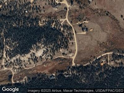
467 Sutherland Rd Allenspark, CO 80510
Allenspark NeighborhoodEstimated Value: $413,000 - $587,000
1
Bed
1
Bath
1,092
Sq Ft
$447/Sq Ft
Est. Value
About This Home
This home is located at 467 Sutherland Rd, Allenspark, CO 80510 and is currently estimated at $487,641, approximately $446 per square foot. 467 Sutherland Rd is a home located in Boulder County with nearby schools including Estes Park K-5 School, Estes Park Options School, and Estes Park Middle School.
Ownership History
Date
Name
Owned For
Owner Type
Purchase Details
Closed on
Sep 1, 2006
Sold by
Wegenast David P and Ott Janice
Bought by
Ruhehalle Lllp
Current Estimated Value
Purchase Details
Closed on
Dec 3, 1997
Sold by
Wegenast David P
Bought by
Wegenast David P
Purchase Details
Closed on
Aug 31, 1997
Sold by
Wegenast Ann and Wegenast Davip P
Bought by
Wegenast David P
Purchase Details
Closed on
Apr 10, 1990
Bought by
Ruhehalle Lllp
Purchase Details
Closed on
Dec 19, 1983
Bought by
Ruhehalle Lllp
Create a Home Valuation Report for This Property
The Home Valuation Report is an in-depth analysis detailing your home's value as well as a comparison with similar homes in the area
Home Values in the Area
Average Home Value in this Area
Purchase History
| Date | Buyer | Sale Price | Title Company |
|---|---|---|---|
| Ruhehalle Lllp | -- | None Available | |
| Wegenast David P | -- | -- | |
| Wegenast David P | -- | -- | |
| Ruhehalle Lllp | -- | -- | |
| Ruhehalle Lllp | -- | -- |
Source: Public Records
Tax History Compared to Growth
Tax History
| Year | Tax Paid | Tax Assessment Tax Assessment Total Assessment is a certain percentage of the fair market value that is determined by local assessors to be the total taxable value of land and additions on the property. | Land | Improvement |
|---|---|---|---|---|
| 2024 | $1,808 | $28,247 | $2,908 | $25,339 |
| 2023 | $1,808 | $28,247 | $6,593 | $25,339 |
| 2022 | $1,749 | $24,735 | $6,512 | $18,223 |
| 2021 | $1,785 | $25,447 | $6,700 | $18,747 |
| 2020 | $1,682 | $23,438 | $7,579 | $15,859 |
| 2019 | $1,625 | $23,438 | $7,579 | $15,859 |
| 2018 | $1,449 | $20,225 | $7,704 | $12,521 |
| 2017 | $1,435 | $22,359 | $8,517 | $13,842 |
| 2016 | $1,353 | $19,518 | $8,438 | $11,080 |
| 2015 | $1,319 | $17,162 | $2,547 | $14,615 |
| 2014 | $1,142 | $17,162 | $2,547 | $14,615 |
Source: Public Records
Map
Nearby Homes
- 177 Bill Waite Rd
- 1217 Big Owl Rd
- 246 Tahosa Park Rd S
- 2420 Big Owl Rd
- 494 N Skinner Rd
- 11563 Peak To Peak Dr
- 287 S Skinner Rd
- 138 Moss Brook Rd
- 1134 Highway 7 Business
- 223 Taylor Rd
- 585 Taylor Rd
- 212 Valley Rd
- 10 Kittle Ct
- 565 Hemlock Dr
- 0 Hemlock Dr
- 430 Hickory Dr
- 741 Hickory Dr
- 743 Hickory Dr
- 928 Ski Rd
- 31 Cedar Dr
- 467 Sutherland Rd
- 108 County Road 82 E
- 106 County Road 82 E
- 318 Fisk Fenner Rd
- 316 Fisk Fenner Rd
- 258 Fisk Fenner Rd
- 113 County Road 82 E
- 256 Fisk Fenner Rd
- 230 County Road 82 E
- 277 County Road 82 Unit E
- 226 County Road 82 E
- 208 Fisk Fenner Rd
- 77 County Road 82 E
- 232 County Road 82 E
- 900 Cabin Creek Rd
- 268 County Road 82 E
- 177 Sutherland Rd
- 185 Fisk Fenner Rd
- 818 Cabin Creek Rd
- 3 County Road 82e Rd E
