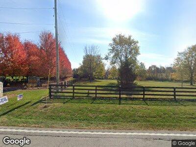
4670 Frankfort Rd Georgetown, KY 40324
Paynes Depot NeighborhoodEstimated Value: $536,000 - $730,000
3
Beds
3
Baths
3,044
Sq Ft
$206/Sq Ft
Est. Value
About This Home
This home is located at 4670 Frankfort Rd, Georgetown, KY 40324 and is currently estimated at $627,693, approximately $206 per square foot. 4670 Frankfort Rd is a home located in Scott County with nearby schools including Stamping Ground Elementary School, Creekside Elementary School, and Royal Spring Middle School.
Ownership History
Date
Name
Owned For
Owner Type
Purchase Details
Closed on
Jun 4, 2012
Sold by
Tillett Virgil E
Bought by
Burton Daniel and Burton Malinda
Current Estimated Value
Home Financials for this Owner
Home Financials are based on the most recent Mortgage that was taken out on this home.
Original Mortgage
$288,150
Interest Rate
3.88%
Mortgage Type
Unknown
Create a Home Valuation Report for This Property
The Home Valuation Report is an in-depth analysis detailing your home's value as well as a comparison with similar homes in the area
Home Values in the Area
Average Home Value in this Area
Purchase History
| Date | Buyer | Sale Price | Title Company |
|---|---|---|---|
| Burton Daniel | $339,000 | None Available |
Source: Public Records
Mortgage History
| Date | Status | Borrower | Loan Amount |
|---|---|---|---|
| Open | Burton Daniel | $152,500 | |
| Closed | Burton Daniel | $288,150 |
Source: Public Records
Tax History Compared to Growth
Tax History
| Year | Tax Paid | Tax Assessment Tax Assessment Total Assessment is a certain percentage of the fair market value that is determined by local assessors to be the total taxable value of land and additions on the property. | Land | Improvement |
|---|---|---|---|---|
| 2024 | $3,012 | $381,300 | $0 | $0 |
| 2023 | $2,958 | $372,600 | $90,000 | $282,600 |
| 2022 | $2,824 | $372,600 | $90,000 | $282,600 |
| 2021 | $2,724 | $351,100 | $75,000 | $276,100 |
| 2020 | $2,588 | $340,576 | $75,000 | $265,576 |
| 2019 | $2,630 | $340,576 | $0 | $0 |
| 2018 | $2,629 | $340,576 | $0 | $0 |
| 2017 | $2,642 | $340,576 | $0 | $0 |
| 2016 | $2,742 | $340,576 | $0 | $0 |
| 2015 | $2,725 | $340,600 | $0 | $0 |
| 2014 | $2,590 | $339,000 | $0 | $0 |
| 2011 | $1,406 | $193,368 | $0 | $0 |
Source: Public Records
Map
Nearby Homes
- 140 Seahawk Trail
- 690 Pea Ridge Rd
- 133 King Fisher Way
- 105 Rolling Ridge Rd
- 360 Pea Ridge Rd
- 1620 Fishers Mill Rd
- 210 Victoria Way
- 143 Rocky Waters Way
- 105 Bold Bidder Dr
- 1782 W Leestown Rd
- 104 Waverly Ln
- 1796 Woodlake Rd
- 1605 Woodlake Rd
- 117 Windsong Way
- 110 Lost Tree Dr
- 2019 Longview Dr
- 1599 Woodlake Rd
- 1120 Duckers Rd
- 921 Walnut Rd
- Lot 19 Taylor Ln
- 4670 Frankfort Rd
- 4670 Frankfort Pike
- 4664 Frankfort Rd
- 4616 Frankfort Rd
- 4616 Frankfort Pike
- 4600 Frankfort Rd
- 4600 Frankfort Rd Unit 4
- 4600 Frankfort Rd Unit 3
- 4600 Frankfort Rd Unit 5
- 4600 Frankfort Rd Unit 1
- 4600 Frankfort Pike Unit 5
- 4600 Frankfort Pike Unit Tract
- 4485 Frankfort Rd
- 4701 Frankfort Rd
- 4492 Frankfort Rd
- 4486 Frankfort Rd
- 4520 Frankfort Rd
- 4520 Frankfort Rd
- 7541 Georgetown Rd
- 4510 Frankfort Rd