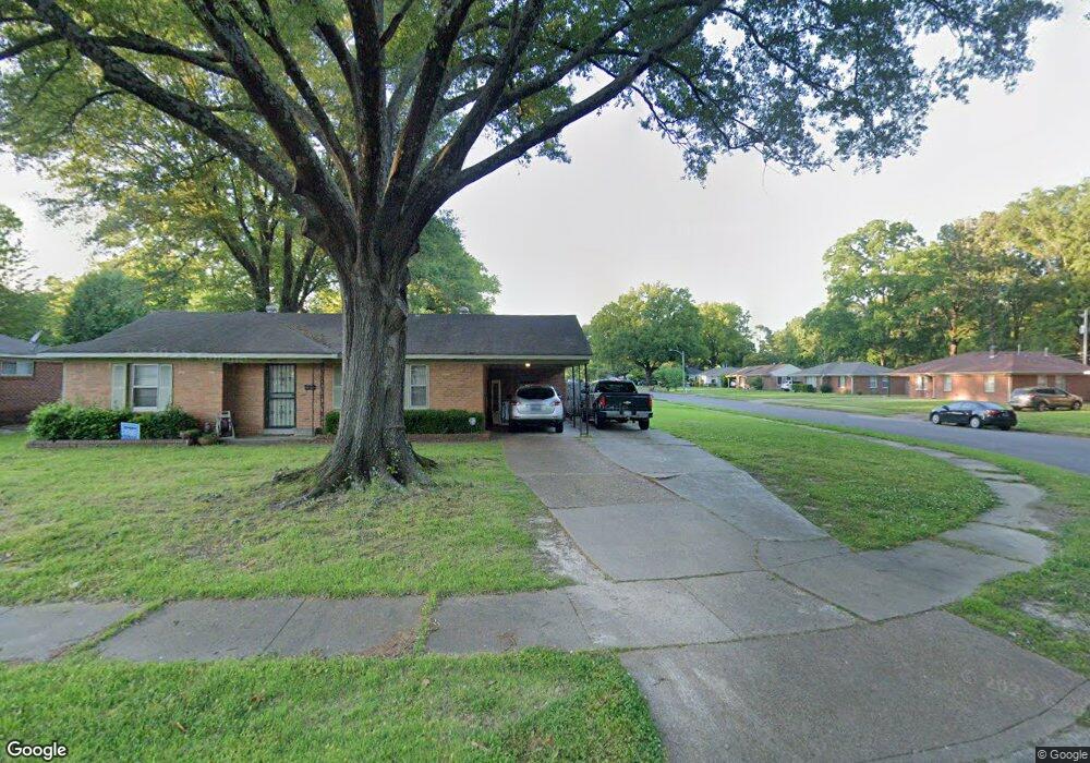
4672 E Dearing Rd Memphis, TN 38117
Colonial Acres NeighborhoodEstimated Value: $159,000 - $190,000
2
Beds
2
Baths
1,403
Sq Ft
$125/Sq Ft
Est. Value
About This Home
This home is located at 4672 E Dearing Rd, Memphis, TN 38117 and is currently estimated at $175,845, approximately $125 per square foot. 4672 E Dearing Rd is a home located in Shelby County with nearby schools including Sea Isle Elementary School, Colonial Middle, and Overton High.
Ownership History
Date
Name
Owned For
Owner Type
Purchase Details
Closed on
May 5, 2021
Sold by
Coffman David K and Keith C Coffman & Frances H Co
Bought by
Coffman Kyle David
Current Estimated Value
Home Financials for this Owner
Home Financials are based on the most recent Mortgage that was taken out on this home.
Original Mortgage
$121,000
Outstanding Balance
$109,189
Interest Rate
3.1%
Mortgage Type
New Conventional
Estimated Equity
$66,656
Purchase Details
Closed on
Oct 8, 1997
Sold by
Coffman Keith C and Coffman Frances H
Bought by
Coffman Keith C and Coffman Revo H R
Create a Home Valuation Report for This Property
The Home Valuation Report is an in-depth analysis detailing your home's value as well as a comparison with similar homes in the area
Home Values in the Area
Average Home Value in this Area
Purchase History
| Date | Buyer | Sale Price | Title Company |
|---|---|---|---|
| Coffman Kyle David | $150,000 | Closetrak | |
| Coffman Keith C | -- | -- | |
| Coffman Keith C | -- | -- |
Source: Public Records
Mortgage History
| Date | Status | Borrower | Loan Amount |
|---|---|---|---|
| Open | Coffman Kyle David | $121,000 |
Source: Public Records
Tax History
| Year | Tax Paid | Tax Assessment Tax Assessment Total Assessment is a certain percentage of the fair market value that is determined by local assessors to be the total taxable value of land and additions on the property. | Land | Improvement |
|---|---|---|---|---|
| 2025 | $989 | $43,300 | $8,750 | $34,550 |
| 2024 | $989 | $29,175 | $5,225 | $23,950 |
| 2023 | $1,777 | $29,175 | $5,225 | $23,950 |
| 2022 | $989 | $29,175 | $5,225 | $23,950 |
| 2021 | $1,007 | $29,175 | $5,225 | $23,950 |
| 2020 | $1,623 | $22,400 | $5,225 | $17,175 |
| 2019 | $1,623 | $22,400 | $5,225 | $17,175 |
| 2018 | $1,623 | $22,400 | $5,225 | $17,175 |
| 2017 | $951 | $23,150 | $5,225 | $17,925 |
| 2016 | $902 | $20,650 | $0 | $0 |
| 2014 | $902 | $20,650 | $0 | $0 |
Source: Public Records
Map
Nearby Homes
- 1597 Marcia Rd
- 1570 Dearing Rd
- 4584 E Dearing Rd
- 1711 Myrna Ln
- 1554 Hopewell Rd
- 1494 Raymore Rd
- 4501 Helene Rd
- 4487 E Dearing Rd
- 1782 Cornelia Ln
- 1776 Dorrie Ln
- 1646 Welsh Rd
- 4808 Quince Rd
- 1731 Sea Isle Rd
- 1416 Marcia Rd
- 1750 Sea Isle Rd
- 4639 Sea Isle Rd
- 1771 Tahiti Ln
- 4491 Dunn Ave
- 4457 Helene Rd
- 1534 Ivy Rd
- 4664 E Dearing Rd
- 1599 Dearing Rd
- 1608 S Perkins Rd
- 1604 Dearing Rd
- 1598 S Perkins Rd
- 4669 E Dearing Rd
- 1610 Dearing Rd
- 1598 Dearing Rd
- 4663 E Dearing Rd
- 4675 E Dearing Rd
- 1592 S Perkins Rd
- 4681 E Dearing Rd
- 1585 Dearing Rd
- 1592 Dearing Rd
- 1622 S Perkins Rd
- 1584 Dearing Rd
- 1632 S Perkins Rd
- 1577 Dearing Rd
- 1605 Marcia Rd
- 1613 Marcia Rd
Your Personal Tour Guide
Ask me questions while you tour the home.