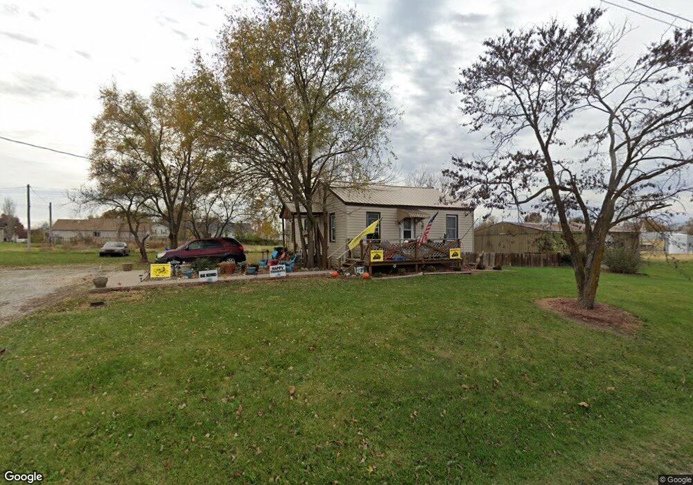
4672 W Highway 47 Hawk Point, MO 63349
Estimated Value: $18,000 - $594,000
2
Beds
1
Bath
820
Sq Ft
$268/Sq Ft
Est. Value
About This Home
This home is located at 4672 W Highway 47, Hawk Point, MO 63349 and is currently estimated at $219,917, approximately $268 per square foot. 4672 W Highway 47 is a home located in Lincoln County with nearby schools including Hawk Point Elementary School, Troy Middle School, and Troy Buchanan High School.
Create a Home Valuation Report for This Property
The Home Valuation Report is an in-depth analysis detailing your home's value as well as a comparison with similar homes in the area
Home Values in the Area
Average Home Value in this Area
Tax History Compared to Growth
Tax History
| Year | Tax Paid | Tax Assessment Tax Assessment Total Assessment is a certain percentage of the fair market value that is determined by local assessors to be the total taxable value of land and additions on the property. | Land | Improvement |
|---|---|---|---|---|
| 2025 | $398 | $6,247 | $1,790 | $4,457 |
| 2024 | $364 | $5,620 | $1,170 | $4,450 |
| 2023 | $362 | $5,620 | $1,170 | $4,450 |
| 2022 | $356 | $5,557 | $1,170 | $4,387 |
| 2021 | $357 | $29,250 | $0 | $0 |
| 2020 | $319 | $26,340 | $0 | $0 |
| 2019 | $319 | $26,340 | $0 | $0 |
| 2018 | $340 | $5,265 | $0 | $0 |
| 2017 | $341 | $5,265 | $0 | $0 |
| 2016 | $251 | $3,789 | $0 | $0 |
| 2015 | $253 | $3,789 | $0 | $0 |
| 2014 | $262 | $3,920 | $0 | $0 |
| 2013 | -- | $3,973 | $0 | $0 |
Source: Public Records
Map
Nearby Homes
- 270 Derek Dr
- 4 Ashley Ln
- 25 Turkey Run Dr
- 70 Summers Dr
- 10 Big Tom Ct
- 290 Shumard Oak Dr
- 335 Shumard Oak Dr
- 804 Timber Creek Ct
- 404 Deep Forest Dr
- 0 Linns Mill Road Lot#wp002
- 697 Linns Mill Rd
- 0 Cedar Circle Ln Unit MIS25071955
- 456 Westridge Dr
- 155 Stepanek Rd
- 0 Westborough Estates (Lot 60)
- 45 Blue Line Ln
- 762 Cave Farm Rd
- 432 Westridge Dr
- 130 Bristol Ridge Dr
- 0 Westborough Estates (Lot 5)