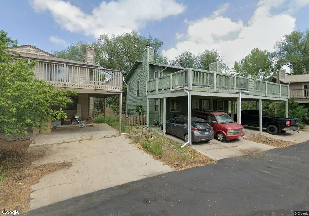
4681 Portside Way Boulder, CO 80301
Gunbarrel NeighborhoodEstimated Value: $402,000 - $447,000
2
Beds
2
Baths
1,024
Sq Ft
$410/Sq Ft
Est. Value
About This Home
This home is located at 4681 Portside Way, Boulder, CO 80301 and is currently estimated at $419,675, approximately $409 per square foot. 4681 Portside Way is a home located in Boulder County with nearby schools including Heatherwood Elementary School, Nevin Platt Middle School, and Boulder High School.
Ownership History
Date
Name
Owned For
Owner Type
Purchase Details
Closed on
Jul 6, 2020
Sold by
Michalski Sandra Jo and Rudolph E Harcarufka Trust
Bought by
Hoard Dean and Shearer Kristin
Current Estimated Value
Home Financials for this Owner
Home Financials are based on the most recent Mortgage that was taken out on this home.
Original Mortgage
$344,000
Interest Rate
3.2%
Mortgage Type
New Conventional
Purchase Details
Closed on
May 27, 2010
Sold by
Harcarufka Rudolph E
Bought by
Rudolph E Harcarufka Declaration Of Trus
Purchase Details
Closed on
Mar 3, 1983
Bought by
Harcarufka Rudolph E Dec Of Trust
Purchase Details
Closed on
May 6, 1981
Bought by
Harcarufka Rudolph E Dec Of Trust
Create a Home Valuation Report for This Property
The Home Valuation Report is an in-depth analysis detailing your home's value as well as a comparison with similar homes in the area
Home Values in the Area
Average Home Value in this Area
Purchase History
| Date | Buyer | Sale Price | Title Company |
|---|---|---|---|
| Hoard Dean | $355,000 | None Available | |
| Rudolph E Harcarufka Declaration Of Trus | -- | None Available | |
| Harcarufka Rudolph E Dec Of Trust | $120,000 | -- | |
| Harcarufka Rudolph E Dec Of Trust | -- | -- |
Source: Public Records
Mortgage History
| Date | Status | Borrower | Loan Amount |
|---|---|---|---|
| Previous Owner | Hoard Dean | $344,000 |
Source: Public Records
Tax History
| Year | Tax Paid | Tax Assessment Tax Assessment Total Assessment is a certain percentage of the fair market value that is determined by local assessors to be the total taxable value of land and additions on the property. | Land | Improvement |
|---|---|---|---|---|
| 2025 | $2,454 | $26,132 | $9,719 | $16,413 |
| 2024 | $2,454 | $26,132 | $9,719 | $16,413 |
| 2023 | $2,414 | $26,318 | $9,300 | $20,703 |
| 2022 | $2,448 | $24,902 | $7,089 | $17,813 |
| 2021 | $2,335 | $25,618 | $7,293 | $18,325 |
| 2020 | $2,328 | $25,268 | $6,578 | $18,690 |
| 2019 | $2,291 | $25,268 | $6,578 | $18,690 |
| 2018 | $2,045 | $22,270 | $5,400 | $16,870 |
| 2017 | $1,984 | $24,620 | $5,970 | $18,650 |
| 2016 | $1,558 | $16,899 | $4,537 | $12,362 |
| 2015 | $1,480 | $15,586 | $5,413 | $10,173 |
| 2014 | $1,512 | $15,586 | $5,413 | $10,173 |
Source: Public Records
Map
Nearby Homes
- 4690 Portside Way
- 4651 Portside Way
- 6495 Barnacle Ct
- 6545 Kalua Rd Unit 203D
- 4559 Beachcomber Ct
- 6398 Twin Lakes Rd
- 4483 Sandpiper Cir
- 4458 Driftwood Place
- 4870 Twin Lakes Rd Unit 1
- 6239 Willow Ln Unit 6239
- 4945 Twin Lakes Rd Unit 39
- 5120 Williams Fork Trail Unit 210
- 5120 Williams Fork Trail Unit 206
- 4647 Burgundy Ln Unit 2-4
- 5012 Carter Ct
- 4584 Robinson Place
- 6170 Habitat Dr Unit 6170
- 6146 Willow Ln
- 6112 Habitat Dr Unit 2
- 4872 Country Club Way
- 4675 Portside Way
- 4685 Portside Way
- 4671 Portside Way
- 4691 Portside Way
- 4665 Portside Way
- 4695 Portside Way
- 4661 Portside Way
- 0 Portside Way
- 4655 Portside Way
- 4660 Portside Way
- 4670 Portside Way
- 4680 Portside Way
- 4650 Portside Way
- 4645 Portside Way
- 4640 Portside Way
- 4641 Portside Way
- 4635 Portside Way
- 4631 Portside Way
- 4655 Starboard Dr
- 6552 Twin Lakes Rd
Your Personal Tour Guide
Ask me questions while you tour the home.