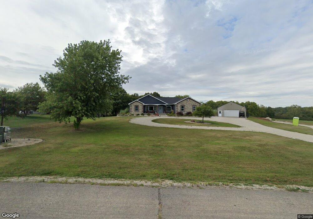
4688 Reid Dr Wamego, KS 66547
Estimated Value: $351,000 - $603,000
5
Beds
3
Baths
1,805
Sq Ft
$287/Sq Ft
Est. Value
About This Home
This home is located at 4688 Reid Dr, Wamego, KS 66547 and is currently estimated at $518,514, approximately $287 per square foot. 4688 Reid Dr is a home located in Pottawatomie County with nearby schools including Rock Creek Junior/Senior High School.
Ownership History
Date
Name
Owned For
Owner Type
Purchase Details
Closed on
Apr 25, 2008
Sold by
Ebert Neil and Ebert Laura
Bought by
Copeland Chad E and Copeland Jeanne M
Current Estimated Value
Home Financials for this Owner
Home Financials are based on the most recent Mortgage that was taken out on this home.
Original Mortgage
$367,000
Interest Rate
6.08%
Create a Home Valuation Report for This Property
The Home Valuation Report is an in-depth analysis detailing your home's value as well as a comparison with similar homes in the area
Home Values in the Area
Average Home Value in this Area
Purchase History
| Date | Buyer | Sale Price | Title Company |
|---|---|---|---|
| Copeland Chad E | -- | None Available |
Source: Public Records
Mortgage History
| Date | Status | Borrower | Loan Amount |
|---|---|---|---|
| Previous Owner | Copeland Chad E | $367,000 |
Source: Public Records
Tax History Compared to Growth
Tax History
| Year | Tax Paid | Tax Assessment Tax Assessment Total Assessment is a certain percentage of the fair market value that is determined by local assessors to be the total taxable value of land and additions on the property. | Land | Improvement |
|---|---|---|---|---|
| 2025 | $6,196 | $64,672 | $8,202 | $56,470 |
| 2024 | $62 | $63,115 | $7,857 | $55,258 |
| 2023 | $6,219 | $61,155 | $7,857 | $53,298 |
| 2022 | $5,079 | $55,517 | $7,631 | $47,886 |
| 2021 | $5,079 | $50,067 | $7,413 | $42,654 |
| 2020 | $5,079 | $49,768 | $7,451 | $42,317 |
| 2019 | $5,934 | $50,246 | $6,838 | $43,408 |
| 2018 | $6,018 | $49,607 | $6,723 | $42,884 |
| 2017 | $5,267 | $47,976 | $6,372 | $41,604 |
| 2016 | $5,000 | $46,690 | $5,437 | $41,253 |
| 2015 | -- | $44,574 | $4,324 | $40,250 |
| 2014 | -- | $44,255 | $3,864 | $40,391 |
Source: Public Records
Map
Nearby Homes
- 13000 Anthony Dr
- 13495 Wildridge Dr
- 4225 Rockenham Rd
- 4075 Rockenham Cir
- 13318 Woodland Dr
- 13880 Berry Ln
- 14362 Prairie W
- 14344 Prairie W
- 14226 Prairie W
- 00000 Prairie Trail (Lot #3)
- 00000 Prairie Trail
- 14205 Prairie Trail
- 00000 Wildwood Cir
- 14416 Wildwood Cir
- 14391 Prairie Trail
- 14409 Wildwood Cir
- 14380 Prairie Trail
- 14434 Wildwood Cir
- 14470 Wildwood Cir
- 14373 Prairie Trail