Estimated Value: $443,835 - $513,000
3
Beds
1
Bath
1,083
Sq Ft
$445/Sq Ft
Est. Value
About This Home
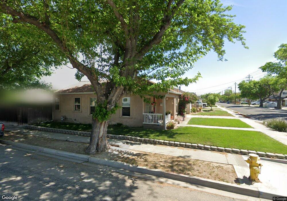
This home is located at 469 W Emerson Ave, Tracy, CA 95376 and is currently estimated at $482,459, approximately $445 per square foot. 469 W Emerson Ave is a home located in San Joaquin County with nearby schools including Central Elementary School, Merrill F. West High School, and Primary Charter School.
Ownership History
Date
Name
Owned For
Owner Type
Purchase Details
Closed on
Apr 25, 2019
Sold by
Tolbert Margaret Mary and Tolbert Richard G
Bought by
Tolbert Margaret Mary
Current Estimated Value
Home Financials for this Owner
Home Financials are based on the most recent Mortgage that was taken out on this home.
Original Mortgage
$279,000
Outstanding Balance
$243,778
Interest Rate
4%
Mortgage Type
New Conventional
Estimated Equity
$238,681
Purchase Details
Closed on
Jul 18, 1995
Sold by
Mccann Dorothy J and Meder Donald J
Bought by
Salazar Margaret M
Home Financials for this Owner
Home Financials are based on the most recent Mortgage that was taken out on this home.
Original Mortgage
$114,775
Interest Rate
7.62%
Mortgage Type
FHA
Purchase Details
Closed on
Aug 16, 1994
Sold by
Brady Kathleen Ann
Bought by
Brady Kathleen Ann and Brady Revocable Living Trust
Create a Home Valuation Report for This Property
The Home Valuation Report is an in-depth analysis detailing your home's value as well as a comparison with similar homes in the area
Home Values in the Area
Average Home Value in this Area
Purchase History
| Date | Buyer | Sale Price | Title Company |
|---|---|---|---|
| Tolbert Margaret Mary | -- | First American Title Company | |
| Salazar Margaret M | $115,000 | Chicago Title Co | |
| Brady Kathleen Ann | -- | -- |
Source: Public Records
Mortgage History
| Date | Status | Borrower | Loan Amount |
|---|---|---|---|
| Open | Tolbert Margaret Mary | $279,000 | |
| Closed | Salazar Margaret M | $114,775 |
Source: Public Records
Tax History Compared to Growth
Tax History
| Year | Tax Paid | Tax Assessment Tax Assessment Total Assessment is a certain percentage of the fair market value that is determined by local assessors to be the total taxable value of land and additions on the property. | Land | Improvement |
|---|---|---|---|---|
| 2025 | $2,132 | $191,025 | $83,054 | $107,971 |
| 2024 | $1,963 | $187,280 | $81,426 | $105,854 |
| 2023 | $1,932 | $183,609 | $79,830 | $103,779 |
| 2022 | $1,891 | $180,010 | $78,265 | $101,745 |
| 2021 | $1,868 | $176,481 | $76,731 | $99,750 |
| 2020 | $1,855 | $174,673 | $75,945 | $98,728 |
| 2019 | $1,824 | $171,249 | $74,456 | $96,793 |
| 2018 | $1,792 | $167,893 | $72,997 | $94,896 |
| 2017 | $1,702 | $164,602 | $71,566 | $93,036 |
| 2016 | $1,721 | $161,375 | $70,163 | $91,212 |
| 2014 | $1,574 | $152,900 | $46,200 | $106,700 |
Source: Public Records
Map
Nearby Homes
- 1930 Wall St
- 535 W Carlton Way
- 1561 Bessie Ave
- 262 W Lowell Ave
- 242 W Lowell Ave
- 228 W Lowell Ave
- 2192 Wildflower Ct
- 546 W Grant Line Rd
- 1792 Chester Dr
- 2214 Morningside Ct
- 110 W 23rd St
- 16 Pereira Ave
- 2840-2896 Holly Dr
- 34 Pereira Ave
- 1228 Bessie Ave
- 130 E 21st St
- 1865 Newport Ct
- 971 Plantation Ct
- 222 Pereira Ave
- 80 Portola Way Unit 105
- 453 W Emerson Ave
- 1824 Bessie Ave
- 443 W Emerson Ave
- 1803 Bessie Ave
- 1826 Bessie Ave
- 470 W Emerson Ave
- 435 W Emerson Ave
- 454 W Emerson Ave
- 517 W Emerson Ave
- 1825 Bessie Ave
- 452 W Emerson Ave
- 470 W Whittier Ave
- 500 W Emerson Ave
- 460 W Whittier Ave
- 1827 Bessie Ave
- 427 W Emerson Ave
- 525 W Emerson Ave
- 450 W Whittier Ave
- 1835 Bessie Ave
- 436 W Emerson Ave