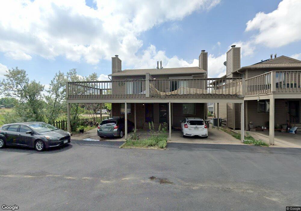
4690 Portside Way Boulder, CO 80301
Gunbarrel NeighborhoodEstimated Value: $429,000 - $454,000
2
Beds
2
Baths
1,024
Sq Ft
$432/Sq Ft
Est. Value
About This Home
This home is located at 4690 Portside Way, Boulder, CO 80301 and is currently estimated at $442,219, approximately $431 per square foot. 4690 Portside Way is a home located in Boulder County with nearby schools including Heatherwood Elementary School, Nevin Platt Middle School, and Boulder High School.
Ownership History
Date
Name
Owned For
Owner Type
Purchase Details
Closed on
Jun 12, 2020
Sold by
Michalski Sandra Jo and Rudolph E Harcarufka Trust
Bought by
Pappas Katherine Page and Arnold Shane Miles
Current Estimated Value
Home Financials for this Owner
Home Financials are based on the most recent Mortgage that was taken out on this home.
Original Mortgage
$333,841
Interest Rate
3.2%
Mortgage Type
FHA
Purchase Details
Closed on
May 7, 2010
Sold by
Harcarufka Rudolph E
Bought by
Rudolph E Harcarufka Declaration Of Trus
Purchase Details
Closed on
Jul 3, 1980
Bought by
Harcarufka Rudolph E Dec Of Trust
Purchase Details
Closed on
Dec 27, 1979
Bought by
Harcarufka Rudolph E Dec Of Trust
Create a Home Valuation Report for This Property
The Home Valuation Report is an in-depth analysis detailing your home's value as well as a comparison with similar homes in the area
Home Values in the Area
Average Home Value in this Area
Purchase History
| Date | Buyer | Sale Price | Title Company |
|---|---|---|---|
| Pappas Katherine Page | $340,000 | None Available | |
| Rudolph E Harcarufka Declaration Of Trus | -- | None Available | |
| Harcarufka Rudolph E Dec Of Trust | $124,000 | -- | |
| Harcarufka Rudolph E Dec Of Trust | $107,000 | -- |
Source: Public Records
Mortgage History
| Date | Status | Borrower | Loan Amount |
|---|---|---|---|
| Previous Owner | Pappas Katherine Page | $333,841 |
Source: Public Records
Tax History Compared to Growth
Tax History
| Year | Tax Paid | Tax Assessment Tax Assessment Total Assessment is a certain percentage of the fair market value that is determined by local assessors to be the total taxable value of land and additions on the property. | Land | Improvement |
|---|---|---|---|---|
| 2025 | $2,483 | $26,163 | $10,238 | $15,925 |
| 2024 | $2,483 | $26,163 | $10,238 | $15,925 |
| 2023 | $2,443 | $26,639 | $9,903 | $20,422 |
| 2022 | $2,471 | $25,145 | $7,520 | $17,625 |
| 2021 | $2,357 | $25,868 | $7,736 | $18,132 |
| 2020 | $2,312 | $25,097 | $6,721 | $18,376 |
| 2019 | $2,276 | $25,097 | $6,721 | $18,376 |
| 2018 | $2,072 | $22,572 | $5,688 | $16,884 |
| 2017 | $2,011 | $24,954 | $6,288 | $18,666 |
| 2016 | $1,575 | $17,090 | $4,776 | $12,314 |
| 2015 | $1,496 | $15,546 | $5,333 | $10,213 |
| 2014 | $1,508 | $15,546 | $5,333 | $10,213 |
Source: Public Records
Map
Nearby Homes
- 4651 Portside Way
- 6495 Barnacle Ct
- 6798 Bugle Ct
- 4458 Driftwood Place
- 6239 Willow Ln Unit 6239
- 5122 Williams Fork Trail Unit 108
- 5122 Williams Fork Trail Unit 205
- 6201 Willow Ln Unit 6201
- 5120 Williams Fork Trail Unit 210
- 4584 Robinson Place
- 4872 Country Club Way
- 6686 Jay Rd
- 4862 Silver Sage Ct
- 4471 Wellington Rd
- 7028 Indian Peaks Trail
- 4682 White Rock Cir Unit 5
- 4839 White Rock Cir Unit D
- 4767 White Rock Cir Unit D
- 4763 White Rock Cir Unit A
- 4791 White Rock Cir Unit A
- 4680 Portside Way
- 4670 Portside Way
- 4660 Portside Way
- 4650 Portside Way
- 4640 Portside Way
- 4655 Starboard Dr
- 4665 Portside Way
- 4671 Portside Way
- 4661 Portside Way
- 4675 Portside Way
- 4637 Starboard Dr
- 4655 Portside Way
- 6552 Twin Lakes Rd
- 4681 Portside Way
- 4645 Portside Way
- 4685 Portside Way
- 4641 Portside Way
- 4695 Portside Way
- 0 Portside Way
- 4691 Portside Way