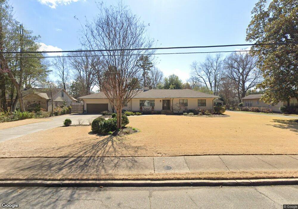
4691 Barfield Rd Memphis, TN 38117
Audubon Park NeighborhoodEstimated Value: $394,172 - $465,000
3
Beds
2
Baths
2,375
Sq Ft
$180/Sq Ft
Est. Value
About This Home
This home is located at 4691 Barfield Rd, Memphis, TN 38117 and is currently estimated at $428,543, approximately $180 per square foot. 4691 Barfield Rd is a home located in Shelby County with nearby schools including White Station Elementary School, White Station High, and White Station Middle.
Ownership History
Date
Name
Owned For
Owner Type
Purchase Details
Closed on
Jul 21, 2022
Sold by
Carroll Michael E
Bought by
Carroll Michael Edward and Carroll Catalina Julia
Current Estimated Value
Purchase Details
Closed on
Oct 27, 2000
Sold by
Parks Brett T and Parks Laura L
Bought by
Carroll Michael E
Home Financials for this Owner
Home Financials are based on the most recent Mortgage that was taken out on this home.
Original Mortgage
$159,500
Interest Rate
7.94%
Purchase Details
Closed on
Sep 8, 1999
Sold by
Shroyer Edward E
Bought by
Parks Brett T and Parks Laura L
Home Financials for this Owner
Home Financials are based on the most recent Mortgage that was taken out on this home.
Original Mortgage
$128,000
Interest Rate
7.73%
Create a Home Valuation Report for This Property
The Home Valuation Report is an in-depth analysis detailing your home's value as well as a comparison with similar homes in the area
Home Values in the Area
Average Home Value in this Area
Purchase History
| Date | Buyer | Sale Price | Title Company |
|---|---|---|---|
| Carroll Michael Edward | -- | Tual Graves Pllc | |
| Carroll Michael E | $244,500 | -- | |
| Parks Brett T | $160,000 | -- |
Source: Public Records
Mortgage History
| Date | Status | Borrower | Loan Amount |
|---|---|---|---|
| Previous Owner | Carroll Michael E | $159,500 | |
| Previous Owner | Parks Brett T | $128,000 |
Source: Public Records
Tax History Compared to Growth
Tax History
| Year | Tax Paid | Tax Assessment Tax Assessment Total Assessment is a certain percentage of the fair market value that is determined by local assessors to be the total taxable value of land and additions on the property. | Land | Improvement |
|---|---|---|---|---|
| 2025 | $2,717 | $95,925 | $33,350 | $62,575 |
| 2024 | $2,717 | $80,150 | $33,350 | $46,800 |
| 2023 | $4,882 | $80,150 | $33,350 | $46,800 |
| 2022 | $4,882 | $80,150 | $33,350 | $46,800 |
| 2021 | $4,940 | $80,150 | $33,350 | $46,800 |
| 2020 | $4,438 | $61,250 | $33,350 | $27,900 |
| 2019 | $4,438 | $61,250 | $33,350 | $27,900 |
| 2018 | $4,438 | $61,250 | $33,350 | $27,900 |
| 2017 | $2,517 | $61,250 | $33,350 | $27,900 |
| 2016 | $2,520 | $57,675 | $0 | $0 |
| 2014 | $2,520 | $57,675 | $0 | $0 |
Source: Public Records
Map
Nearby Homes
- 4723 Normandy Ln
- 4798 Normandy Ln
- 4679 Walnut Grove Rd
- 4640 Chickasaw Rd
- 131 N Mendenhall Rd
- 4501 Minden Rd
- 352 Avon Rd
- 4737 Sequoia Rd
- 4956 Robindale Ln
- 4730 Sequoia Rd
- 137 Perkins Extension
- 105 Grove Park Cir
- 4578 Sequoia Rd
- 4980 Barfield Rd
- 4525 Sequoia Rd
- 154 Perkins Extension
- 4772 Gwynne Rd
- 4975 Brookwood Cove
- 150 Waring Rd
- 180 Waring Rd
- 4679 Barfield Rd
- 4701 Barfield Rd
- 4661 Barfield Rd
- 4690 Normandy Ave
- 4709 Barfield Rd
- 4698 Normandy Ave
- 4682 Barfield Rd
- 4678 Normandy Ave
- 4704 Normandy Ave
- 4690 Barfield Rd
- 4660 Normandy Ave
- 4649 Barfield Rd
- 4723 Barfield Rd
- 4714 Normandy Ave
- 4704 Barfield Rd
- 4672 Barfield Rd
- 4714 Barfield Rd
- 4650 Normandy Ave
- 4656 Barfield Rd
- 4724 Normandy Ave