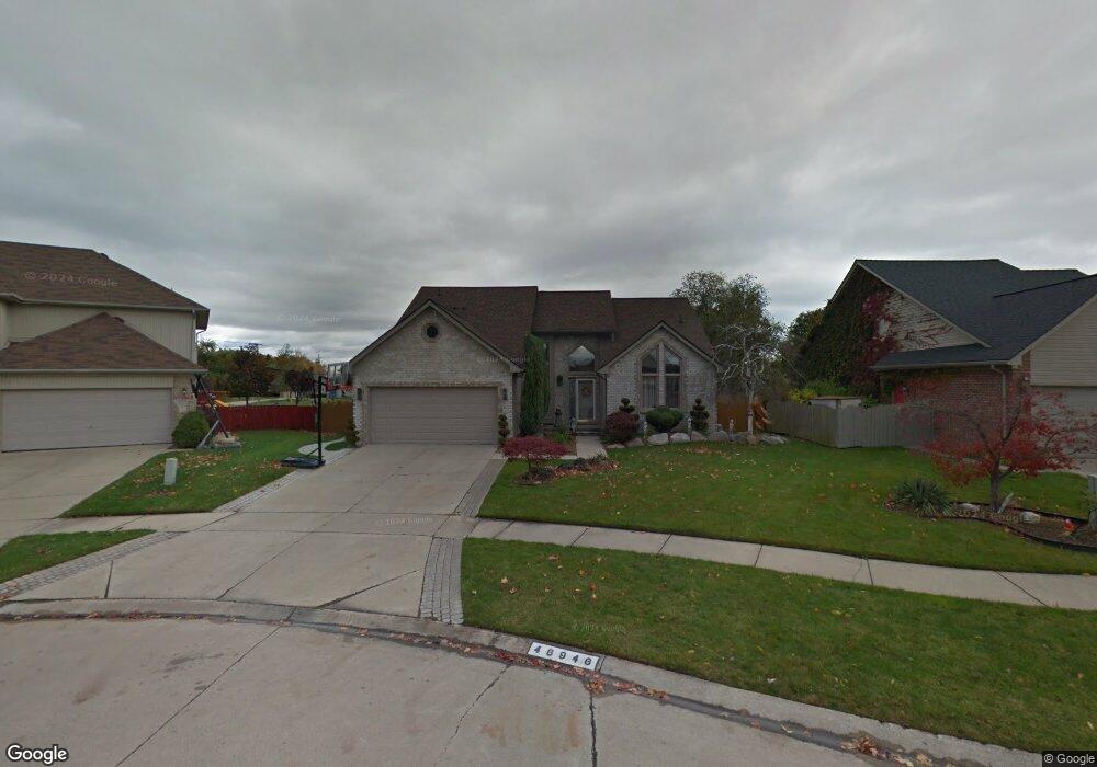
46946 Millpointe Dr Macomb, MI 48042
Estimated Value: $424,670 - $464,000
Studio
2
Baths
2,460
Sq Ft
$180/Sq Ft
Est. Value
About This Home
This home is located at 46946 Millpointe Dr, Macomb, MI 48042 and is currently estimated at $441,918, approximately $179 per square foot. 46946 Millpointe Dr is a home located in Macomb County with nearby schools including Atwood Elementary School, L'Anse Creuse Middle School - North, and L'Anse Creuse High School - North.
Ownership History
Date
Name
Owned For
Owner Type
Purchase Details
Closed on
Mar 15, 2019
Sold by
Mendez Manuel H and Mendez Tracy L
Bought by
Mendez Manuel H and Mendez Tracy L
Current Estimated Value
Purchase Details
Closed on
Mar 31, 1997
Sold by
Burke C and Burke J
Bought by
Mendez M and Mendez T
Purchase Details
Closed on
Jun 16, 1995
Sold by
Rcm Homes Inc
Bought by
Burke Carl B and Burke Judith
Create a Home Valuation Report for This Property
The Home Valuation Report is an in-depth analysis detailing your home's value as well as a comparison with similar homes in the area
Home Values in the Area
Average Home Value in this Area
Purchase History
| Date | Buyer | Sale Price | Title Company |
|---|---|---|---|
| Mendez Manuel H | -- | None Available | |
| Mendez M | $209,000 | -- | |
| Burke Carl B | $176,000 | -- |
Source: Public Records
Tax History
| Year | Tax Paid | Tax Assessment Tax Assessment Total Assessment is a certain percentage of the fair market value that is determined by local assessors to be the total taxable value of land and additions on the property. | Land | Improvement |
|---|---|---|---|---|
| 2025 | $2,985 | $206,000 | $0 | $0 |
| 2024 | $29 | $190,800 | $0 | $0 |
| 2023 | $2,752 | $181,900 | $0 | $0 |
| 2022 | $3,475 | $162,200 | $0 | $0 |
| 2021 | $3,382 | $151,400 | $0 | $0 |
| 2020 | $2,527 | $145,600 | $0 | $0 |
| 2019 | $3,081 | $135,600 | $0 | $0 |
| 2018 | $3,016 | $130,800 | $0 | $0 |
| 2017 | $2,955 | $125,420 | $30,500 | $94,920 |
| 2016 | $2,796 | $125,390 | $0 | $0 |
| 2015 | $2,760 | $121,010 | $0 | $0 |
| 2014 | $2,760 | $97,110 | $19,000 | $78,110 |
| 2011 | $602 | $102,000 | $16,000 | $86,000 |
Source: Public Records
Map
Nearby Homes
- 24374 21 Mile Rd
- 23856 Keyway Dr
- 46290 Brentwood St
- 46828 Scotch Pine Ln
- 47338 Hunters Chase Dr
- 23330 Duprey St
- 23206 21 Mile Rd
- 23944 Harrellson St
- 0 Gratiot Ave
- 6009 Gratiot Ave
- 45945 N Gratiot Ave
- 45729 N Gratiot Ave
- 47846 North Ave
- 25591 Lord Dr
- 23346 Spring Creek Dr
- 25891 Briar Towne Blvd
- 45937 Duke Dr
- 45215 Fairchild Rd
- 23075 Shepherd Ln
- 23424 Urban St
- 46904 Millpointe Dr
- 46988 Millpointe Dr
- 46862 Millpointe Dr
- 24199 Pointe Dr
- 46820 Millpointe Dr
- 24187 Pointe Dr
- 46885 Millpointe Dr
- 24160 Pointe Dr
- 46778 Millpointe Dr
- 46950 Fairchild Rd
- 24175 Pointe Dr
- 46843 Millpointe Dr
- 46888 Fairchild Rd
- 46864 Fairchild Rd
- 46840 Fairchild Rd
- 46980 Fairchild Rd
- 24138 Pointe Dr
- 24151 Pointe Dr
- 46801 Millpointe Dr
- 46816 Fairchild Rd
Your Personal Tour Guide
Ask me questions while you tour the home.