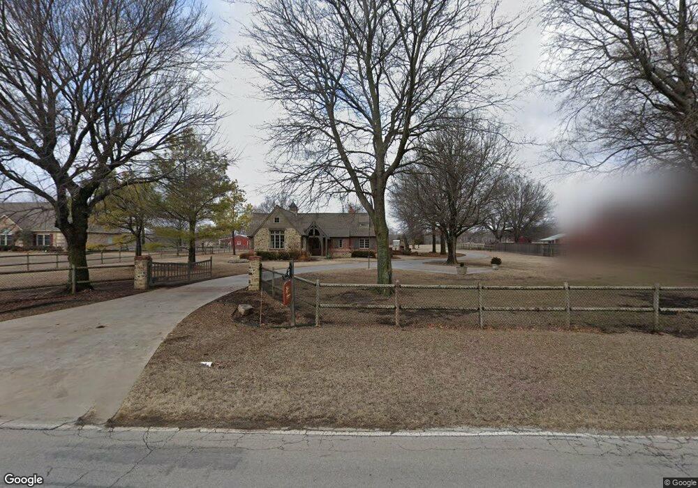
4695 E 490 Rd Claremore, OK 74019
Estimated Value: $429,000 - $558,000
2
Beds
2
Baths
2,315
Sq Ft
$208/Sq Ft
Est. Value
About This Home
This home is located at 4695 E 490 Rd, Claremore, OK 74019 and is currently estimated at $482,458, approximately $208 per square foot. 4695 E 490 Rd is a home with nearby schools including Pamela Hodson Elementary School, Owasso 6th Grade Center, and Owasso 8th Grade Center.
Ownership History
Date
Name
Owned For
Owner Type
Purchase Details
Closed on
Jul 18, 2023
Sold by
Leonard E Wren Revocable Trust
Bought by
Wren Joint Revocable Trust and Wren
Current Estimated Value
Purchase Details
Closed on
Feb 6, 2015
Sold by
Wren Leonard E and Wren Roberta
Bought by
Millard Roger Lance and Millard Susan Wren
Purchase Details
Closed on
Dec 18, 2014
Sold by
Wren Leonard E and Wren Roberta
Bought by
Millard Roger Lance and Millard Susan Wren
Purchase Details
Closed on
Dec 28, 2007
Sold by
Snyder John W
Bought by
Wren Leonard E and Wren Roberta D
Purchase Details
Closed on
May 26, 2004
Sold by
Dean Cynthia L Trustee
Purchase Details
Closed on
Jun 2, 1994
Sold by
Roe Joe David
Purchase Details
Closed on
Dec 1, 1993
Sold by
Brown Robert Carl
Create a Home Valuation Report for This Property
The Home Valuation Report is an in-depth analysis detailing your home's value as well as a comparison with similar homes in the area
Purchase History
| Date | Buyer | Sale Price | Title Company |
|---|---|---|---|
| Wren Joint Revocable Trust | -- | None Listed On Document | |
| Millard Roger Lance | -- | None Available | |
| Millard Roger Lance | -- | None Available | |
| Wren Leonard E | $280,000 | None Available | |
| -- | $222,500 | -- | |
| -- | $145,000 | -- | |
| -- | $20,000 | -- |
Source: Public Records
Tax History
| Year | Tax Paid | Tax Assessment Tax Assessment Total Assessment is a certain percentage of the fair market value that is determined by local assessors to be the total taxable value of land and additions on the property. | Land | Improvement |
|---|---|---|---|---|
| 2025 | $4,107 | $38,736 | $6,526 | $32,210 |
| 2024 | $4,054 | $37,609 | $6,336 | $31,273 |
| 2023 | $4,054 | $36,513 | $5,872 | $30,641 |
| 2022 | $3,881 | $35,449 | $4,488 | $30,961 |
| 2021 | $3,832 | $35,431 | $4,488 | $30,943 |
| 2020 | $3,714 | $34,843 | $4,488 | $30,355 |
| 2019 | $3,604 | $33,361 | $4,488 | $28,873 |
| 2018 | $3,593 | $34,335 | $4,488 | $29,847 |
| 2017 | $3,581 | $33,924 | $4,488 | $29,436 |
| 2016 | $3,502 | $33,166 | $4,488 | $28,678 |
| 2015 | $3,432 | $32,200 | $4,488 | $27,712 |
| 2014 | -- | $31,557 | $4,488 | $27,069 |
Source: Public Records
Map
Nearby Homes
- 5132 E Madison St
- 5207 E Brookhaven St
- 5226 E Madison St
- 20624 S Brentwood Ave
- 20706 S Concord Ave
- 20823 S Concord Ave
- 5225 E Norwood St
- 20903 S Richmond Ave
- 20925 S Windsor Ave
- 9931 N Chadford
- 19715 E Clear Brook Rd
- 19837 E Woodhaven Rd
- 19000 E Knightsbridge Rd
- 18509 E 100th St N
- 11738 N 194th East Ave
- 4728 E Hwy 20
- 11671 N 191st Ave E
- 0 E 106th St N Unit 2543814
- 0 E 106th St N Unit 2546711
- 6133 E Engelmann St
- 20308 E 106th St N
- 4669 E 490 Rd
- 4950 E 490 Rd
- 20211 E 106th St N
- 4826 E 490 Rd
- 20205 E 106th St N
- 10447 N 205th East Ave
- 1814 N 202nd East Ave
- 20406 E 106th St N
- 20318 E 106th St N
- 4809 E 490 Rd
- 20831 S 4076 Rd
- 10540 N 205th East Ave
- 20500 E 106th St N
- 20650 E 106th St N
- 20512 E 106th St N
- 4590 E 490 Rd
- 10515 N 205th East Ave
- 20830 S 4076 Rd
- 4532 E 490 Rd
Your Personal Tour Guide
Ask me questions while you tour the home.