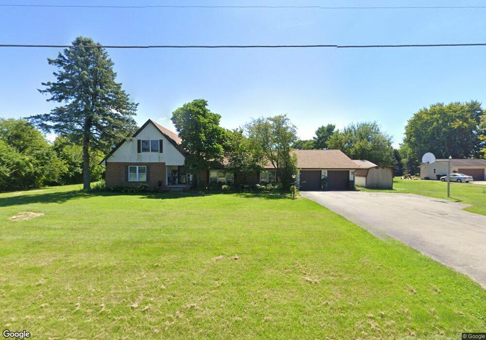
4695 Mumper Rd Springfield, OH 45502
Estimated Value: $270,000 - $445,000
5
Beds
3
Baths
2,453
Sq Ft
$146/Sq Ft
Est. Value
About This Home
This home is located at 4695 Mumper Rd, Springfield, OH 45502 and is currently estimated at $357,437, approximately $145 per square foot. 4695 Mumper Rd is a home located in Clark County with nearby schools including Northridge Elementary School and Kenton Ridge Middle & High School.
Ownership History
Date
Name
Owned For
Owner Type
Purchase Details
Closed on
Sep 5, 2014
Sold by
Federal Home Loan Mortgage Corporation
Bought by
Arnold Dolores D
Current Estimated Value
Home Financials for this Owner
Home Financials are based on the most recent Mortgage that was taken out on this home.
Original Mortgage
$40,000
Outstanding Balance
$30,287
Interest Rate
4.08%
Mortgage Type
New Conventional
Estimated Equity
$327,150
Purchase Details
Closed on
Nov 7, 2013
Sold by
Henson Keith and Henson Debra
Bought by
Federal Home Laon Mortgage Corp
Purchase Details
Closed on
May 9, 2001
Sold by
Paul Larry W
Bought by
Henson Keith and Henson Debra
Home Financials for this Owner
Home Financials are based on the most recent Mortgage that was taken out on this home.
Original Mortgage
$125,000
Interest Rate
7.02%
Mortgage Type
Purchase Money Mortgage
Purchase Details
Closed on
Jun 12, 1995
Sold by
Markey Ralph H
Bought by
Paul William
Create a Home Valuation Report for This Property
The Home Valuation Report is an in-depth analysis detailing your home's value as well as a comparison with similar homes in the area
Purchase History
| Date | Buyer | Sale Price | Title Company |
|---|---|---|---|
| Arnold Dolores D | -- | Intitle Agency Inc | |
| Federal Home Laon Mortgage Corp | $93,000 | Attorney | |
| Henson Keith | $170,000 | -- | |
| Paul William | $155,900 | -- |
Source: Public Records
Mortgage History
| Date | Status | Borrower | Loan Amount |
|---|---|---|---|
| Open | Arnold Dolores D | $40,000 | |
| Previous Owner | Henson Keith | $125,000 |
Source: Public Records
Tax History
| Year | Tax Paid | Tax Assessment Tax Assessment Total Assessment is a certain percentage of the fair market value that is determined by local assessors to be the total taxable value of land and additions on the property. | Land | Improvement |
|---|---|---|---|---|
| 2025 | $3,341 | $107,850 | $26,300 | $81,550 |
| 2024 | $3,234 | $74,770 | $19,090 | $55,680 |
| 2023 | $3,234 | $74,770 | $19,090 | $55,680 |
| 2022 | $3,070 | $70,740 | $19,090 | $51,650 |
| 2021 | $3,317 | $64,750 | $15,150 | $49,600 |
| 2020 | $3,320 | $64,750 | $15,150 | $49,600 |
| 2019 | $3,383 | $64,750 | $15,150 | $49,600 |
| 2018 | $2,383 | $43,750 | $15,150 | $28,600 |
| 2017 | $2,051 | $65,528 | $15,152 | $50,376 |
| 2016 | $2,037 | $65,528 | $15,152 | $50,376 |
| 2015 | $2,057 | $65,528 | $15,152 | $50,376 |
| 2014 | $3,083 | $65,528 | $15,152 | $50,376 |
| 2013 | $3,011 | $65,528 | $15,152 | $50,376 |
Source: Public Records
Map
Nearby Homes
- 4607 Plateau Dr S
- 4273 Kay Ave
- 4954 E County Line Rd
- 4293 Yale St
- 5060 Morris Rd
- 1977 Willoughby Ave
- 5309 Virts Rd
- 4500 Bosart Rd
- 1812 Willow Lakes Dr
- 1836 Dunseth Ln
- 9 Middle Urbana Rd
- 5393 Neer Rd
- 4890 Brannan Dr W Unit 4890
- 1470 Oldham Dr Unit 12
- 1398 Elizabeth Ct Unit 66
- 5564 Ridgewood Rd E Unit 7
- 4180 Briarwood Dr
- 1495 Victorian Way
- 4381 Briarwood Dr
- 1521 Erika Dr
- 4663 Mumper Rd
- 4737 Mumper Rd
- 6326 Plateau Dr
- 6334 Plateau Dr
- 4680 Mumper Rd
- 6430 Floyd Dr
- 4781 Mumper Rd
- 6340 Plateau Dr
- 4630 Mumper Rd
- 6320 Plateau Dr
- 6325 Plateau Dr
- 6333 Plateau Dr
- 6319 Plateau Dr
- 4570 Mumper Rd
- 6330 Floyd Dr
- 4571 Mumper Rd
- 6425 Floyd Dr
- 6314 Plateau Dr
- 6343 Floyd Dr
- 6407 Floyd Dr
Your Personal Tour Guide
Ask me questions while you tour the home.