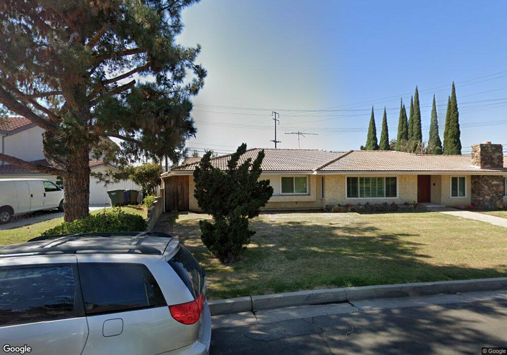
4695 Saint Andrews Ave Buena Park, CA 90621
Estimated Value: $1,187,000 - $1,549,000
4
Beds
3
Baths
2,689
Sq Ft
$506/Sq Ft
Est. Value
About This Home
This home is located at 4695 Saint Andrews Ave, Buena Park, CA 90621 and is currently estimated at $1,359,611, approximately $505 per square foot. 4695 Saint Andrews Ave is a home located in Orange County with nearby schools including Charles G. Emery Elementary School, Buena Park Junior High School, and Sunny Hills High School.
Ownership History
Date
Name
Owned For
Owner Type
Purchase Details
Closed on
Aug 21, 2025
Sold by
Goedhart Bernardus Willem and Goedhart Ben W
Bought by
Bernardus Willem Goedhart And Trudy Goedhart and Goedhart
Current Estimated Value
Purchase Details
Closed on
Sep 27, 2001
Sold by
Goedhart Bernardus W and Goedhart Trudy I
Bought by
Goodhart Bernardus Willem and Goedhart Trudy
Create a Home Valuation Report for This Property
The Home Valuation Report is an in-depth analysis detailing your home's value as well as a comparison with similar homes in the area
Home Values in the Area
Average Home Value in this Area
Purchase History
| Date | Buyer | Sale Price | Title Company |
|---|---|---|---|
| Bernardus Willem Goedhart And Trudy Goedhart | -- | None Listed On Document | |
| Goodhart Bernardus Willem | -- | -- |
Source: Public Records
Tax History Compared to Growth
Tax History
| Year | Tax Paid | Tax Assessment Tax Assessment Total Assessment is a certain percentage of the fair market value that is determined by local assessors to be the total taxable value of land and additions on the property. | Land | Improvement |
|---|---|---|---|---|
| 2025 | $2,263 | $176,543 | $26,719 | $149,824 |
| 2024 | $2,263 | $173,082 | $26,195 | $146,887 |
| 2023 | $2,213 | $169,689 | $25,682 | $144,007 |
| 2022 | $2,174 | $166,362 | $25,178 | $141,184 |
| 2021 | $2,157 | $163,100 | $24,684 | $138,416 |
| 2020 | $2,131 | $161,428 | $24,431 | $136,997 |
| 2019 | $2,086 | $158,263 | $23,952 | $134,311 |
| 2018 | $2,047 | $155,160 | $23,482 | $131,678 |
| 2017 | $2,019 | $152,118 | $23,021 | $129,097 |
| 2016 | $1,981 | $149,136 | $22,570 | $126,566 |
| 2015 | $1,901 | $146,896 | $22,231 | $124,665 |
| 2014 | $1,891 | $144,019 | $21,796 | $122,223 |
Source: Public Records
Map
Nearby Homes
- 4738 Durango Dr
- 4840 Sunnybrook Ave
- 14806 Faceta Dr
- 14724 Mercado Ave
- 4900 Lincolnshire Ave
- 2150 Cheyenne Way Unit 169
- 14828 Rayfield Dr
- 8244 Henderson Green
- 2200 Cheyenne Way Unit 117
- 5211 Fox Hills Ave
- 15213 Santa Gertrudes Ave Unit W106
- 15233 Santa Gertrudes Ave
- 15819 Rosalita Dr
- 14727 La Mesa Dr
- 15011 La Mesa Dr
- 15740 Rosalita Dr
- 5412 Arrowhead Ave
- 15220 Ocaso Ave Unit H103
- 15224 Ocaso Ave Unit H212
- 14504 Manecita Dr
- 4744 Beach Blvd
- 4742 Beach Blvd
- 4740 Beach Blvd
- 4690 Saint Andrews Ave
- 4715 Saint Andrews Ave
- 8249 Elliott Green
- 8245 Elliott Green
- 4660 Saint Andrews Ave
- 4706 Saint Andrews Ave
- 8241 Elliott Green
- 4580 Durango Dr
- 8237 Elliott Green
- 4578 Durango Dr
- 4571 Toledo Way
- 4639 Beach Blvd
- 4576 Durango Dr
- 4735 Saint Andrews Ave
- 4720 Saint Andrews Ave
- 4569 Toledo Way
- 4574 Durango Dr