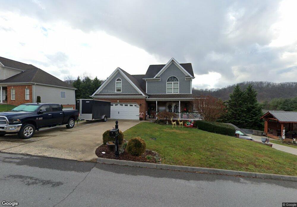
4695 Sterling Ln Kingsport, TN 37664
Estimated Value: $394,539 - $453,000
3
Beds
3
Baths
1,950
Sq Ft
$219/Sq Ft
Est. Value
About This Home
This home is located at 4695 Sterling Ln, Kingsport, TN 37664 and is currently estimated at $426,385, approximately $218 per square foot. 4695 Sterling Ln is a home located in Sullivan County with nearby schools including Andrew Johnson Elementary School, Ross N. Robinson Middle School, and Dobyns-Bennett High School.
Ownership History
Date
Name
Owned For
Owner Type
Purchase Details
Closed on
Aug 17, 2011
Sold by
Rose David L
Bought by
Lewis Bradley and Lewis Tammy
Current Estimated Value
Home Financials for this Owner
Home Financials are based on the most recent Mortgage that was taken out on this home.
Original Mortgage
$193,955
Outstanding Balance
$133,853
Interest Rate
4.5%
Mortgage Type
FHA
Estimated Equity
$292,532
Create a Home Valuation Report for This Property
The Home Valuation Report is an in-depth analysis detailing your home's value as well as a comparison with similar homes in the area
Home Values in the Area
Average Home Value in this Area
Purchase History
| Date | Buyer | Sale Price | Title Company |
|---|---|---|---|
| Lewis Bradley | $199,000 | -- |
Source: Public Records
Mortgage History
| Date | Status | Borrower | Loan Amount |
|---|---|---|---|
| Open | Lewis Bradley | $193,955 |
Source: Public Records
Tax History Compared to Growth
Tax History
| Year | Tax Paid | Tax Assessment Tax Assessment Total Assessment is a certain percentage of the fair market value that is determined by local assessors to be the total taxable value of land and additions on the property. | Land | Improvement |
|---|---|---|---|---|
| 2024 | -- | $63,225 | $5,075 | $58,150 |
| 2023 | $2,784 | $63,225 | $5,075 | $58,150 |
| 2022 | $2,784 | $63,225 | $5,075 | $58,150 |
| 2021 | $2,536 | $63,225 | $5,075 | $58,150 |
| 2020 | $1,416 | $59,200 | $5,075 | $54,125 |
| 2019 | $2,553 | $55,100 | $5,075 | $50,025 |
| 2018 | $2,493 | $55,100 | $5,075 | $50,025 |
| 2017 | $2,493 | $55,100 | $5,075 | $50,025 |
| 2016 | $2,459 | $52,925 | $6,350 | $46,575 |
| 2014 | $2,315 | $52,912 | $0 | $0 |
Source: Public Records
Map
Nearby Homes
- Tbd Silver Ct
- 4736 Sterling Ln
- 4527 Harbor Dr
- 4509 Old Stage Rd
- 4524 Glenbrook Dr
- Lot 6 Briarwood Rd
- 4528 Glenbrook Dr
- 4513 Stagecoach Rd
- 625 Cooks Valley Rd
- 4589 Old Stage Rd
- 861 Cedar Branch Rd
- 4617 Old Stage Rd
- 1109 Cooks Terrace
- 2320 Woodridge Ave
- 5009 Surrey Dr
- 112 Shuler Dr
- 3909 Bond Dr
- 3970 Memorial Blvd
- 3953 Pear St
- 408 Cedar Branch Rd
- 4699 Sterling Ln
- 4712 Sterling (Lot 4) Ln
- 4700 Sterling Ln
- 4704 Sterling Ln
- 4703 Sterling Ln
- 4708 Sterling Ln
- 4708 Sterling (Lot 3) Ln
- 4819 Silver Ct
- 4823 Silver Ct
- 4707 Sterling Ln
- 4802 Silver Ct
- 946 Cooks Valley Rd Unit 129
- 4827 Silver Ct
- 4712 Sterling Ln
- Tbd Cooks Valley Rd Off
- 4831 Silver Ct
- 0 Sterling Ln
- Lot 2 Sterling Ln
- 934 Cooks Valley Rd Unit 77
- 4806 Silver Ct